MyTopo
Classic USGS Tunkhannock Pennsylvania 7.5'x7.5' Topo Map
Couldn't load pickup availability
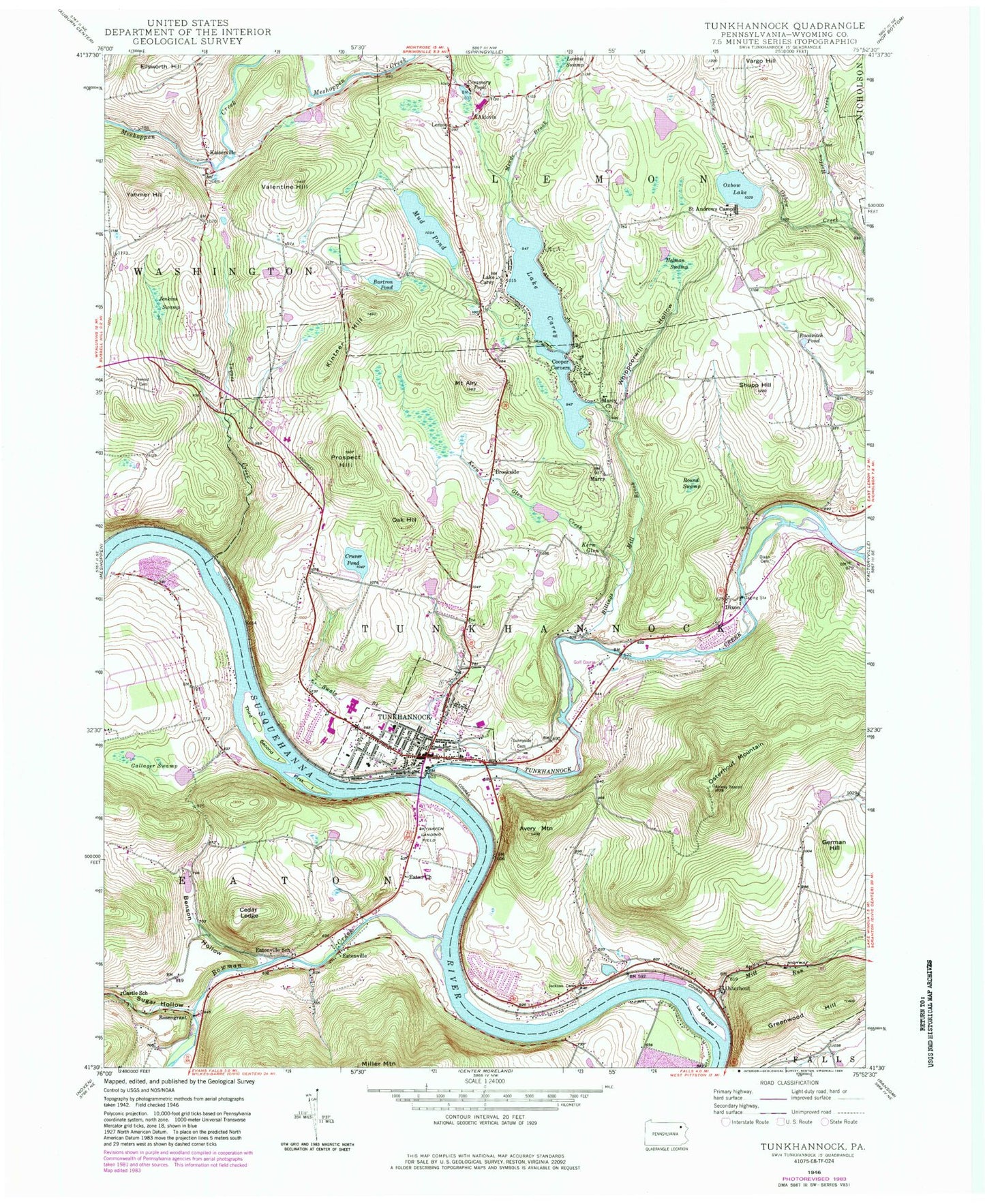
Historical USGS topographic quad map of Tunkhannock in the state of Pennsylvania. Typical map scale is 1:24,000, but may vary for certain years, if available. Print size: 24" x 27"
This quadrangle is in the following counties: Wyoming.
The map contains contour lines, roads, rivers, towns, and lakes. Printed on high-quality waterproof paper with UV fade-resistant inks, and shipped rolled.
Contains the following named places: Kern Glen, Mill Run, Mount Airy, Aldovin, Avery Mountain, Bartron Pond, Benson Hollow, Billings Mill Brook, Lake Carey, Castle School, Cooper Corners, Creamery Pond, Cruver Pond, Dixon, Dixon Cemetery, Eaton Church, Eatonville, Eatonville School, Gallager Swamp, German Hill, Helman Swamp, Horton Creek, Jackson Cemetery, Jenkins Swamp, Kaiserville, Kern Glen Creek, Kintner Hill, Lake Carey, Lemon, Marcy Church, Meade Brook, Stevens Lake, Oak Hill, Osterhout, Osterhout Mountain, Oxbow Lake, Russell - Prevost Cemetery, Prospect Hill, Racavitch Pond, Round Swamp, Saint Andrews Camp, Shupp Hill, Sugar Hollow, Sunnyside Cemetery, Swale Brook, Taques Creek, Tunkhannock Creek, Valentine Hill, Vargo Hill, Whippoorwill Hollow, Yahmer Hill, Cedar Ledge, First Island, La Grange Island, Oxbow Inlet, Second Island, Sugar Hollow Creek, Third Island, Skyhaven Airport, C J K Airport (historical), Lake Carey Dam, Stevens Lake Dam, Bowman Creek, Jackson Creek, Dixon, Lemon, Brookside, Marcy, Rosengrant, Shadow Brook Golf Course, Tunkhannock High School, Tunkhannock Middle School, Roslund Elementary School, Tunkhannock, Towne Plaza, Route 6 Plaza, Charles Brothers Plaza, Village Center, Borough of Tunkhannock, Township of Eaton, Township of Lemon, Township of Tunkhannock, Lake Carey Post Office (historical), Lake Carey Volunteer Fire Company, Triton Hose Fire Company, Tyler Memorial Hospital, Tunkhannock Ambulance Service, Garrison Creek, Tunkhannock Post Office, Tunkhannock Township Police Department, Kern Glen, Mill Run, Mount Airy, Aldovin, Avery Mountain, Bartron Pond, Benson Hollow, Billings Mill Brook, Lake Carey, Castle School, Cooper Corners, Creamery Pond, Cruver Pond, Dixon, Dixon Cemetery, Eaton Church, Eatonville, Eatonville School, Gallager Swamp, German Hill, Helman Swamp, Horton Creek, Jackson Cemetery, Jenkins Swamp, Kaiserville, Kern Glen Creek, Kintner Hill, Lake Carey, Lemon, Marcy Church, Meade Brook, Stevens Lake, Oak Hill, Osterhout, Osterhout Mountain, Oxbow Lake, Russell - Prevost Cemetery, Prospect Hill, Racavitch Pond, Round Swamp, Saint Andrews Camp, Shupp Hill, Sugar Hollow, Sunnyside Cemetery, Swale Brook, Taques Creek, Tunkhannock Creek, Valentine Hill, Vargo Hill, Whippoorwill Hollow, Yahmer Hill, Cedar Ledge, First Island, La Grange Island, Oxbow Inlet, Second Island, Sugar Hollow Creek, Third Island, Skyhaven Airport, C J K Airport (historical), Lake Carey Dam, Stevens Lake Dam, Bowman Creek, Jackson Creek, Dixon, Lemon, Brookside, Marcy, Rosengrant, Shadow Brook Golf Course, Tunkhannock High School, Tunkhannock Middle School, Roslund Elementary School, Tunkhannock, Towne Plaza, Route 6 Plaza, Charles Brothers Plaza, Village Center, Borough of Tunkhannock, Township of Eaton, Township of Lemon, Township of Tunkhannock, Lake Carey Post Office (historical), Lake Carey Volunteer Fire Company, Triton Hose Fire Company, Tyler Memorial Hospital, Tunkhannock Ambulance Service, Garrison Creek, Tunkhannock Post Office, Tunkhannock Township Police Department


