MyTopo
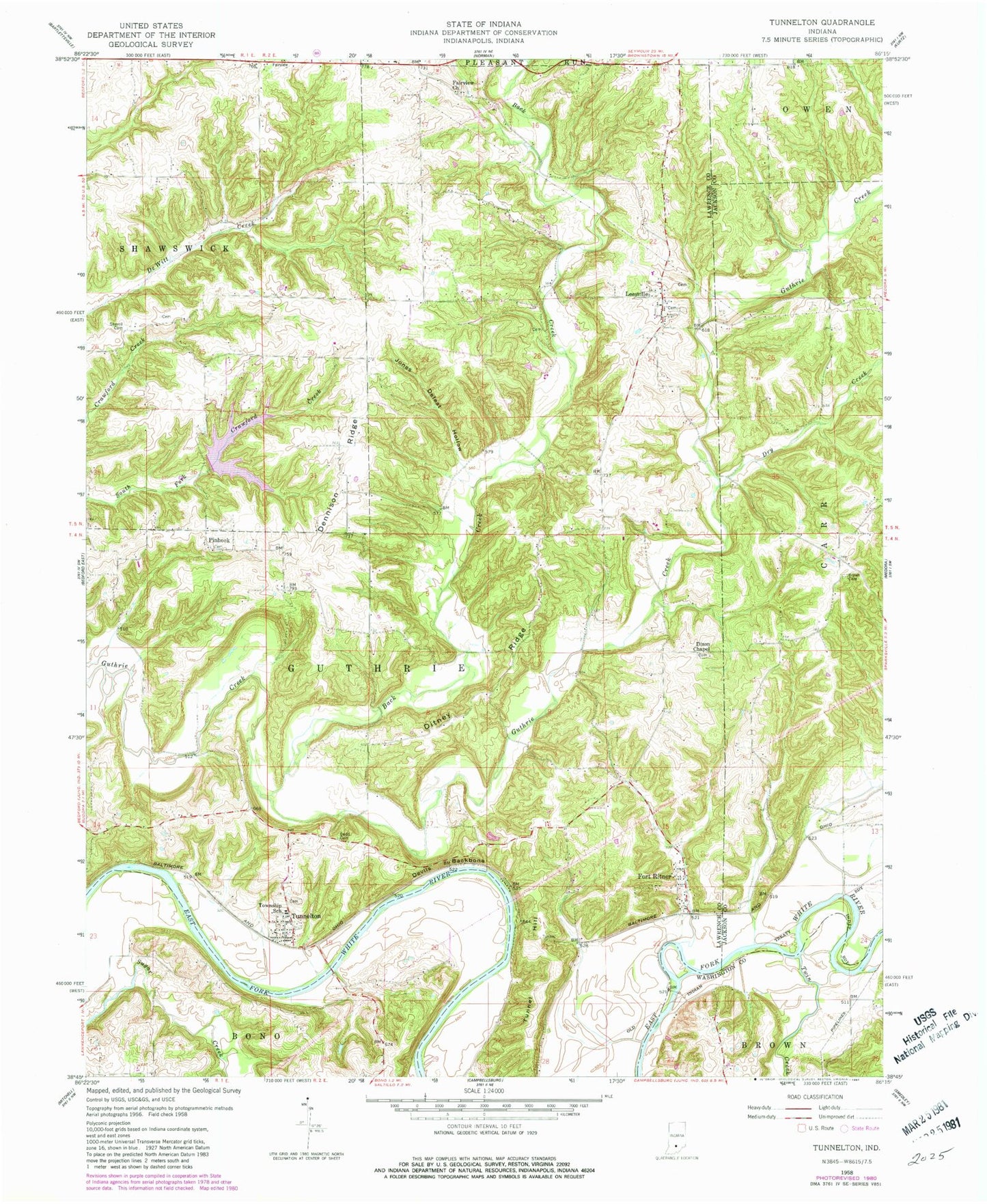
Classic USGS Tunnelton Indiana 7.5'x7.5' Topo Map
Couldn't load pickup availability
Historical USGS topographic quad map of Tunnelton in the state of Indiana. Map scale may vary for some years, but is generally around 1:24,000. Print size is approximately 24" x 27"
This quadrangle is in the following counties: Jackson, Lawrence, Washington.
The map contains contour lines, roads, rivers, towns, and lakes. Printed on high-quality waterproof paper with UV fade-resistant inks, and shipped rolled.
Contains the following named places: Back Creek, Brown Cemetery, Coxs Ferry, Dennison Ridge, Devils Backbone, Ditney Ridge, Dixon Chapel, Dodd Cemetery, Dry Creek, Fairview Church, Fort Ritner, Guthrie Township Volunteer Fire Department Station 1, Jones Defeat Hollow, Ken-Ray Lake, Ken-Ray Lake Dam, Leesville, Pinhook, Shawswick Township Volunteer Fire Department Station 4, Shawswick Volunteer Fire Department Station 4, Sherrill Cemetery, Township of Guthrie, Tunnel Hill, Tunnelton, Tunnelton Post Office, Twin Creek, ZIP Code: 47467