MyTopo
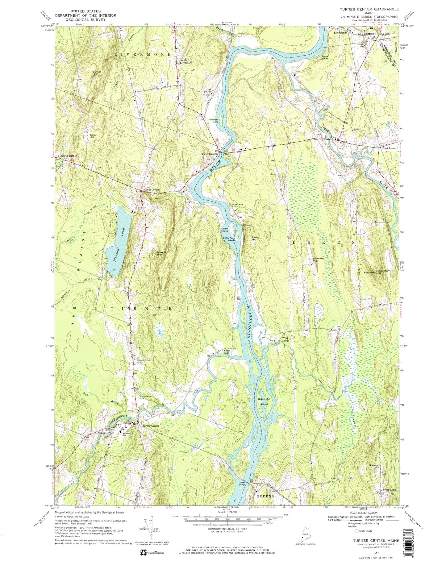
Classic USGS Turner Center Maine 7.5'x7.5' Topo Map
Couldn't load pickup availability
Historical USGS topographic quad map of Turner Center in the state of Maine. Typical map scale is 1:24,000, but may vary for certain years, if available. Print size: 24" x 27"
This quadrangle is in the following counties: Androscoggin, Kennebec.
The map contains contour lines, roads, rivers, towns, and lakes. Printed on high-quality waterproof paper with UV fade-resistant inks, and shipped rolled.
Contains the following named places: Allen Stream, Butter Hill, Dead River, Fairview Hill, Griswold Island, House Brook, Keens Mills, Keens Mills Cemetery, Keith Brook, Little Ram Island, Lovewell Island, Maple Grove Cemetery, Merrill Hill, Monument Hill, Pleasant Pond, Quaker Hill, Ram Island, Red Brook, River Grove Cemetery, Sand Hill, South Livermore, Torry Hill, Turner Bridge, Turner Center, Turtle Island, West Leeds, Howes Corner, North Leeds, South Leeds, Stricklands, The Plains, Nezinscot River, Town of Leeds, Town of Turner, Pleasant Pond Dam, Dead River Dam, Dead River Reservoir, Leeds Community Church, Monument Hill Trail, Tripp Middle School, Turner Elementary School, Turner Primary School, West Leeds Cemetery, Turner Volunteer Fire Department North Turner Station, Carver Cemetery, Turner Centerville Cemetery, Knapp Cemetery, Perley Cemetery, Strickland Cemetery, True Cemetery, Morris Cemetery, North Turner Cemetery, Quaker Ridge Cemetery, Timberlake Cemetery, Additon Cemetery, Fairview Cemetery, Foss Cemetery, Francis Cemetery, Howes Corner Cemetery, Island Cemetery, Leavitt Area High School, Turner Public Library