MyTopo
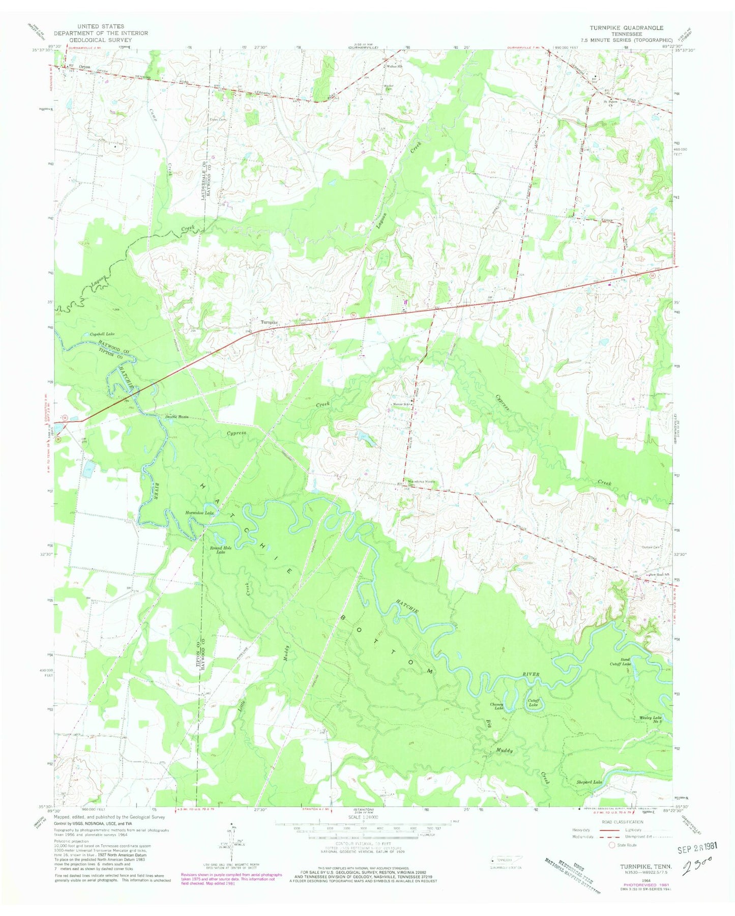
Classic USGS Turnpike Tennessee 7.5'x7.5' Topo Map
Couldn't load pickup availability
Historical USGS topographic quad map of Turnpike in the state of Tennessee. Map scale may vary for some years, but is generally around 1:24,000. Print size is approximately 24" x 27"
This quadrangle is in the following counties: Haywood, Lauderdale, Tipton.
The map contains contour lines, roads, rivers, towns, and lakes. Printed on high-quality waterproof paper with UV fade-resistant inks, and shipped rolled.
Contains the following named places: Anthony School, Big Muddy Creek, Bond Cutoff Lake, Camp Creek, Cannon Lake, Cannon Lake Dam, Chaney Lake, Cogshell Lake, Commissioner District 9, Cutoff Lake, Cypress Creek, Double Basin, Estes Cemetery, Horseshoe Lake, Lebanon Division, Little Muddy Creek, Macedonia Mercer Cemetery, Mercer School, New Hope School, Orysa, Outlaw Cemetery, Round Hole Lake, Saint Peter School, Saint Peters, Saint Peters Church, Shepard Lake, Turnpike, Turnpike Family Memorial Garden, Walker Cemetery, Walker School