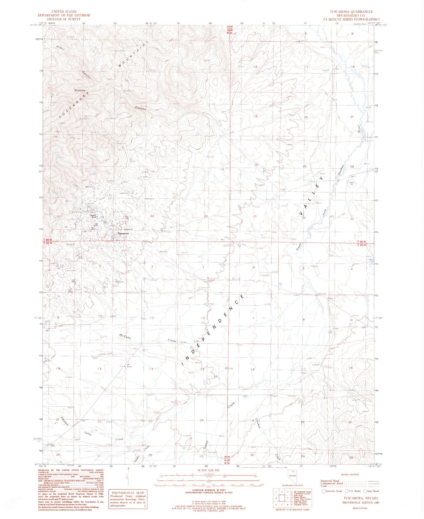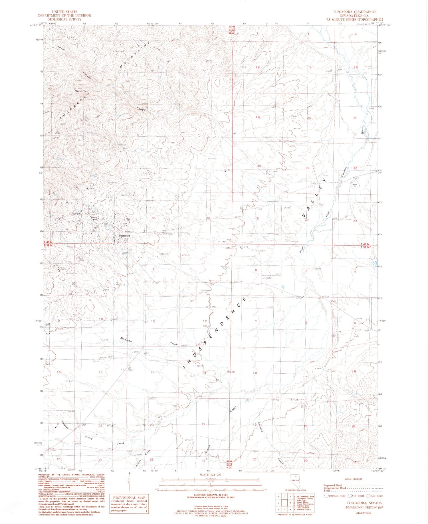
MyTopo
Classic USGS Tuscarora Nevada 7.5'x7.5' Topo Map
Couldn't load pickup availability
Historical USGS topographic quad map of Tuscarora in the state of Nevada. Map scale may vary for some years, but is generally around 1:24,000. Print size is approximately 24" x 27"
This quadrangle is in the following counties: Elko.
The map contains contour lines, roads, rivers, towns, and lakes. Printed on high-quality waterproof paper with UV fade-resistant inks, and shipped rolled.
Contains the following named places: Adams Creek, Argenta Mine, Arthur Canyon, Badger Creek, Belle Isle Mine, Boulder Creek, Burns Creek, Commonwealth Mine, Crooked Creek, De Freez Mine, Dexter Mill, Dexter Mine, Eira Mine, Fort Tuscarora, Gold Bug Mine, Grand Prize Mine, Independence Valley Elementary School, Indian Creek, McCann Creek, Modoc Mine, Navajo Mine, North Belle Isle Mine, North Commonwealth Mine, Old Tuscarora, Pleasant Valley Creek, Quarter Circle S Ranch, Queen Mine, Sixmile Canyon, Taylor Canyon, Taylors Canon Creek, Tuscarora, Tuscarora Mining District, Tuscarora Post Office