MyTopo
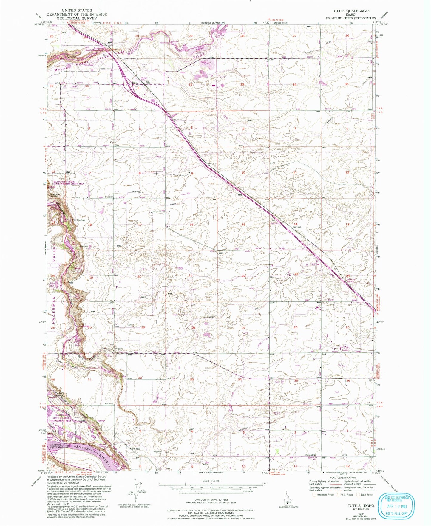
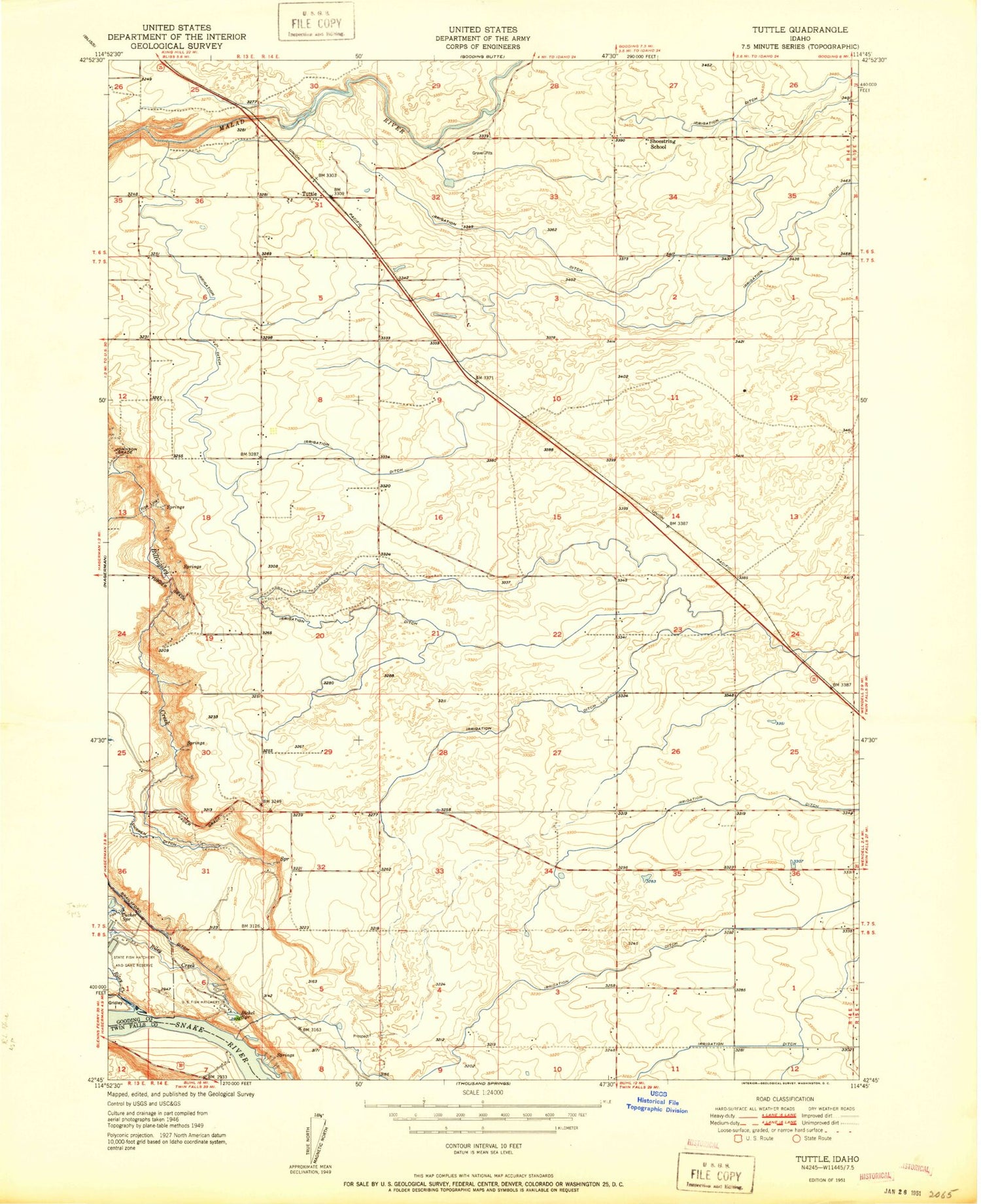
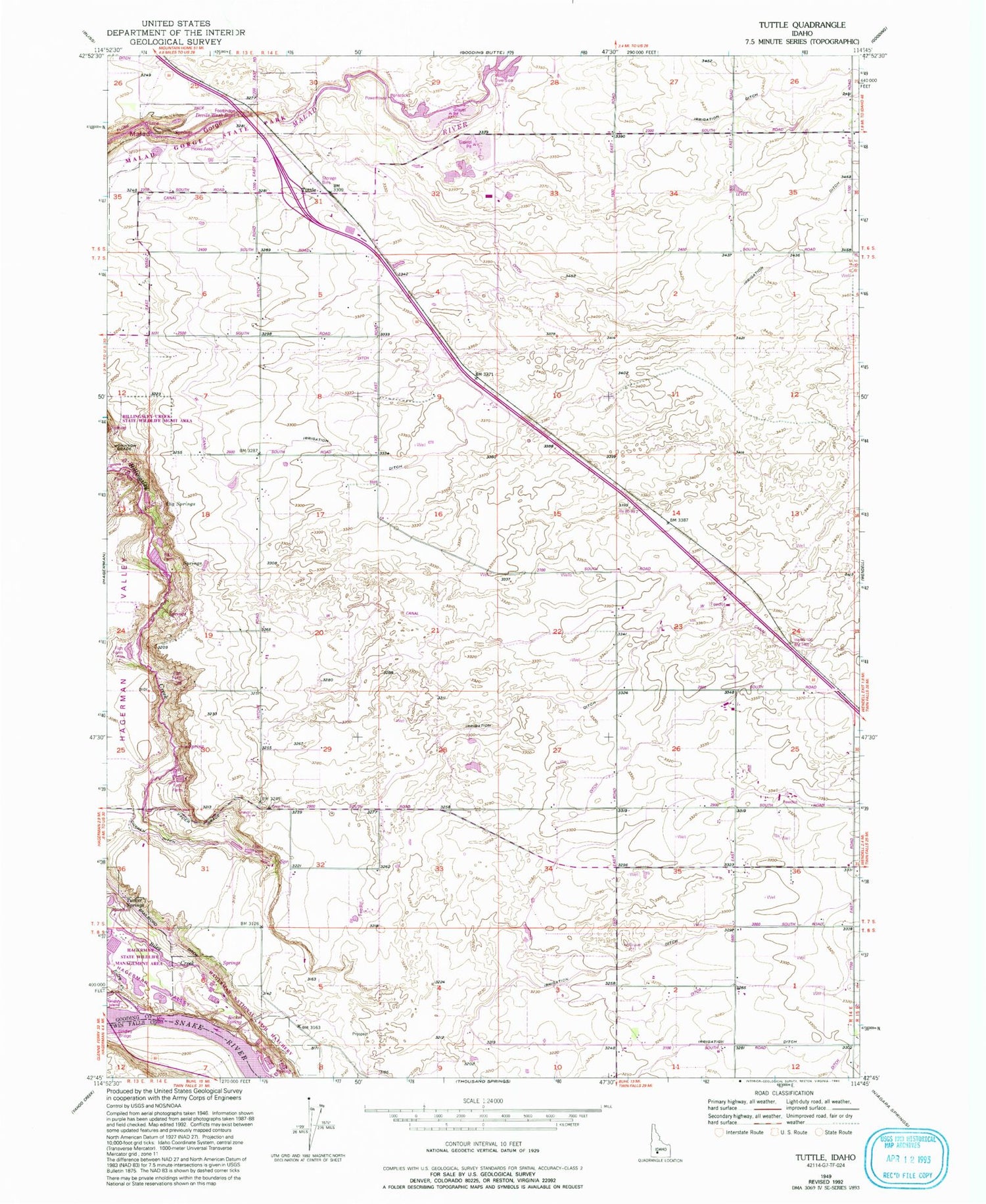
Classic USGS Tuttle Idaho 7.5'x7.5' Topo Map
Couldn't load pickup availability
Historical USGS topographic quad map of Tuttle in the state of Idaho. Map scale may vary for some years, but is generally around 1:24,000. Print size is approximately 24" x 27"
This quadrangle is in the following counties: Gooding, Twin Falls.
The map contains contour lines, roads, rivers, towns, and lakes. Printed on high-quality waterproof paper with UV fade-resistant inks, and shipped rolled.
Contains the following named places: Bickel Spring, Big Springs, Bridal Wreath Springs, Devils Wash Bowl, Hagerman National Fish Hatchery, Hagerman State Fish Hatchery, Hagerman Valley, Hagerman Wildlife Management Area, Johnson Grade, Lateral W-26, Lateral W-34, Lateral W-35, Lateral W-36, Lateral W-37, Lateral W-40, Lateral W-45, Lateral W-46, Lateral W-47, Lateral W-54, Lateral W-57, Lateral X-10, Lateral X-11, Lateral X-14, Lateral X-15, Lateral X-18, Lateral X-19, Lateral X-24, Lateral X-29, Lateral X-30, Lateral X-32, Lateral X-33, Lateral X-5, Malad Gorge State Park, Riley Creek, Shoestring School, Tucker Springs, Tuttle, Vader Grade