MyTopo
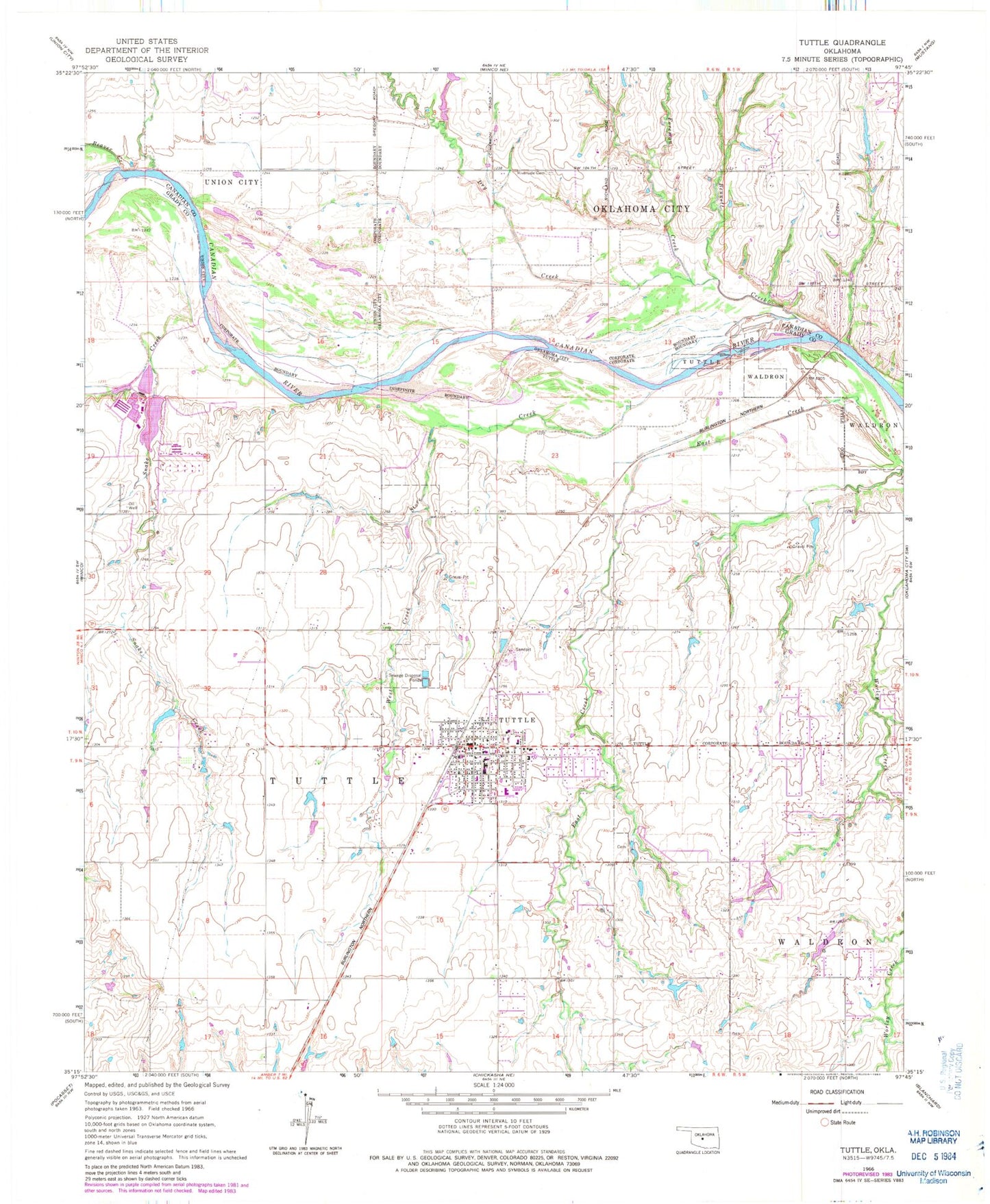
Classic USGS Tuttle Oklahoma 7.5'x7.5' Topo Map
Couldn't load pickup availability
Historical USGS topographic quad map of Tuttle in the state of Oklahoma. Map scale may vary for some years, but is generally around 1:24,000. Print size is approximately 24" x 27"
This quadrangle is in the following counties: Canadian, Grady.
The map contains contour lines, roads, rivers, towns, and lakes. Printed on high-quality waterproof paper with UV fade-resistant inks, and shipped rolled.
Contains the following named places: Beaver Creek, Bennett Creek, Church of Christ, City of Tuttle, Dry Creek, Fairview Cemetery, First Assembly of God Church, First Baptist Church of Tuttle, Fisher Lake, Fisher Lake Dam, Foreman Creek, Liberty Christian Fellowship Church, New Heights Baptist Church, Oknoname 051038 Dam, Oknoname 051038 Reservoir, Oknoname 051040 Dam, Oknoname 051040 Reservoir, Riverside Cemetery, Silver City Cemetery, Snake Creek, Store Creek, Township of Tuttle, Tuttle, Tuttle Christian Church, Tuttle Division, Tuttle Elementary School, Tuttle Emergency Medical Services, Tuttle Fire Department, Tuttle High School, Tuttle Intermediate School, Tuttle Middle School, Tuttle Police Department, Tuttle Post Office, West Creek, ZIP Code: 73089