MyTopo
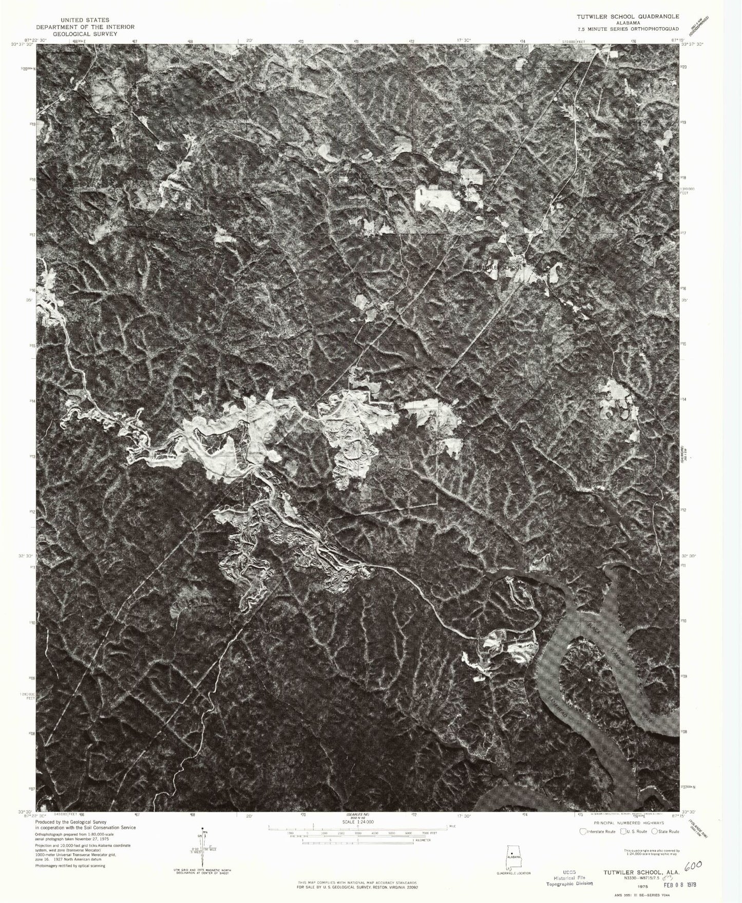
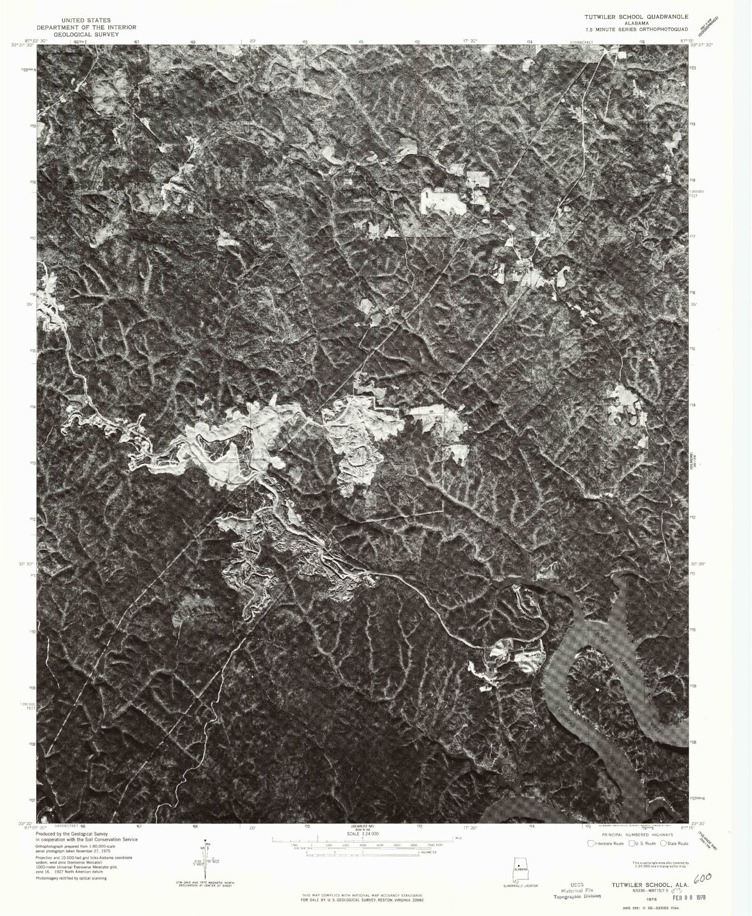
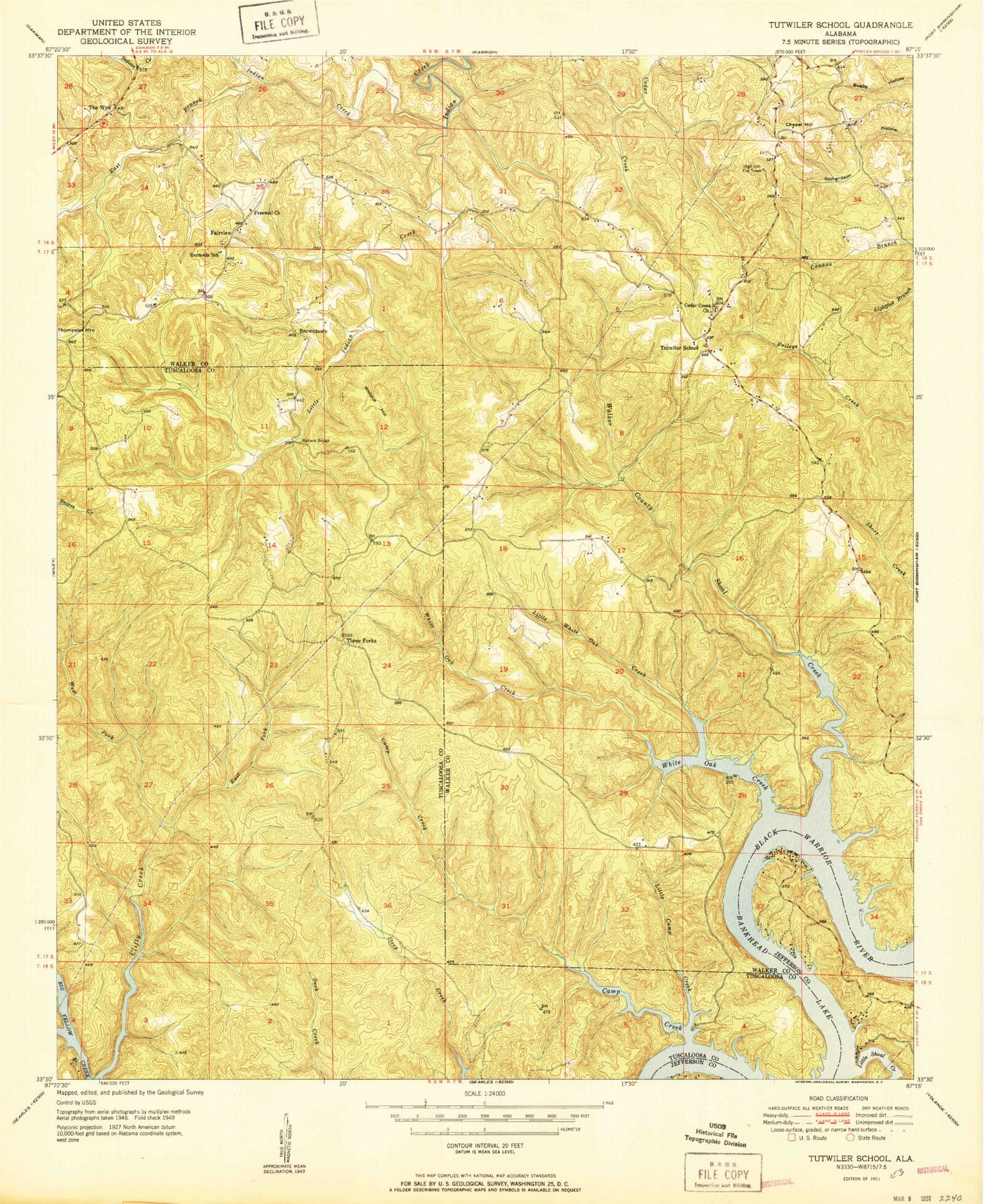
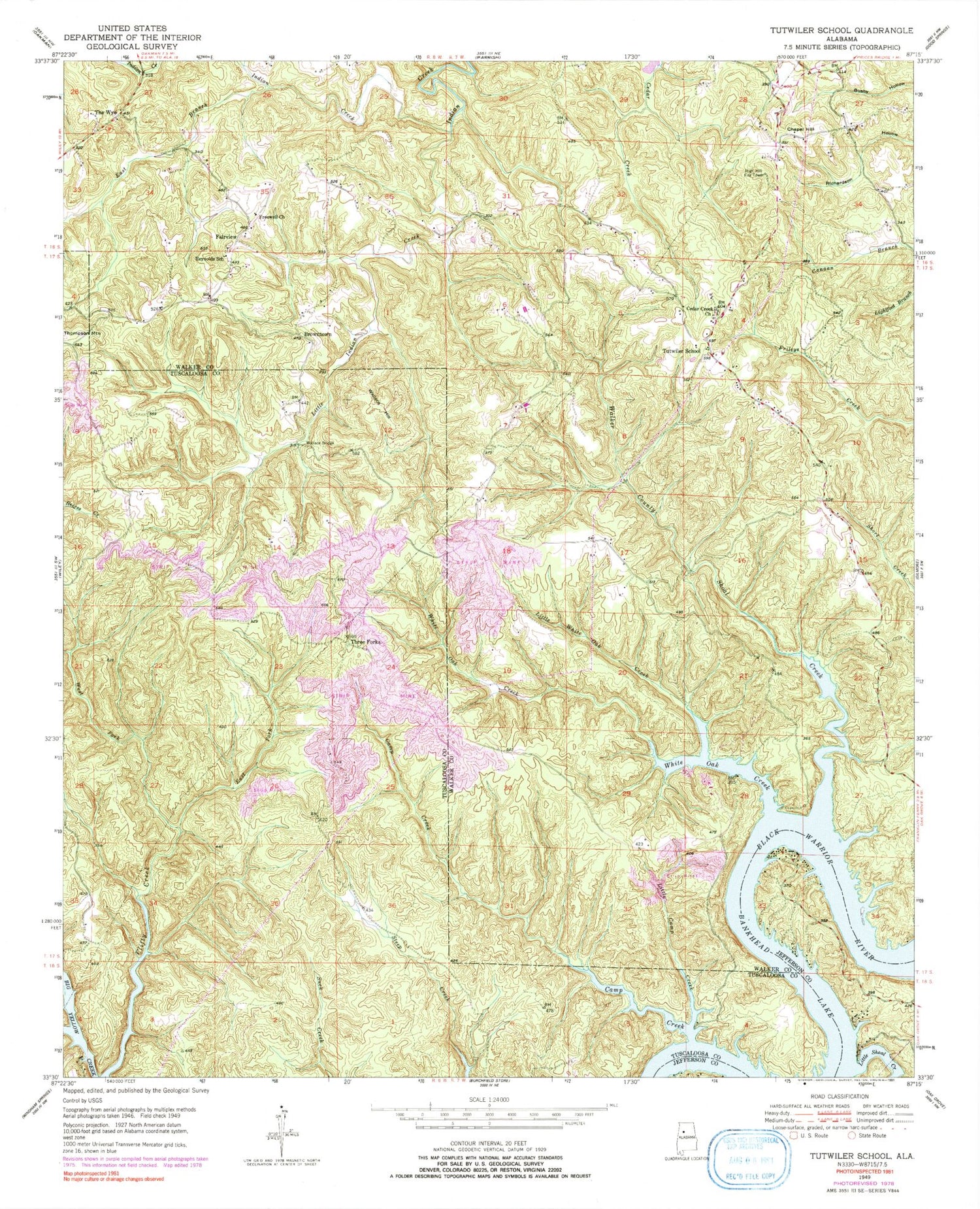
Classic USGS Tutwiler School Alabama 7.5'x7.5' Topo Map
Couldn't load pickup availability
Historical USGS topographic quad map of Tutwiler School in the state of Alabama. Typical map scale is 1:24,000, but may vary for certain years, if available. Print size: 24" x 27"
This quadrangle is in the following counties: Jefferson, Tuscaloosa, Walker.
The map contains contour lines, roads, rivers, towns, and lakes. Printed on high-quality waterproof paper with UV fade-resistant inks, and shipped rolled.
Contains the following named places: Camp Creek, Cedar Creek Church of Christ, Chapel Hill, Clifty Creek, East Branch Indian Creek, East Fork Clifty Creek, Freewell Church, Little Camp Creek, Little Indian Creek, Little Shoal Creek, Little White Oak Creek, Reynolds School (historical), Rocky Branch, The Wye, Tutwiler School (historical), Wallace Bridge, Wallace Hill, West Fork Clifty Creek, White Oak Creek, Wyatt Creek, Drummond Airport (historical), Brown Coal Bed Mine, Yacht Club Camp, Fairview Cemetery, Garganus (historical), Grant School (historical), High Hill Church, Jug (historical), Knights School (historical), Miller Cemetery, Perrys Store (historical), Tutwiler, Wilmington (historical), Henderson Camp, Coal Spring, Yellow Creek Camp, Black Rock Shoals, Humber Bend, Lock Number Twelve (historical), Heards Bend, Walker County Shoal Creek, Browntown, Fairview, Three Forks, Starview Church, High Hill Fire Tower, Tutwiler Volunteer Fire and Rescue, Camp Creek, Cedar Creek Church of Christ, Chapel Hill, Clifty Creek, East Branch Indian Creek, East Fork Clifty Creek, Freewell Church, Little Camp Creek, Little Indian Creek, Little Shoal Creek, Little White Oak Creek, Reynolds School (historical), Rocky Branch, The Wye, Tutwiler School (historical), Wallace Bridge, Wallace Hill, West Fork Clifty Creek, White Oak Creek, Wyatt Creek, Drummond Airport (historical), Brown Coal Bed Mine, Yacht Club Camp, Fairview Cemetery, Garganus (historical), Grant School (historical), High Hill Church, Jug (historical), Knights School (historical), Miller Cemetery, Perrys Store (historical), Tutwiler, Wilmington (historical), Henderson Camp, Coal Spring, Yellow Creek Camp, Black Rock Shoals, Humber Bend, Lock Number Twelve (historical), Heards Bend, Walker County Shoal Creek, Browntown, Fairview, Three Forks, Starview Church, High Hill Fire Tower, Tutwiler Volunteer Fire and Rescue