MyTopo
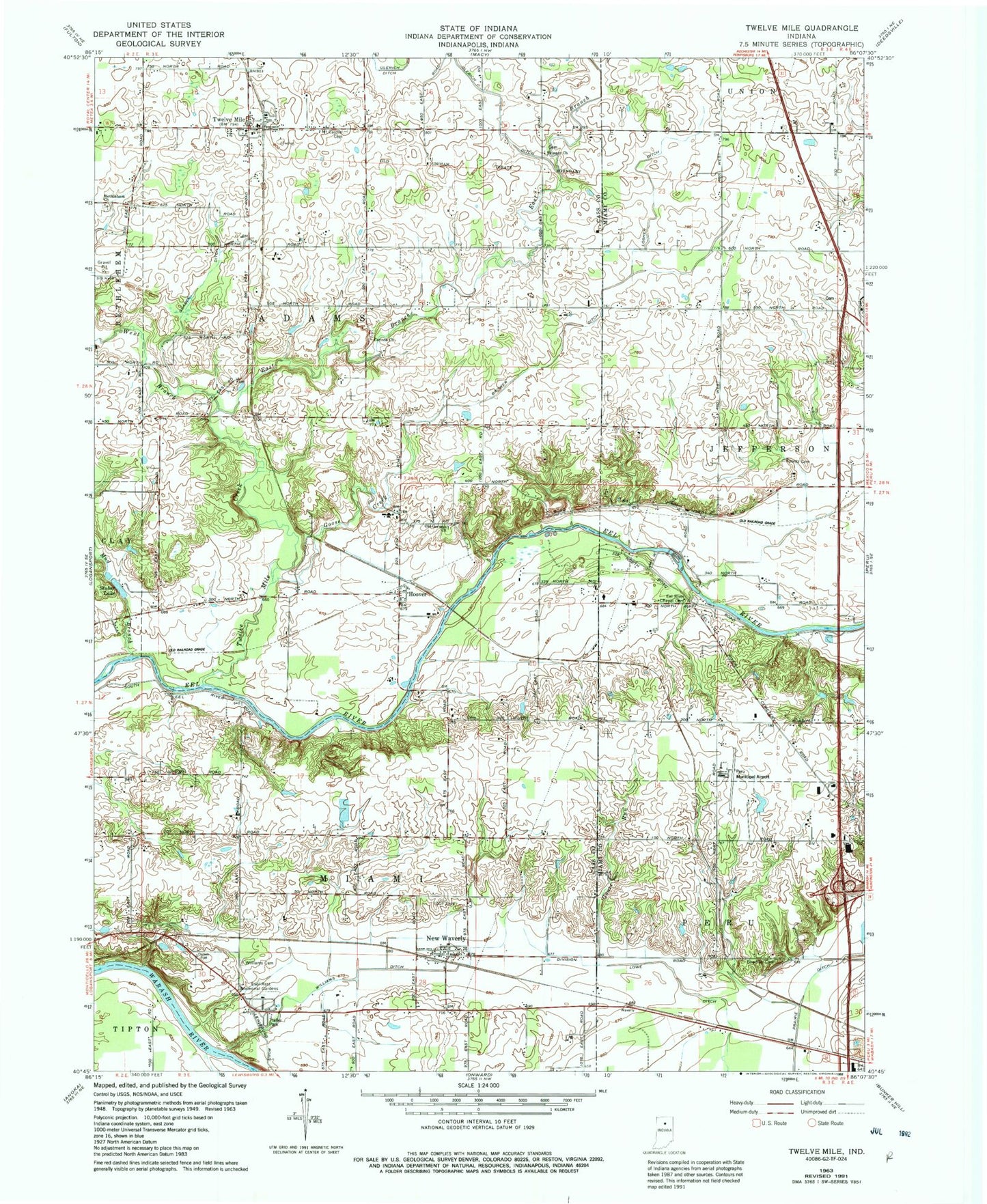
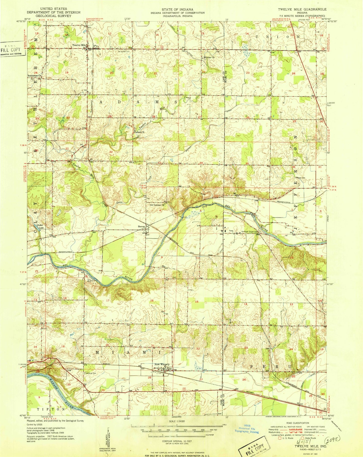
Classic USGS Twelve Mile Indiana 7.5'x7.5' Topo Map
Couldn't load pickup availability
Historical USGS topographic quad map of Twelve Mile in the state of Indiana. Map scale may vary for some years, but is generally around 1:24,000. Print size is approximately 24" x 27"
This quadrangle is in the following counties: Cass, Miami.
The map contains contour lines, roads, rivers, towns, and lakes. Printed on high-quality waterproof paper with UV fade-resistant inks, and shipped rolled.
Contains the following named places: Bethlehem Church, Bowman Cemetery, Brower Ditch, Corinth Church, East Branch Twelve Mile Creek, Eel River Chapel Cemetery, Ever Rest Memorial Park, Goose Creek, Goose Run, Grable Ditch, Hoover, Indiana State Police Department District 16, Koontz Cemetery, Little Charlie, Losher Ditch, Lowe Ditch, Mount Carmel Cemetery, Mud Branch, New Waverly, New Waverly Fire Department Station 2, Old German Church, Peru Municipal Airport, Skinner Church, Stuber Lake, Township of Adams, Township of Miami, Twelve Mile, Twelve Mile Creek, Twelve Mile Post Office, Twelve Mile Volunteer Fire Department, West Branch Twelve Mile Creek, Williams Cemetery, Williams Ditch, WSAL-FM (Logansport), ZIP Code: 46961