MyTopo
Classic USGS Twin Crags Idaho 7.5'x7.5' Topo Map
Regular price
$16.95
Regular price
Sale price
$16.95
Unit price
per
Couldn't load pickup availability
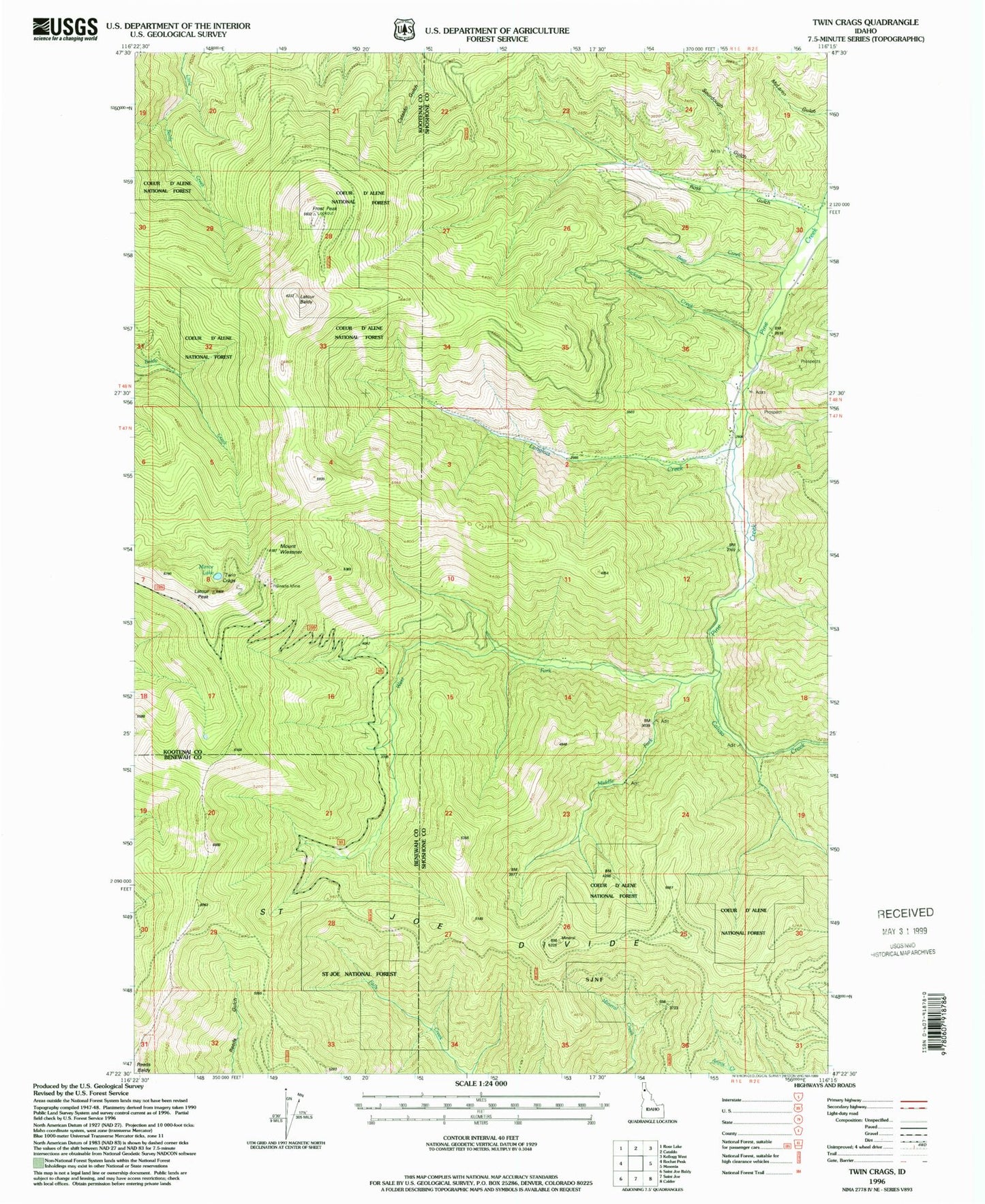
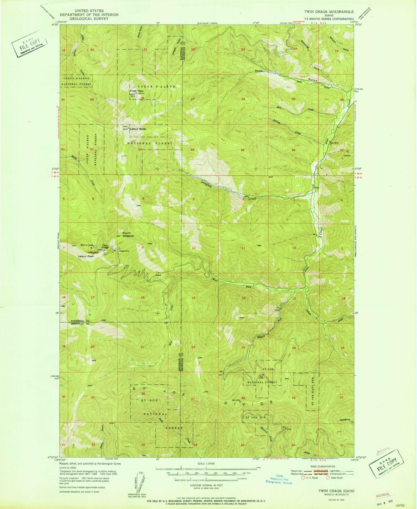
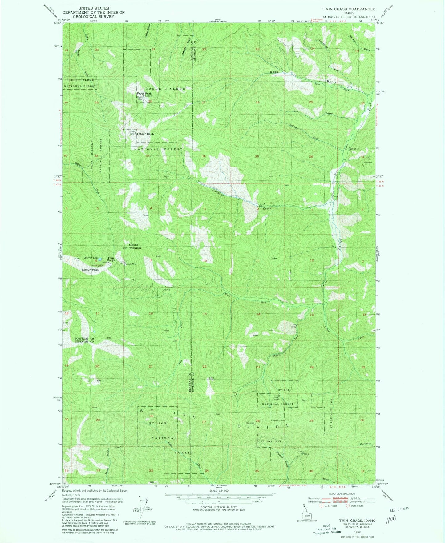
Historical USGS topographic quad map of Twin Crags in the state of Idaho. Map scale may vary for some years, but is generally around 1:24,000. Print size is approximately 24" x 27"
This quadrangle is in the following counties: Benewah, Kootenai, Shoshone.
The map contains contour lines, roads, rivers, towns, and lakes. Printed on high-quality waterproof paper with UV fade-resistant inks, and shipped rolled.
Contains the following named places: Bear Creek, Calusa Creek, Frost Peak, Frost Peak Lookout, Jackass Creek, Langlois Creek, Latour Baldy, Latour Peak, Middle Fork Pine Creek, Mirror Lake, Mount Wiessner, Palisade Mine, Ross Gulch, Saint Joe Divide, Sourdough Gulch, Twin Crags, West Fork Pine Creek