MyTopo
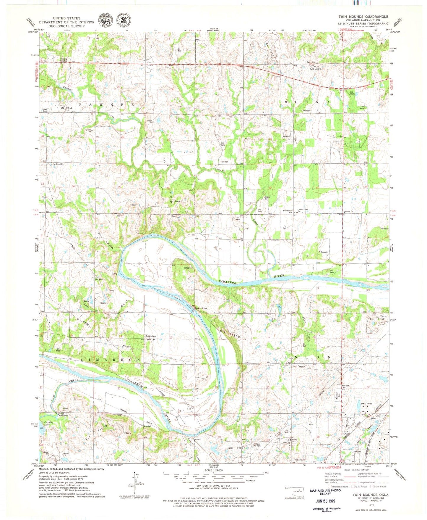
Classic USGS Twin Mounds Oklahoma 7.5'x7.5' Topo Map
Couldn't load pickup availability
Historical USGS topographic quad map of Twin Mounds in the state of Oklahoma. Map scale may vary for some years, but is generally around 1:24,000. Print size is approximately 24" x 27"
This quadrangle is in the following counties: Payne.
The map contains contour lines, roads, rivers, towns, and lakes. Printed on high-quality waterproof paper with UV fade-resistant inks, and shipped rolled.
Contains the following named places: Advent Church, Amabel, Bend Cemetery, Big Creek, Cabin Creek, Council Creek, Council Valley Church, Dunkin Bridge, Dunkin Cemetery, Fairlawn Cemetery, Gano, Hillside School, Hog Hollow, Ingalls Cemetery, Ingalls Census Designated Place, Long Branch, New Zion Cemetery, Short Creek, Township of Mound, Township of Pawnee, Township of Union, Twin Mounds