MyTopo
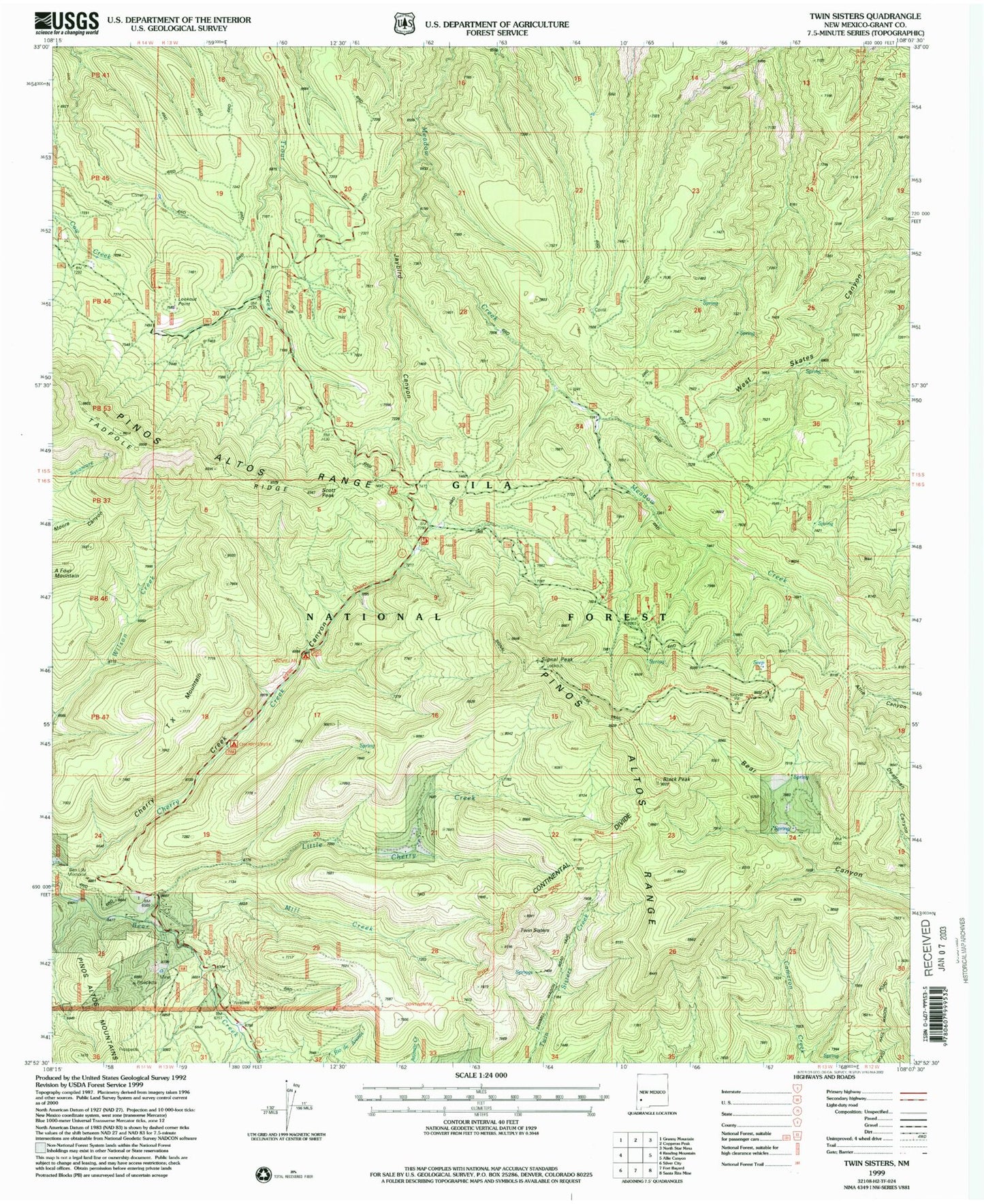
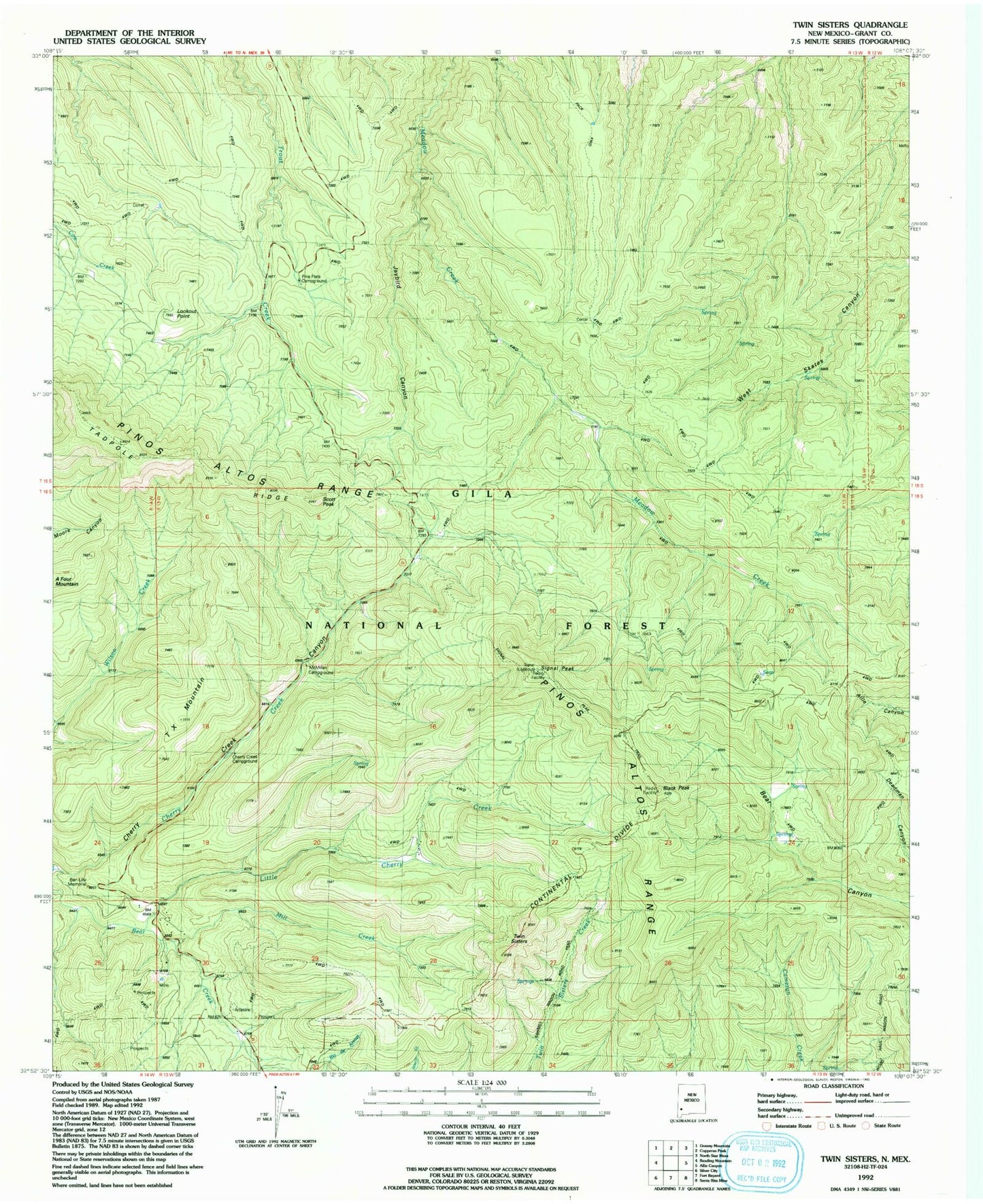
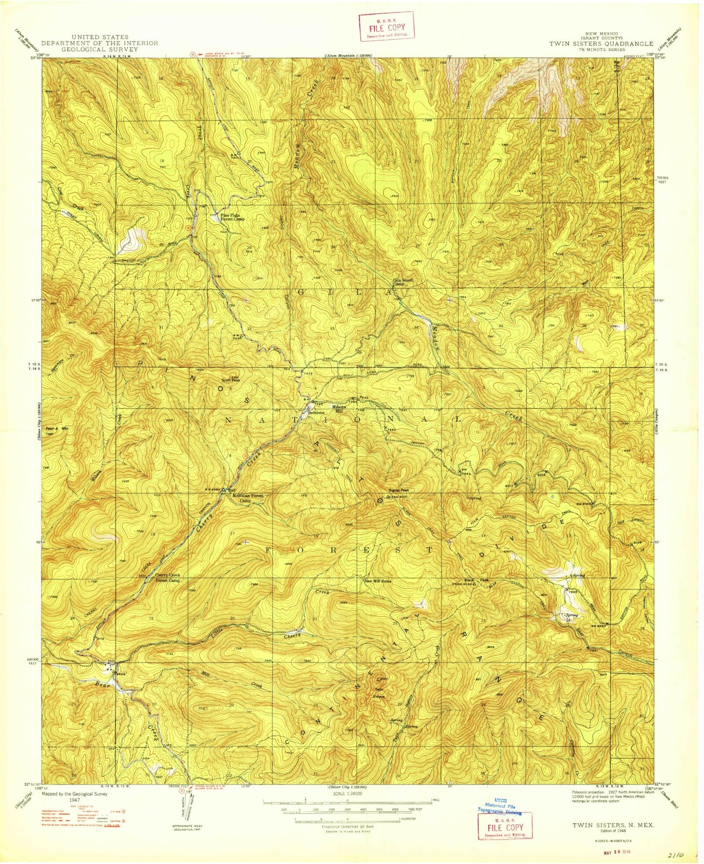
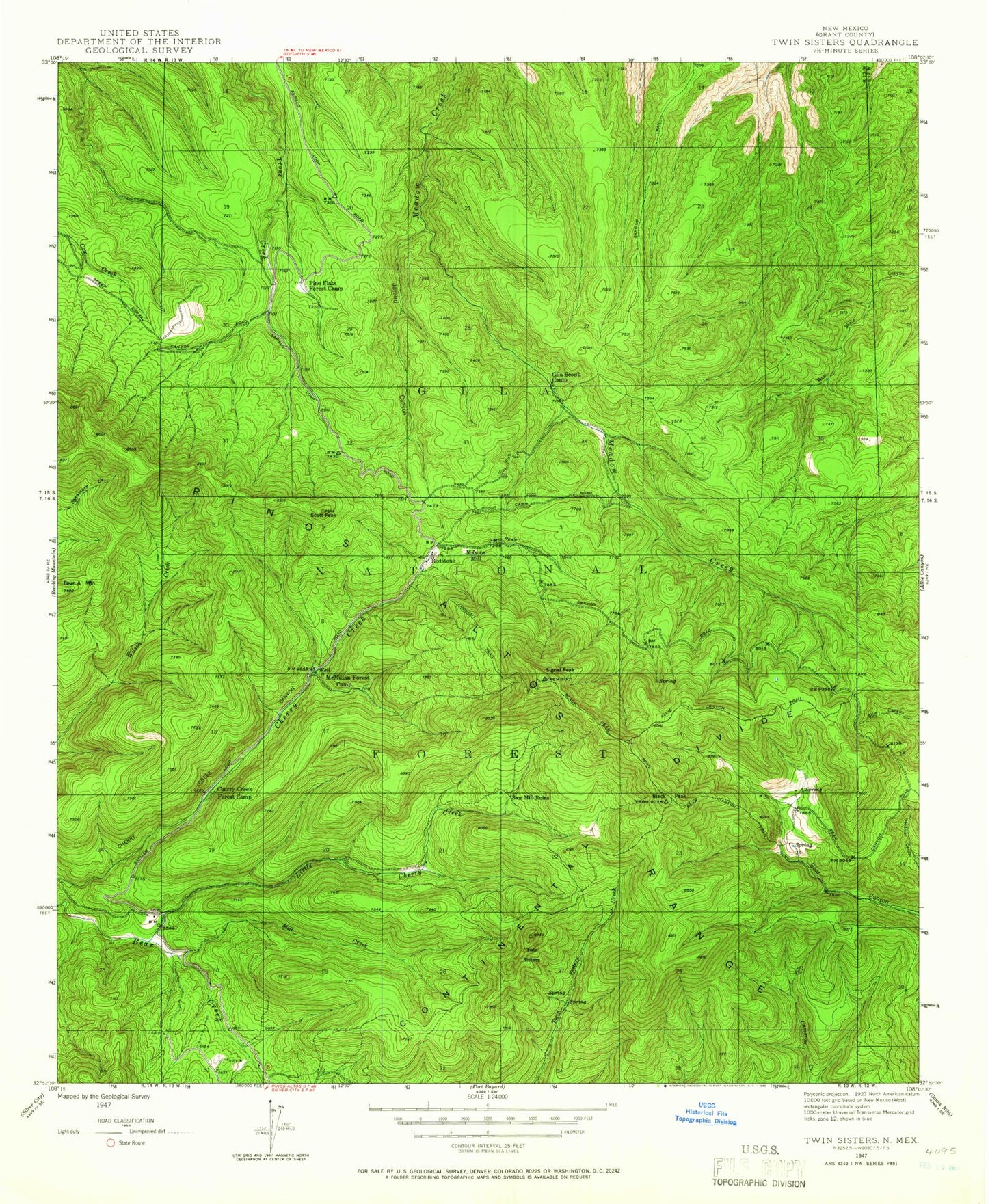
Classic USGS Twin Sisters New Mexico 7.5'x7.5' Topo Map
Couldn't load pickup availability
Historical USGS topographic quad map of Twin Sisters in the state of New Mexico. Typical map scale is 1:24,000, but may vary for certain years, if available. Print size: 24" x 27"
This quadrangle is in the following counties: Grant.
The map contains contour lines, roads, rivers, towns, and lakes. Printed on high-quality waterproof paper with UV fade-resistant inks, and shipped rolled.
Contains the following named places: Ben Lilly Memorial, Lookout Point, Signal Peak Trail, T X Mountain, Allie Canyon Trail, Bear Canyon Trail, Black Peak, Black Peak Trail, Cherry Creek Campground, Gila Scout Camp, Jaybird Canyon, Little Cherry Creek, Lookout Trail, Masons Mill (historical), McMillan Campground, Mill Creek, Pine Flats Campground, Pinos Altos Range, Redstone, Sapillo Trail, Saw Mill Ruins (historical), Scott Peak, Signal Peak, Twin Sisters, Three Pine Tank, Allie Spring, McMillan Spring, Slack Sawmill Tank, No Name Tank, Pinos Altos, Little Victor Tunnel, Gloden Rule Mine, 00020 Water Well, Silver City Ranger District, Ben Lilly Memorial, Lookout Point, Signal Peak Trail, T X Mountain, Allie Canyon Trail, Bear Canyon Trail, Black Peak, Black Peak Trail, Cherry Creek Campground, Gila Scout Camp, Jaybird Canyon, Little Cherry Creek, Lookout Trail, Masons Mill (historical), McMillan Campground, Mill Creek, Pine Flats Campground, Pinos Altos Range, Redstone, Sapillo Trail, Saw Mill Ruins (historical), Scott Peak, Signal Peak, Twin Sisters, Three Pine Tank, Allie Spring, McMillan Spring, Slack Sawmill Tank, No Name Tank, Pinos Altos, Little Victor Tunnel, Gloden Rule Mine, 00020 Water Well, Silver City Ranger District, Ben Lilly Memorial, Lookout Point, Signal Peak Trail, T X Mountain, Allie Canyon Trail, Bear Canyon Trail, Black Peak, Black Peak Trail, Cherry Creek Campground, Gila Scout Camp, Jaybird Canyon, Little Cherry Creek, Lookout Trail, Masons Mill (historical), McMillan Campground, Mill Creek, Pine Flats Campground, Pinos Altos Range, Redstone, Sapillo Trail, Saw Mill Ruins (historical), Scott Peak, Signal Peak, Twin Sisters, Three Pine Tank, Allie Spring, McMillan Spring, Slack Sawmill Tank, No Name Tank, Pinos Altos, Little Victor Tunnel, Gloden Rule Mine, 00020 Water Well, Silver City Ranger District