MyTopo
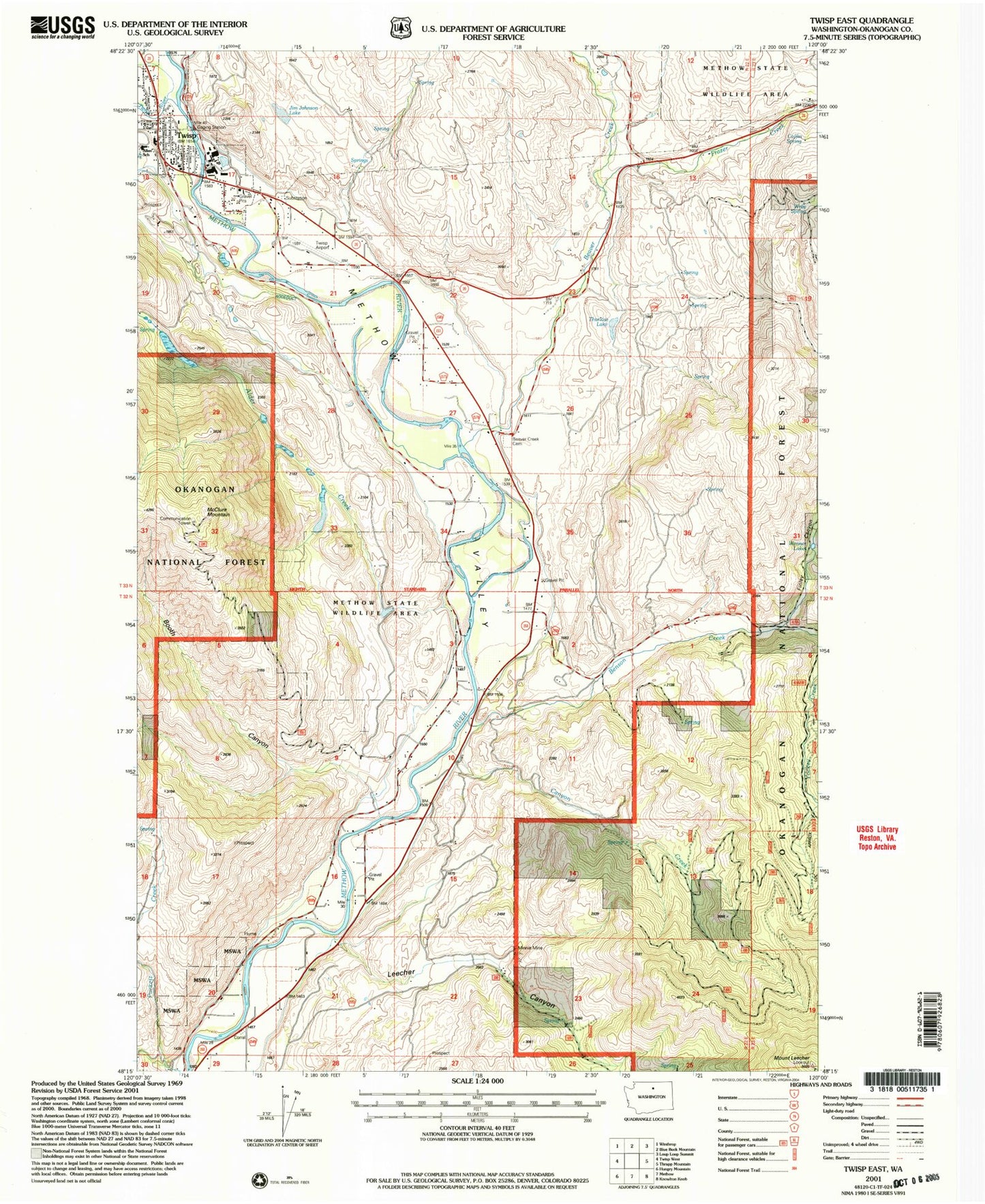
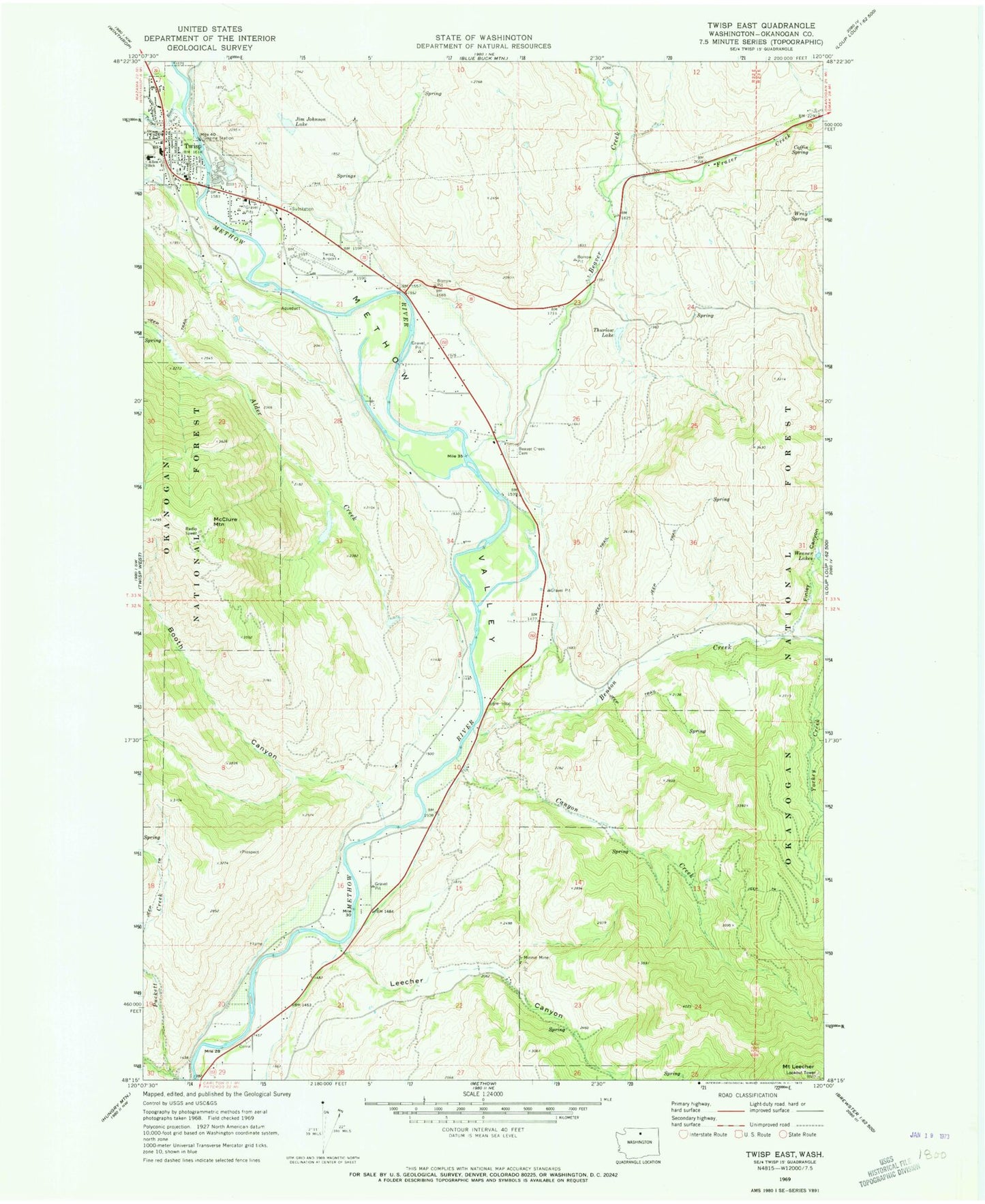
Classic USGS Twisp East Washington 7.5'x7.5' Topo Map
Couldn't load pickup availability
Historical USGS topographic quad map of Twisp East in the state of Washington. Map scale may vary for some years, but is generally around 1:24,000. Print size is approximately 24" x 27"
This quadrangle is in the following counties: Okanogan.
The map contains contour lines, roads, rivers, towns, and lakes. Printed on high-quality waterproof paper with UV fade-resistant inks, and shipped rolled.
Contains the following named places: Aero Methow Rescue Service, Alder Creek, Beaver Creek, Beaver Creek Cemetery, Benson Creek, Booth Canyon, Calvary Baptist Church, Canyon Creek, Carlton Post Office, Coffin Spring, Community Kids Child Care and Enrichment Center, Finley Canyon, Frazer Creek, Jim Johnson Lake, Leecher Canyon, McClure Mountain, Minnie Mine, Mount Leecher, North Fork Booth Canyon Creek, Port Field, South Fork Booth Canyon Creek, The Church of Jesus Christ of Latter Day Saints, Thurlow Lake, Town of Twisp, Twisp, Twisp City Hall, Twisp Library, Twisp Municipal Airport, Twisp Police Department, Twisp Post Office, Twisp River, Twisp Sewage Treatment Plant, Wenner Lake Number One Dam, Wenner Lakes Number One, Wray Spring