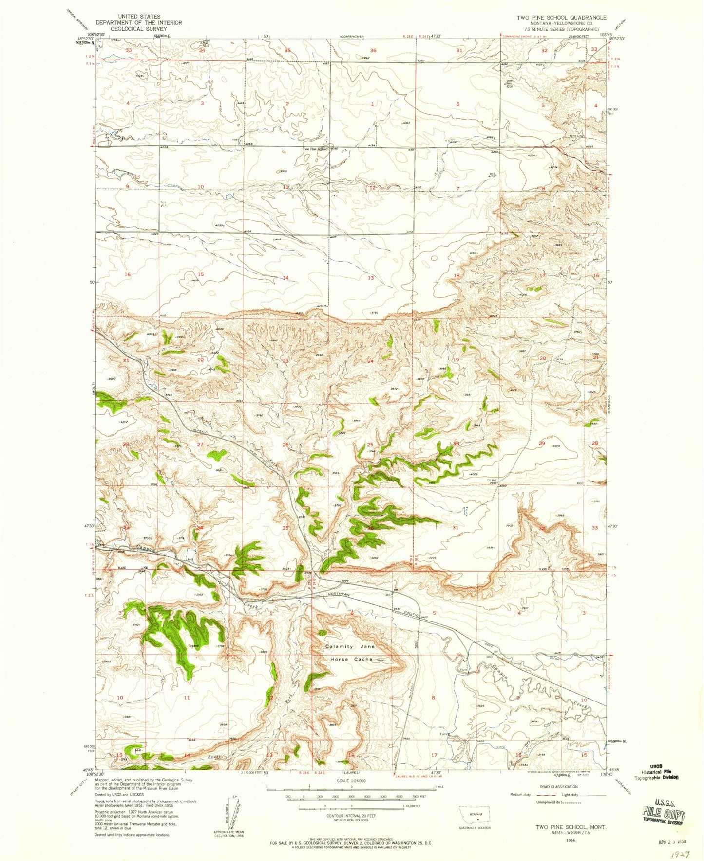
MyTopo
Classic USGS Two Pine School Montana 7.5'x7.5' Topo Map
Regular price
$16.95
Regular price
Sale price
$16.95
Unit price
per
Couldn't load pickup availability
Historical USGS topographic quad map of Two Pine School in the state of Montana. Map scale may vary for some years, but is generally around 1:24,000. Print size is approximately 24" x 27"
This quadrangle is in the following counties: Yellowstone.
The map contains contour lines, roads, rivers, towns, and lakes. Printed on high-quality waterproof paper with UV fade-resistant inks, and shipped rolled.
Contains the following named places: 01N23E12A___01 Well, 01N23E35DDBD01 Well, 01S24E10BDAA01 Well, Calamity Jane Horse Cache, Dry Creek, F Downs Number 1 Dam, North Fork Canyon Creek, South Fork Canyon Creek, Two Pine School