MyTopo
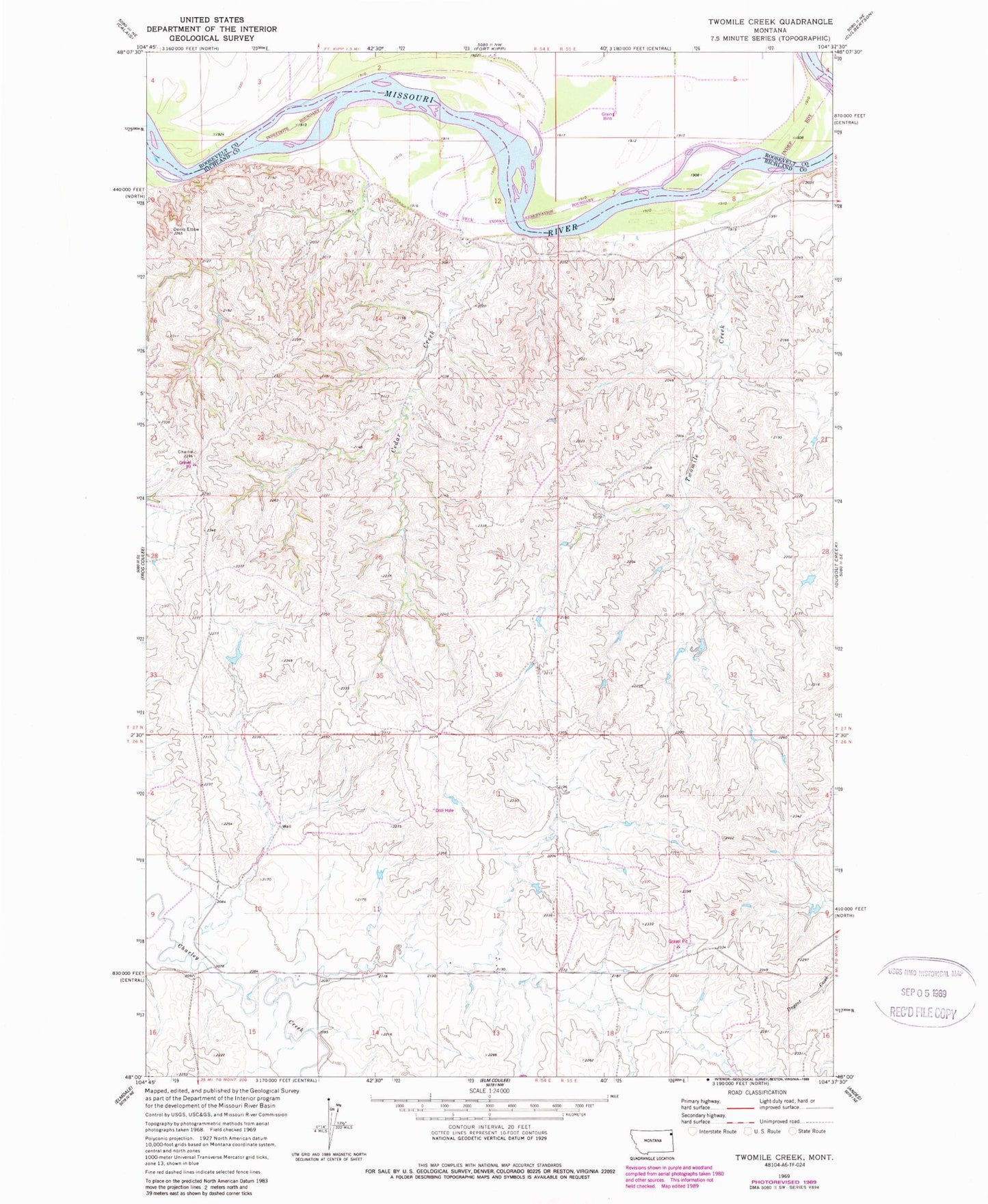
Classic USGS Twomile Creek Montana 7.5'x7.5' Topo Map
Regular price
$16.95
Regular price
Sale price
$16.95
Unit price
per
Couldn't load pickup availability
Historical USGS topographic quad map of Twomile Creek in the state of Montana. Map scale may vary for some years, but is generally around 1:24,000. Print size is approximately 24" x 27"
This quadrangle is in the following counties: Richland, Roosevelt.
The map contains contour lines, roads, rivers, towns, and lakes. Printed on high-quality waterproof paper with UV fade-resistant inks, and shipped rolled.
Contains the following named places: 26N54E03DCAB01 Well, 26N55E06CBCD01 Well, 27N54E12CC__01 Well, 27N54E12CCAC01 Well, 27N54E12CCAD01 Well, 27N55E17BB__01 Well, C Sowle Reservoir Dam, Cedar Creek, Fort Stewart, Juniors Place Dam, Twomile Creek