MyTopo
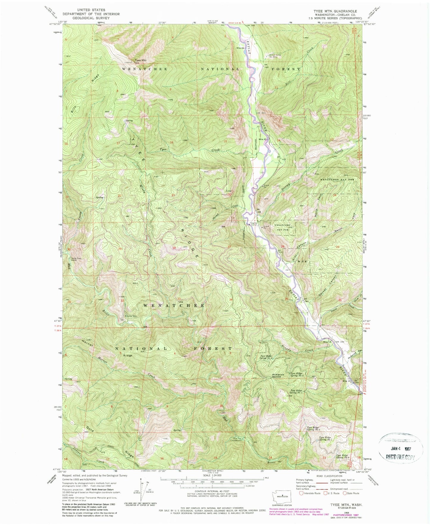
Classic USGS Tyee Mountain Washington 7.5'x7.5' Topo Map
Couldn't load pickup availability
Historical USGS topographic quad map of Tyee Mountain in the state of Washington. Map scale may vary for some years, but is generally around 1:24,000. Print size is approximately 24" x 27"
This quadrangle is in the following counties: Chelan.
The map contains contour lines, roads, rivers, towns, and lakes. Printed on high-quality waterproof paper with UV fade-resistant inks, and shipped rolled.
Contains the following named places: Billy Ridge, Camp Nine, Decker Canyon, Dill Creek, Entiat Division, Entiat Valley Ski Area, Gray Canyon, Hornet Creek, McKenzie Canyon, McKenzie Saddle, North Fork Gray Canyon, North Fork Potato Creek, Pine Flat Campground, Potato Creek, Roundy Creek, Shamel Creek, South Fork Grays Canyon, Stormy Creek, Tyee Creek, Tyee Mountain, Tyee Mountain Lookout, Tyee Ridge Spring Number 1, Tyee Ridge Spring Number 2, Tyee Ridge Spring Number 3, Tyee Ridge Spring Number 6, Tyee Ridge Spring Number 7, Tyee Ridge Spring Number 8, Windy Creek, Young Creek, Young Creek Shelter