MyTopo
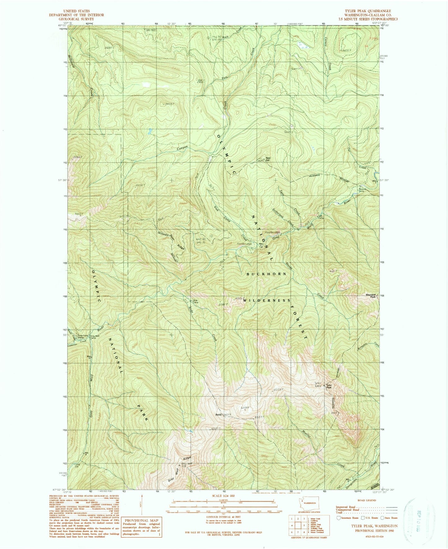
Classic USGS Tyler Peak Washington 7.5'x7.5' Topo Map
Couldn't load pickup availability
Historical USGS topographic quad map of Tyler Peak in the state of Washington. Typical map scale is 1:24,000, but may vary for certain years, if available. Print size: 24" x 27"
This quadrangle is in the following counties: Clallam.
The map contains contour lines, roads, rivers, towns, and lakes. Printed on high-quality waterproof paper with UV fade-resistant inks, and shipped rolled.
Contains the following named places: Baldy, Baldy Trail (historical), Cameron Creek, Camp Ellis, Camp Tony (historical), Cat Creek, Cliff Camp, Deer Ridge, Divide Creek, Grand Creek, Gray Wolf Ridge, Gray Wolf Camp, Maynard Burn Way (historical), Maynard Peak, Mineral Spring (historical), Mueller Creek, Ned Hill, Ned Hill Trail (historical), Slab Camp Creek, Slab Camp Guard Station (historical), Slide Camp, Slide Creek, Sutherland Creek, Three Forks Shelter, Three O'Clock Ridge, Twin Creek, Twomile Camp, Tyler Peak, Gray Wolf, Peak B