MyTopo
Classic USGS Tyonek C-1 NE Alaska 7.5'x7.5' Topo Map
Couldn't load pickup availability
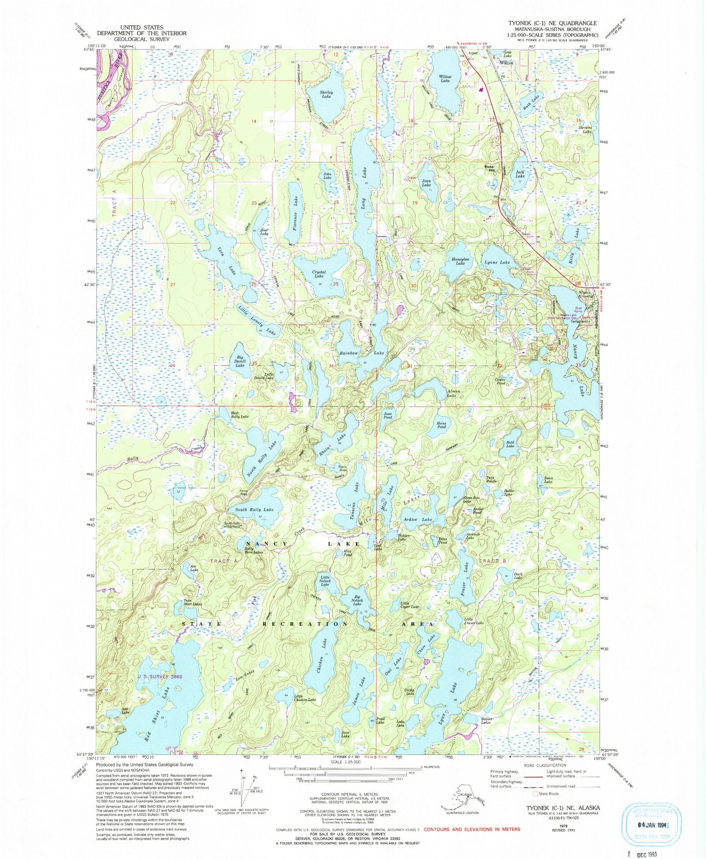
Historical USGS topographic quad map of Tyonek C-1 NE in the state of Alaska. Map scale may vary for some years, but is generally around 1:24,000. Print size is approximately 24" x 27"
This quadrangle is in the following counties: Matanuska-Susitna.
The map contains contour lines, roads, rivers, towns, and lakes. Printed on high-quality waterproof paper with UV fade-resistant inks, and shipped rolled.
Contains the following named places: AK-10 Airstrip, Bald Lake, Big Noluck Lake, Boot Lake, Cathy Lake, Charr Lake, Chicken Lake, Crystal Lake, Florence Lake, Frazer Lake, Gene Lake, Heins Pond, Honeybee Lake, Honeybee Lake Aero Park, Jack Lake, Jacknife Lake, James Lake, Jano Pond, Jean Lake, John Lake, Kelly Lake, Lilly Creek, Little Chicken Lake, Little Lonely Lake, Little Noluck Lake, Long Lake, Long Lake Airport, Long Lake Seaplane Base, Low Lakes, Lynne Lake, Lynx Creek, Lynx Lake, Milo Lakes, Minuteman Lake Seaplane Base, Minuteman Strip, Nancy Lake, North Rolly Lake, Owl Lake, Pond Lake, Radar Hill, Rainbow Lake, Rhein Lake, Rolly Twin Lakes, Ruth Lake, Shirley Lake Airport, Skid Marks Airport, South Rolly Lake, Sunbeam Lake, Suncrest Lake, Sunshine Community Health Center Willow, Tanaina Lake, Tanltun Dinlent, Twin Shirt Lakes, Vera Lake, Willow, Willow Ambulance Service, Willow Fire Department Main Station 12 - 1, Willow Lake, Willow Post Office, Willow Seaplane Base, Yates Pond