MyTopo
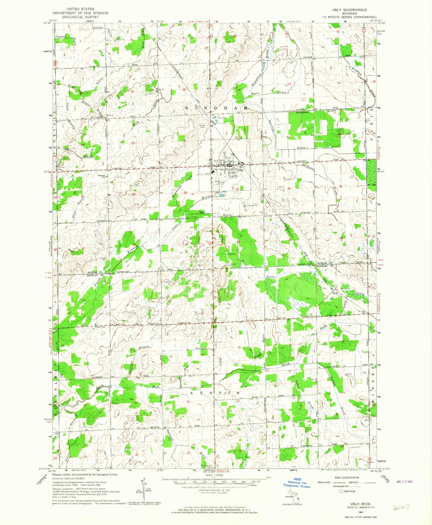
Classic USGS Ubly Michigan 7.5'x7.5' Topo Map
Couldn't load pickup availability
Historical USGS topographic quad map of Ubly in the state of Michigan. Map scale may vary for some years, but is generally around 1:24,000. Print size is approximately 24" x 27"
This quadrangle is in the following counties: Huron, Sanilac.
The map contains contour lines, roads, rivers, towns, and lakes. Printed on high-quality waterproof paper with UV fade-resistant inks, and shipped rolled.
Contains the following named places: Austin Drain, Bingham Drain, Bingham School, Bingham Township Ambulance Service, Bingham Township Fire Department, Bloomington Post Office, Brown Drain, Brumba Park, Byers Drain, Citizens Bank Block Historical Marker, Humphrey Drain, Huron Medical Center Ubly Campus, Janowaik Drain, Lamka Drain, Mount Pleasant Cemetery, Nugent Drain, Old Saint John's Cemetery, Osentoski Branch, O'Shea Drain, Perviski Drain, Rathbone Drain, Rush Drain, Saint John the Evangelist Catholic Cemetery, Saint John's Evangelist Parish, Schant Drain, Schiestel Drain, Sleeper Public Library, South Branch Rush Drain, Sparling Drain, Stanbaugh Drain, Tough Drain, Township of Austin, Township of Bingham, Tyre, Tyre Cemetery, Tyre Drain, Tyre Post Office, Tyre Station, Ubly, Ubly Dragway, Ubly Heights Golf Course, Ubly High School, Ubly Medical Clinic, Ubly Police Department, Ubly Post Office, Ubly Station, Ubly Village Hall, Ubly Village Park, Valley Cemetery, Village of Ubly, WUCX-TV (Bad Axe), ZIP Code: 48475