MyTopo
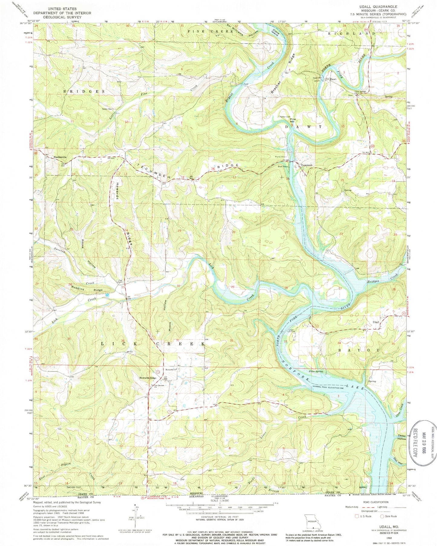
Classic USGS Udall Missouri 7.5'x7.5' Topo Map
Couldn't load pickup availability
Historical USGS topographic quad map of Udall in the state of Missouri. Typical map scale is 1:24,000, but may vary for certain years, if available. Print size: 24" x 27"
This quadrangle is in the following counties: Ozark.
The map contains contour lines, roads, rivers, towns, and lakes. Printed on high-quality waterproof paper with UV fade-resistant inks, and shipped rolled.
Contains the following named places: Big Hollow, Bracher Ridge, Bridges Creek, Cane Creek, Cedar Hollow, Clear Springs Church, Crane Island, Doc Hollow, Fay Cemetery, Hardenville, Howards Church, Howards Ridge, Howards Ridge, Lick Creek, Liner Creek, Little Pine Creek, Moore Hollow, Our Saviors Church, Parker Cemetery, Pine Hill, Price Spring, Provo Hollow, Robbins Ridge, Rouse Hollow, Sal Williams Hollow, Sallee Cemetery, Sweeten Creek, Tecumseh, Tecumseh Ridge, Udall, Sallee School (historical), Fay School (historical), Bratcher School (historical), Sand Ridge School (historical), Liner School (historical), Dawt School (historical), Udall School (historical), Billy Buster Ford (historical), Gifford Ford, Banner School (historical), Poe Ford (historical), Price Cemetery (historical), Pumphrey Ford (historical), Bryant Creek, Saint Leger, Prestonia, Fay, Dawt, Dawt Mill, Udall Landing, Bridges Creek Access, Ford Cove Access, Prestonia Post Office (historical), Dawt Mill Pond Dam, Dawt Mill Pond, Township of Dawt, Township of Lick Creek, Lick Creek Valley Volunteer Fire Department, Tecumseh Post Office, Hardenville Post Office


