MyTopo
Classic USGS Uehling Nebraska 7.5'x7.5' Topo Map
Couldn't load pickup availability
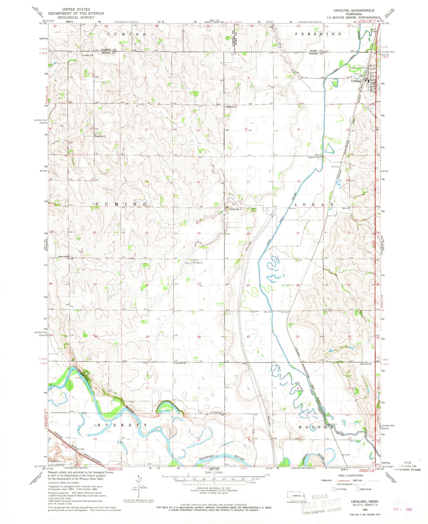
Historical USGS topographic quad map of Uehling in the state of Nebraska. Map scale may vary for some years, but is generally around 1:24,000. Print size is approximately 24" x 27"
This quadrangle is in the following counties: Burt, Cuming, Dodge.
The map contains contour lines, roads, rivers, towns, and lakes. Printed on high-quality waterproof paper with UV fade-resistant inks, and shipped rolled.
Contains the following named places: Agland Cooperative Elevator, Dry Creek, First Congregational Church, KWPN-FM (West Point), Lewisburgh Post Office, Logan View Junior-Senior High School, Old Channel Logan Creek, Saint Johns Cemetery, Saint Johns Church, Saint Paul Church, Saint Pauls Lutheran Church, School Number 16, School Number 18, School Number 35, School Number 60, School Number 83, School Number 89, Township of Cuming, Township of Logan, Uehling, Uehling Elementary School, Uehling Fire Department, Uehling Post Office, Uehling Rescue Squad, Village of Uehling, ZIP Code: 68031