MyTopo
Classic USGS Umbarger Texas 7.5'x7.5' Topo Map
Regular price
$16.95
Regular price
Sale price
$16.95
Unit price
per
Couldn't load pickup availability
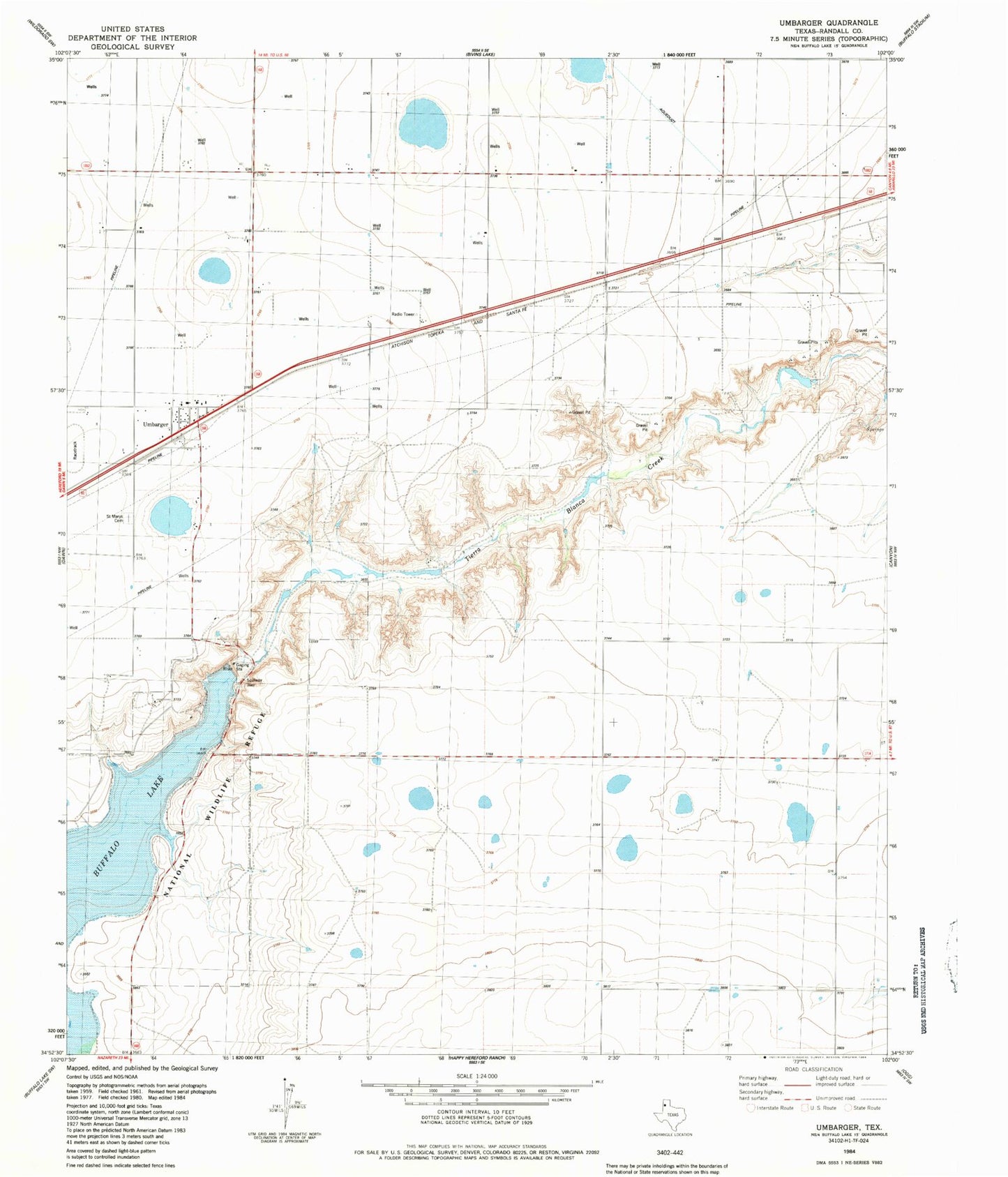
Historical USGS topographic quad map of Umbarger in the state of Texas. Map scale may vary for some years, but is generally around 1:24,000. Print size is approximately 24" x 27"
This quadrangle is in the following counties: Randall.
The map contains contour lines, roads, rivers, towns, and lakes. Printed on high-quality waterproof paper with UV fade-resistant inks, and shipped rolled.
Contains the following named places: Buffalo Lake, Buffalo Lake National Wildlife Refuge, Flying Mare Ranch, Randall County Fire and Rescue Station 3, Saint Marys Catholic Church, Saint Mary's Cemetery, Seven B Ranch, Umbarger, Umbarger Census Designated Place, Umbarger Dam, Umbarger Post Office