
MyTopo
Classic USGS Umcolcus Lake Maine 7.5'x7.5' Topo Map
Regular price
$16.95
Regular price
Sale price
$16.95
Unit price
per
Couldn't load pickup availability
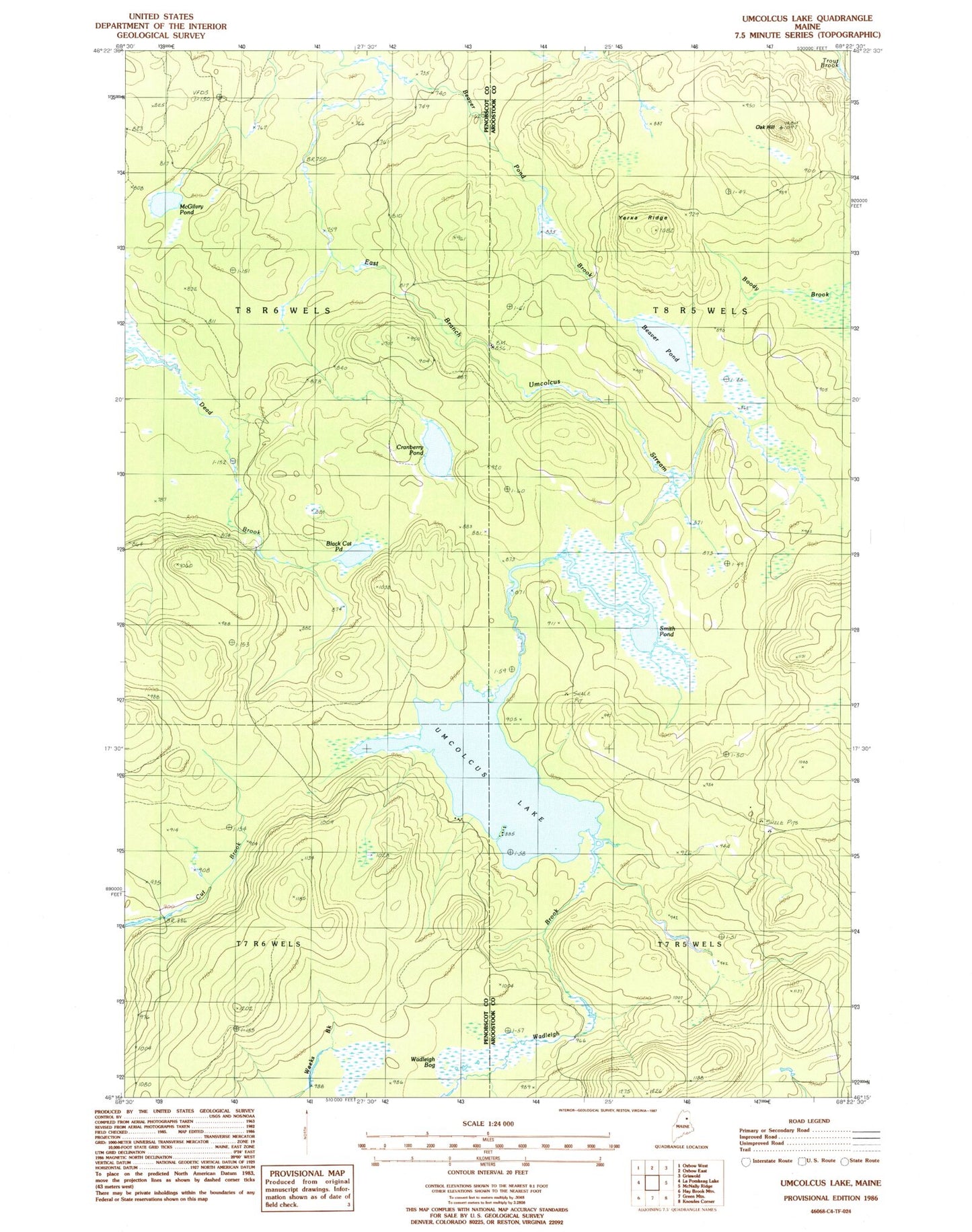
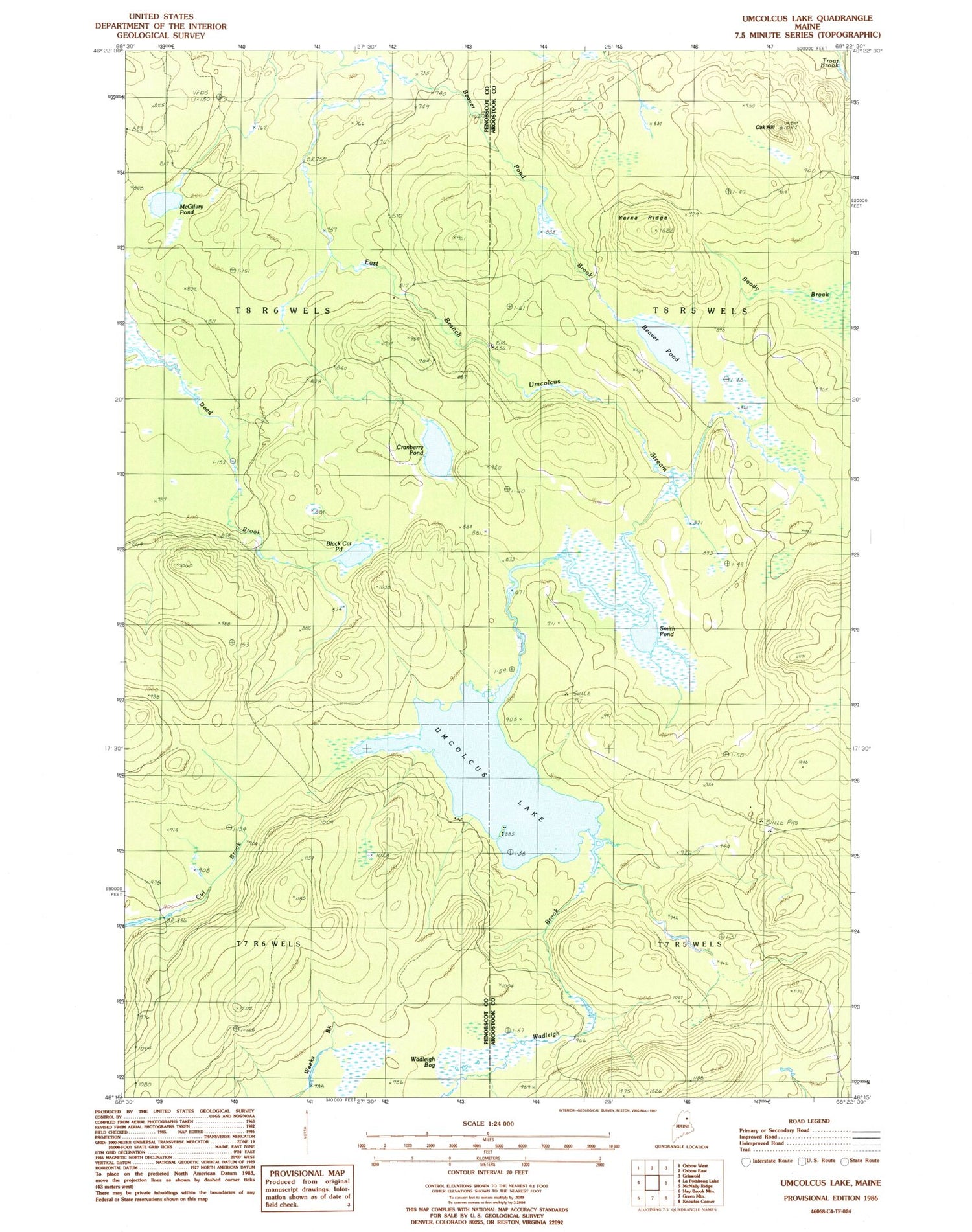
Historical USGS topographic quad map of Umcolcus Lake in the state of Maine. Map scale may vary for some years, but is generally around 1:24,000. Print size is approximately 24" x 27"
This quadrangle is in the following counties: Aroostook, Penobscot.
The map contains contour lines, roads, rivers, towns, and lakes. Printed on high-quality waterproof paper with UV fade-resistant inks, and shipped rolled.
Contains the following named places: Beaver Pond, Beaver Pond Brook, Black Cat Pond, Cranberry Pond, McGilvry Pond, McManus Camp, Oak Hill, Smith Pond, Umcolcus Lake, Wadleigh Brook, West Branch Umcolcus Stream, Yerxa Ridge