MyTopo
Classic USGS Umikoa Hawaii 7.5'x7.5' Topo Map
Regular price
$16.95
Regular price
Sale price
$16.95
Unit price
per
Couldn't load pickup availability
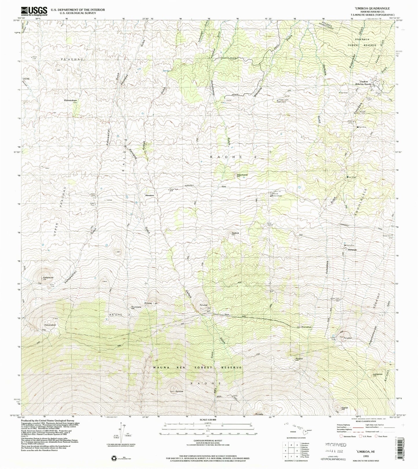
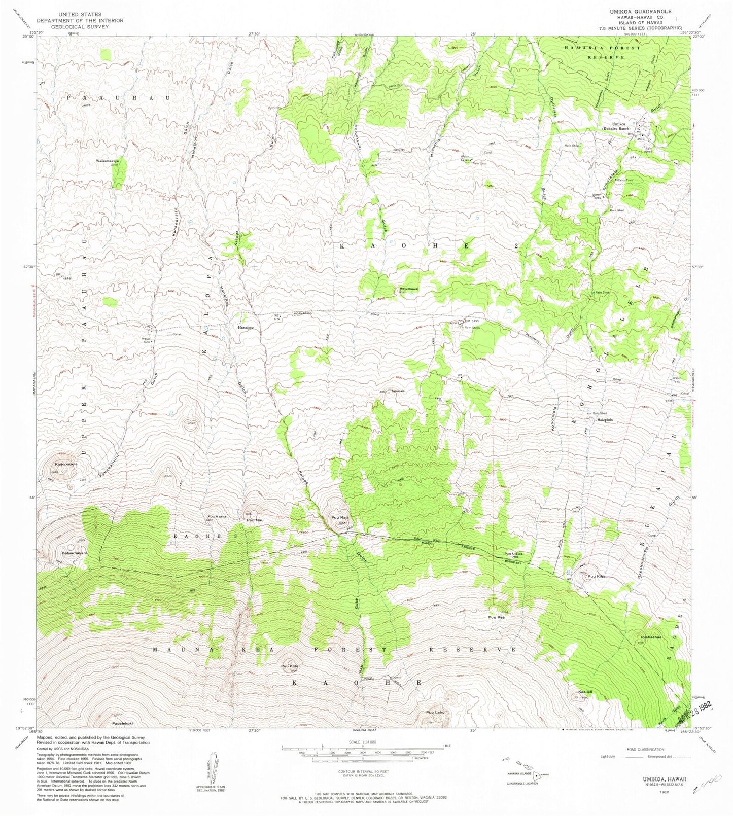
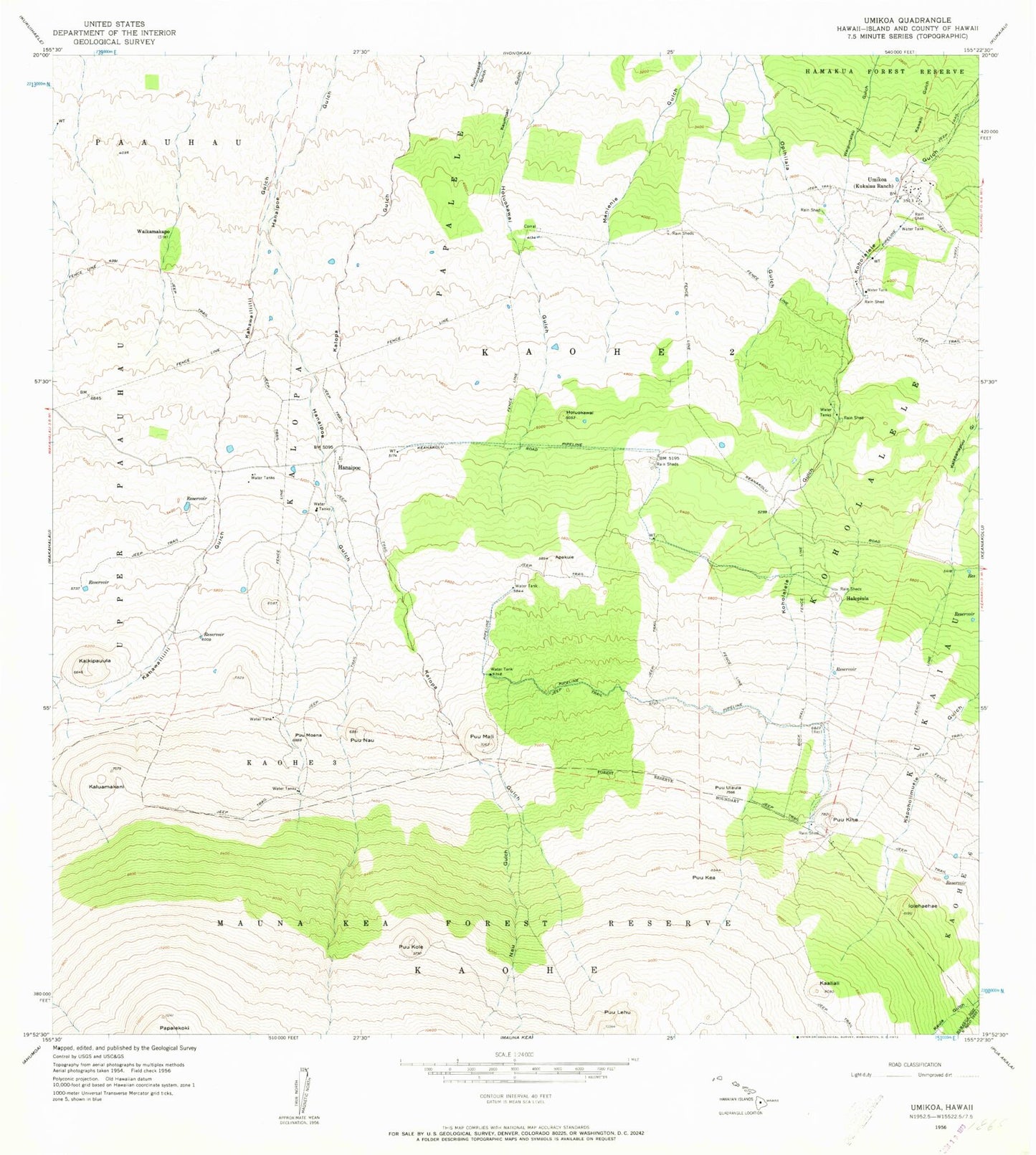
Historical USGS topographic quad map of Umikoa in the state of Hawaii. Map scale may vary for some years, but is generally around 1:24,000. Print size is approximately 24" x 27"
This quadrangle is in the following counties: Hawaii.
The map contains contour lines, roads, rivers, towns, and lakes. Printed on high-quality waterproof paper with UV fade-resistant inks, and shipped rolled.
Contains the following named places: Apakuie, Halepiula, Hanaipoe, Holuokawai, Iolehaehae, Kaaliali, Kaikipauula, Kalopa, Kaluamakani, Ka'ohe Three, Ka'ohe Two, Koholalele, Na'u Gulch, Pu'ukea, Pu'ukihe, Pu'ukole, Pu'umali, Pu'umoana, Pu'unau, Pu'u'ula'ula, 'Umikoa, Waikamakapo, ZIP Code: 96776