MyTopo
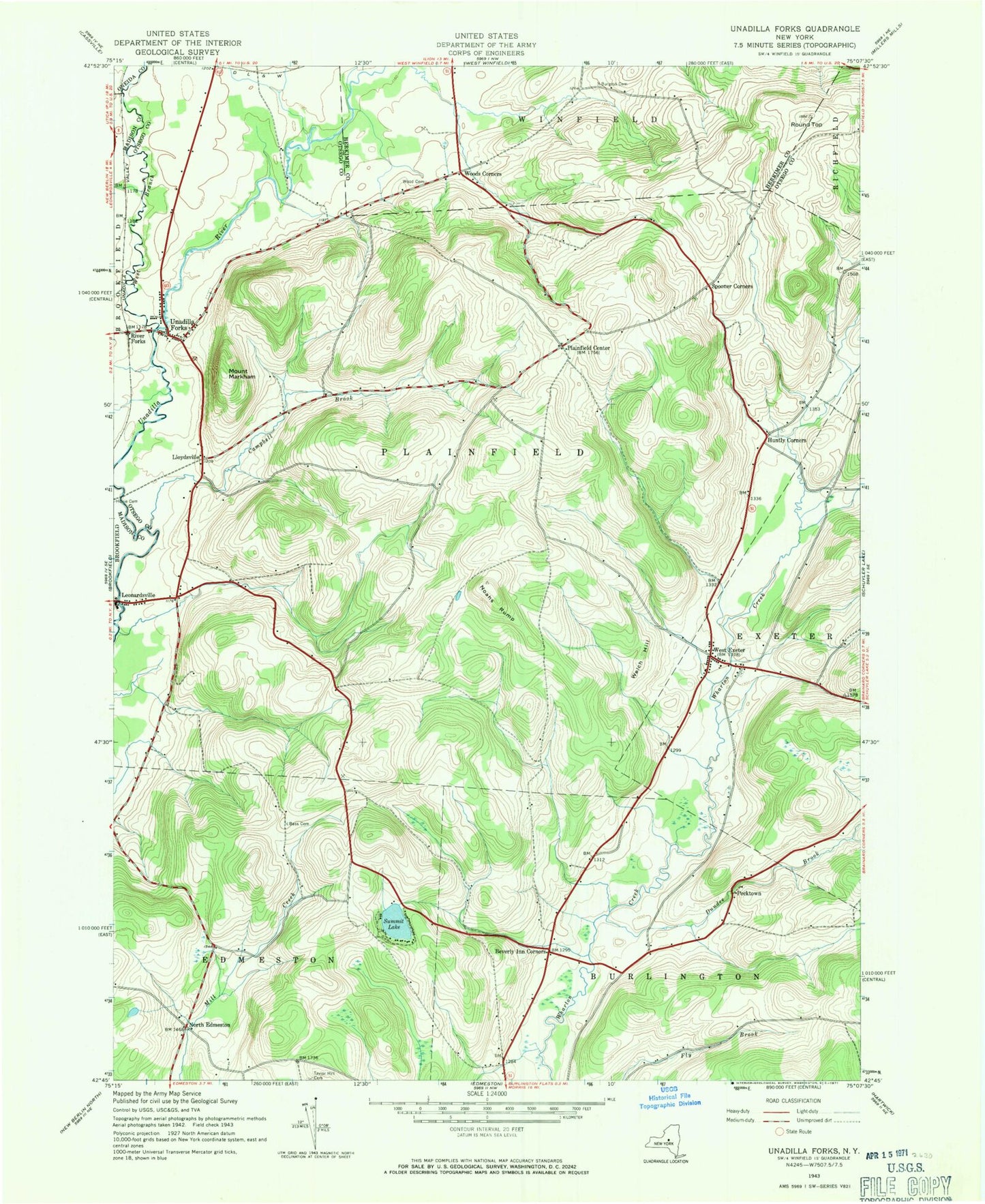
Classic USGS Unadilla Forks New York 7.5'x7.5' Topo Map
Couldn't load pickup availability
Historical USGS topographic quad map of Unadilla Forks in the state of New York. Map scale may vary for some years, but is generally around 1:24,000. Print size is approximately 24" x 27"
This quadrangle is in the following counties: Herkimer, Madison, Oneida, Otsego.
The map contains contour lines, roads, rivers, towns, and lakes. Printed on high-quality waterproof paper with UV fade-resistant inks, and shipped rolled.
Contains the following named places: Bass Cemetery, Beverly Inn Corners, Burgess Cemetery, Campbell Brook, Dundee Brook, Hoxie Cemetery, Huntly Cemetery, Huntly Corners, Lloydsville, Mount Markham, Noahs Rump, North Edmeston, Pecktown, Plainfield Center, River Forks, Round Top, School Number 8, Spooner Corners, Stonegate Country Club at Summit Lakes, Summit Lake, Taylor Hill Cemetery, TGP-245 Heliport, Town of Plainfield, Unadilla Forks, Unadilla Forks Cemetery, Unadilla Forks Census Designated Place, Unadilla Forks Volunteer Fire Company, Welch Hill, West Branch Unadilla River, West Exeter, West Exeter Cemetery, West Exeter Fire Department, Wood Cemetery, Woods Corners, ZIP Code: 13491