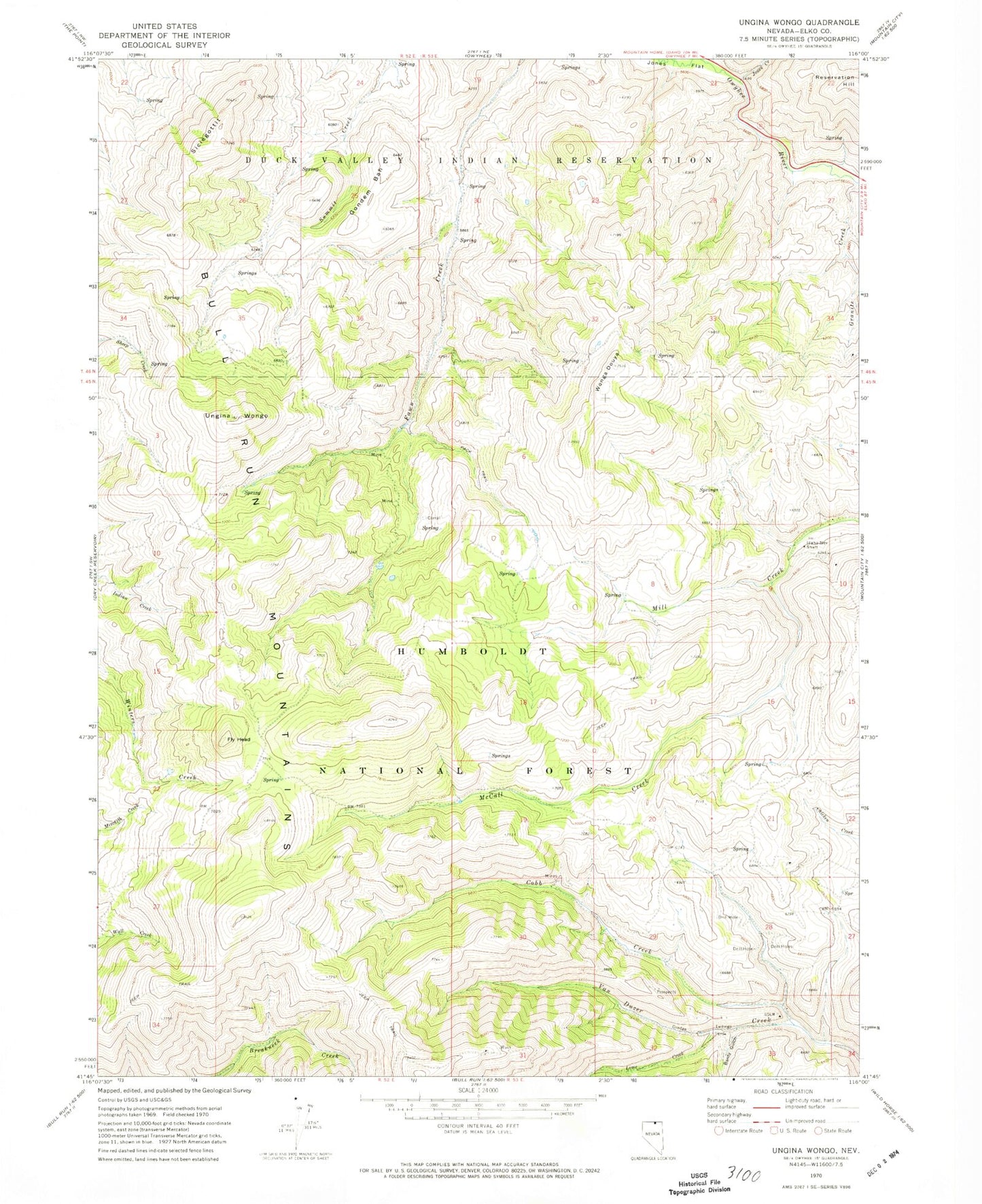
MyTopo
Classic USGS Ungina Wongo Nevada 7.5'x7.5' Topo Map
Regular price
$16.95
Regular price
Sale price
$16.95
Unit price
per
Couldn't load pickup availability
Historical USGS topographic quad map of Ungina Wongo in the state of Nevada. Map scale may vary for some years, but is generally around 1:24,000. Print size is approximately 24" x 27"
This quadrangle is in the following counties: Elko.
The map contains contour lines, roads, rivers, towns, and lakes. Printed on high-quality waterproof paper with UV fade-resistant inks, and shipped rolled.
Contains the following named places: Banty Gulch, Blue Ribbon Mine, Cobb Creek, Fly Head, Gondem Bah, Granite Creek, Idaho Nevada Shaft, Jones Creek, Lime Creek, McCall Creek, Picnic Flats, Siciegottit, Ungina Wongo, Wonga Douya