
MyTopo
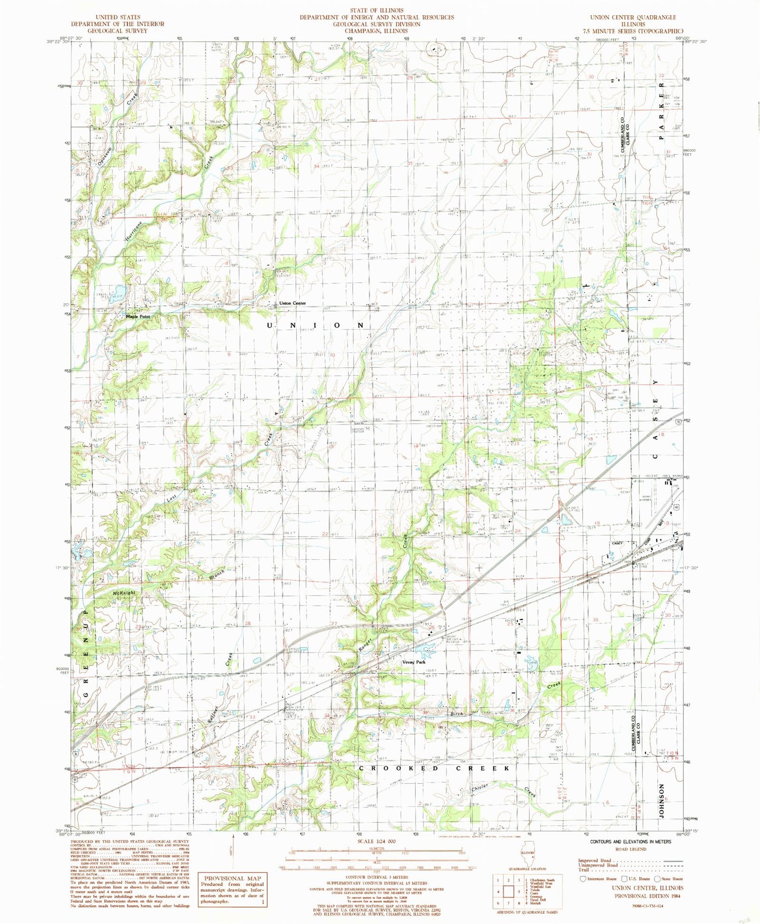
Classic USGS Union Center Illinois 7.5'x7.5' Topo Map
Couldn't load pickup availability
Historical USGS topographic quad map of Union Center in the state of Illinois. Map scale may vary for some years, but is generally around 1:24,000. Print size is approximately 24" x 27"
This quadrangle is in the following counties: Clark, Cumberland.
The map contains contour lines, roads, rivers, towns, and lakes. Printed on high-quality waterproof paper with UV fade-resistant inks, and shipped rolled.
Contains the following named places: Birch Creek, Bootes Cemetery, Brushy Ridge School, Casey Municipal Airport, Decker Cemetery, Duck Pond Cemetery, Ettlebrick Lake, Ettlebrick Lake Dam, Fairview School, Garrett Cemetery, Lacey School, Lefever School, Lincoln Trail Motosports Park, Lockwain School, Long Point Cemetery, Long Point Church, Macedonia Baptist Church, Macedonia Cemetery, Maple Point, McKnight Branch, McMillan School, Mount Zion Church, Nebo Cemetery, Opossum Creek, Pleasant Valley Church, Plum Grove School, Reed School, Ruffner Cemetery, Ruffner Creek, Ruffner School, Township of Union, Union Cemetery, Union Center, Vevay Park, Weaver School, West Side Church of Christ, Yanaway School


