MyTopo
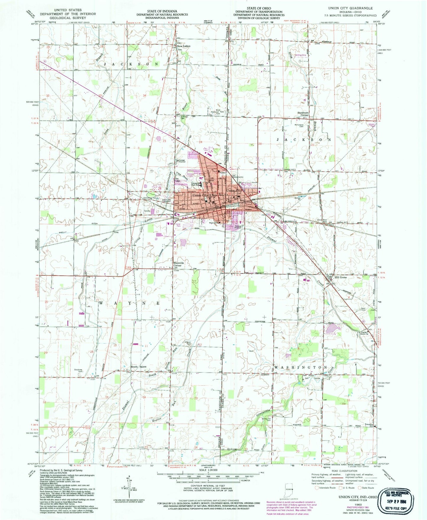
Classic USGS Union City Indiana 7.5'x7.5' Topo Map
Couldn't load pickup availability
Historical USGS topographic quad map of Union City in the states of Indiana, Ohio. Map scale may vary for some years, but is generally around 1:24,000. Print size is approximately 24" x 27"
This quadrangle is in the following counties: Darke, Randolph.
The map contains contour lines, roads, rivers, towns, and lakes. Printed on high-quality waterproof paper with UV fade-resistant inks, and shipped rolled.
Contains the following named places: Bennett School, Bickel School, Brick Memorial Park Cemetery, Buckhorn Corner, Calvary Church, City Drain, City of Union City, Double D Wind Farm, Elson Ditch, Evangelical United Methodist Church, Flory School, Fresh Aire Farms, Haysville Corner, Hill Grove, Hillgrove Cemetery, Hillgrove Federated Church, Hillgrove Post Office, Hoover Cemetery, Hoover Run, Little Ditch, McClure School, McFarland Cemetery, Mississinawa Valley Elementary School, Morris Trailer Park, New Lisbon, North Side Elementary School, O'Conner Ditch, Poplar Grove Church, Price Ditch, Saint Mary Church, Saint Marys Catholic Cemetery, Shelly Ditch, Shockney Cemetery, Snell Cemetery, South Salem, South Salem Run, Spring Hill Cemetery, Spring Hill School, State Run, Stoner School, Township of Jackson, Township of Washington, Township of Wayne, Union City, Union City Cemetery, Union City City Hall, Union City Community High School, Union City Fire Department, Union City Fire Department Station 18, Union City Golf Course, Union City Mobile Home Park, Union City Police Department, Union City Post Office, Village of Union City, WBNN-FM (Union City), West Side Middle School, Whitesell - Conklin Cemetery, Willowcreek Dairy, ZIP Codes: 45390, 47390