MyTopo
Classic USGS Union Furnace Ohio 7.5'x7.5' Topo Map
Couldn't load pickup availability
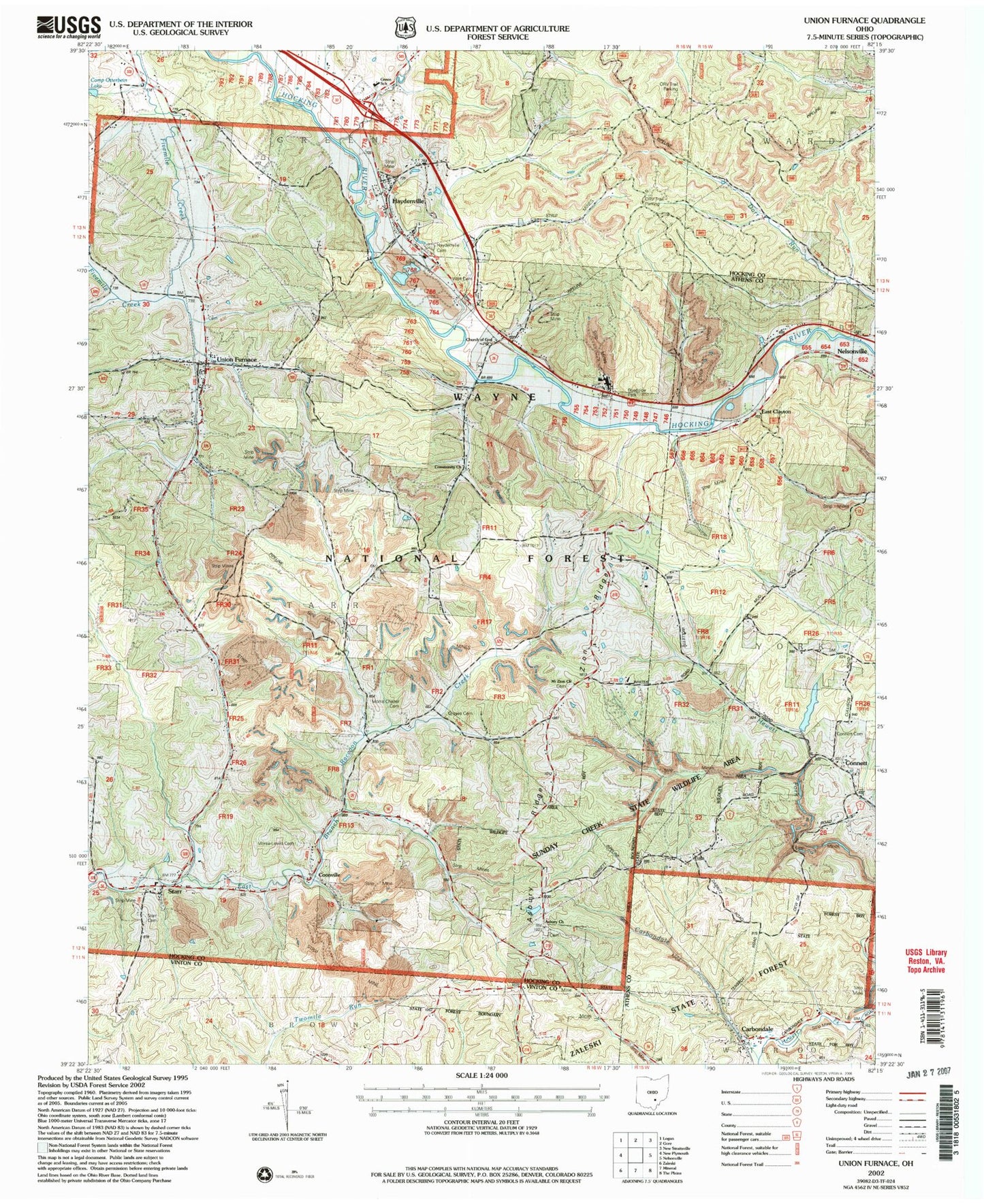
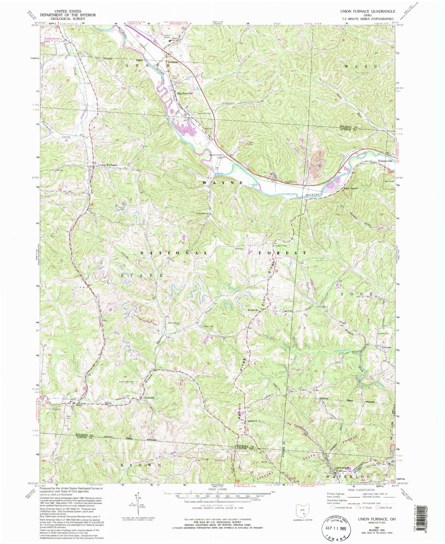
Historical USGS topographic quad map of Union Furnace in the state of Ohio. Typical map scale is 1:24,000, but may vary for certain years, if available. Print size: 24" x 27"
This quadrangle is in the following counties: Athens, Hocking, Vinton.
The map contains contour lines, roads, rivers, towns, and lakes. Printed on high-quality waterproof paper with UV fade-resistant inks, and shipped rolled.
Contains the following named places: Wolf Cemetery, Union Furnace Elementary School, Wolf Basin (historical), Haydenville Station (historical), Summit (historical), Haydenville Historic Town, Asbury Church, Asbury Ridge, Carbondale, Carbondale Creek, Church of God, Connett, Connett Cemetery, Coonville, East Clayton, Groves Cemetery, Haydenville, Haydenville Cemetery, Morris Chapel, Morse - Lewis Cemetery, Mount Zion Church, Starr, Starr Cemetery, Union Furnace, Zion Ridge, Wolfkiln Run, Camp Otterbein Lake Dam, Community Church, Green Elementary School, Township of Starr, Carbondale Post Office, Asbury Cemetery, Croy Cemetery, Morris Chapel Cemetery, Mount Zion Cemetery, Starr Post Office (historical), Haydenville Post Office, Union Furnace Post Office, Starr Township Volunteer Fire Department, Haydenville Census Designated Place, Athens - Hocking Reclamation Center