MyTopo
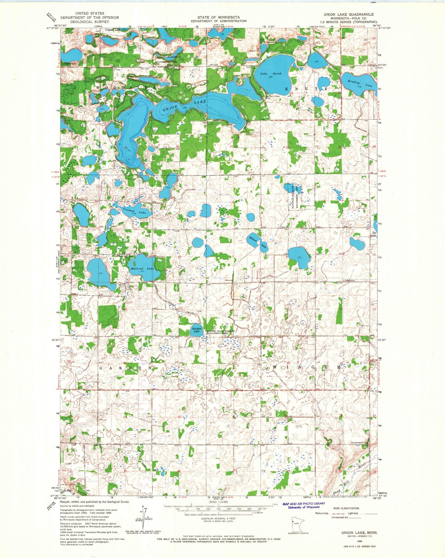
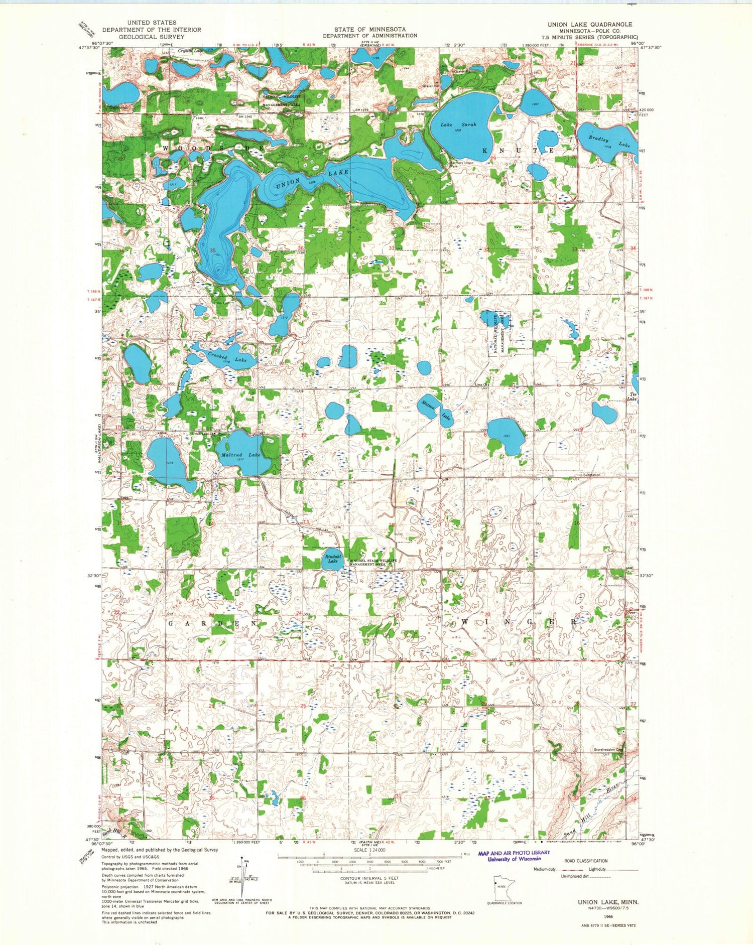
Classic USGS Union Lake Minnesota 7.5'x7.5' Topo Map
Couldn't load pickup availability
Historical USGS topographic quad map of Union Lake in the state of Minnesota. Map scale may vary for some years, but is generally around 1:24,000. Print size is approximately 24" x 27"
This quadrangle is in the following counties: Polk.
The map contains contour lines, roads, rivers, towns, and lakes. Printed on high-quality waterproof paper with UV fade-resistant inks, and shipped rolled.
Contains the following named places: Bailey Cemetery, Bradley Lake, County Ditch Number One Hundred Thirtythree, Crooked Lake, Farmers Union Park, Farmers Union Park Campground, Gossen Post Office, Gregg Post Office, Hemmingsen Private Airport, Lake Sarah, Lima Cemetery, Maltrud Lake, Matson Lake, Rindahl Lake, Rindahl State Wildlife Management Area, Storelvedalen Cemetery, Township of Winger, Union Lake, Union Lake Cemetery, Union Lake Church, Union Lake Sarah Campground, Woodside Post Office, ZIP Code: 56592