MyTopo
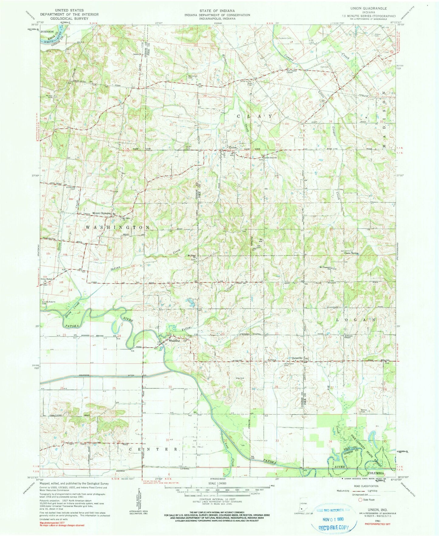
Classic USGS Union Indiana 7.5'x7.5' Topo Map
Couldn't load pickup availability
Historical USGS topographic quad map of Union in the state of Indiana. Map scale may vary for some years, but is generally around 1:24,000. Print size is approximately 24" x 27"
This quadrangle is in the following counties: Gibson, Knox, Pike.
The map contains contour lines, roads, rivers, towns, and lakes. Printed on high-quality waterproof paper with UV fade-resistant inks, and shipped rolled.
Contains the following named places: Armstrong Cemetery, Atkinson Chapel, Barnes Cemetery, Bethlehem Cemetery, Big Creek, Buck Creek, Catt Cemetery, Coats Spring, Decker Branch, Frederick Cemetery, Goose Creek, Houchins Ditch, Independent Order of Odd Fellows Cemetery, Indian Creek, Keg Creek, Kirk - McRoberts Cemetery, Kirk Cemetery, Little Conger Creek, Lost Creek, Miller School, Morrow Lateral, Mount Olive Church, Mount Olympus, Mount Pleasant Church, Mount Tabor Church, New Butler Chapel, Oatsville, Phillips Cemetery, Richardson Cemetery, Salem Church, Stewart Cemetery, Township of Clay, Township of Washington, Union, Union Bethel Church, Wheeling, Yellow Creek, ZIP Code: 47640