MyTopo
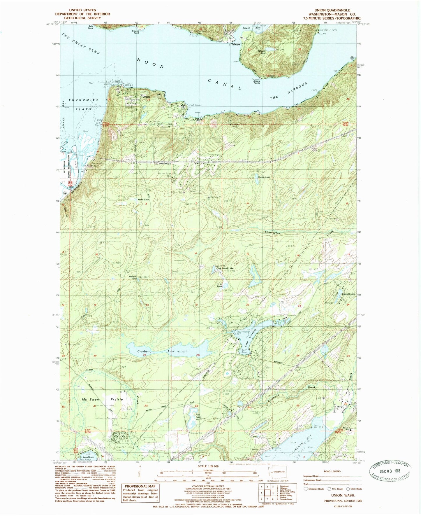
Classic USGS Union Washington 7.5'x7.5' Topo Map
Couldn't load pickup availability
Historical USGS topographic quad map of Union in the state of Washington. Map scale may vary for some years, but is generally around 1:24,000. Print size is approximately 24" x 27"
This quadrangle is in the following counties: Mason.
The map contains contour lines, roads, rivers, towns, and lakes. Printed on high-quality waterproof paper with UV fade-resistant inks, and shipped rolled.
Contains the following named places: Amelia, Ayres Point, Bathtub Lake, Carson Lake, Cranberry Creek, Cranberry Lake, Deepwater Lake, Deer Creek, Emerald Lake, Fernwood, Keene Lake, Lake Leprechaun, Lake Leprechaun Dam, Lake Limerick, Lake Limerick Dam, Lily Pond, Little Island Lake, Malaney Creek, Mason County Fire District 5 Station 4 - Lake Limerick, Mason County Fire District 5 Station 6 - Deer Creek, Mason County Fire District 6, Mason County Fire Protection District 6 Union Fire Department Station 1, McEwen Prairie, New Community Church of Union, North Mason Regional Fire Authority Station 81, Pioneer Intermediate - Middle School, Rainbow Lake, Rex Lake, Rosand Dam, Saint Nicholas Community Episcopal Church, Sisters Point, Skokomish Flats, Skokomish River, Skokomish Valley, Tahuya, Tahuya Post Office, Tahuya River, The Great Bend, The Narrows, Union, Union Census Designated Place, Union Pioneer Cemetery, Union Post Office, Webb Hill, Wheeler Lake, ZIP Code: 98592