MyTopo
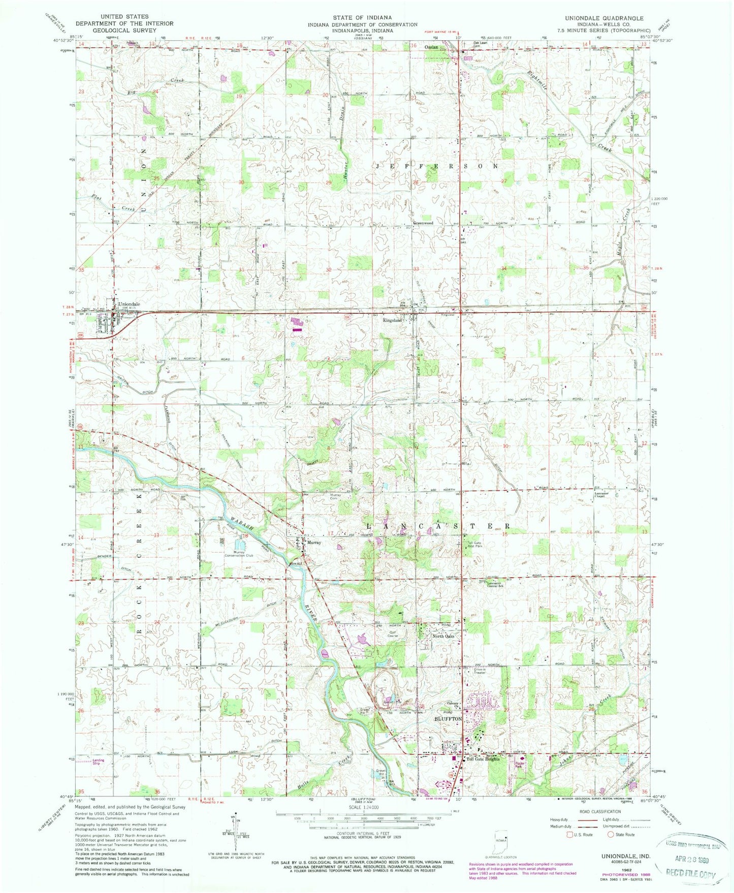
Classic USGS Uniondale Indiana 7.5'x7.5' Topo Map
Couldn't load pickup availability
Historical USGS topographic quad map of Uniondale in the state of Indiana. Map scale may vary for some years, but is generally around 1:24,000. Print size is approximately 24" x 27"
This quadrangle is in the following counties: Wells.
The map contains contour lines, roads, rivers, towns, and lakes. Printed on high-quality waterproof paper with UV fade-resistant inks, and shipped rolled.
Contains the following named places: Bender Ditch, Calvary Church, Dowty Ditch, Flemming Ditch, Grandlienard-Hogg Airport, Greenwood, Halls Creek, Johns Creek, Kingsland, Lancaster Central School, Lancaster Chapel, Lusk Ditch, Mayer Airport, McCullough Ditch, Murray, Murray Cemetery, Murray Conservation Club, North Oaks, Oak Lawn Cemetery, Prospect Church, Skip's Place Airport, Stewart Ditch, Toll Gate Heights, Toll Gate Rest Park, Town of Uniondale, Township of Jefferson, Township of Lancaster, Uniondale, Uniondale Post Office, Uniondale Volunteer Fire Department, ZIP Codes: 46777, 46791