
MyTopo
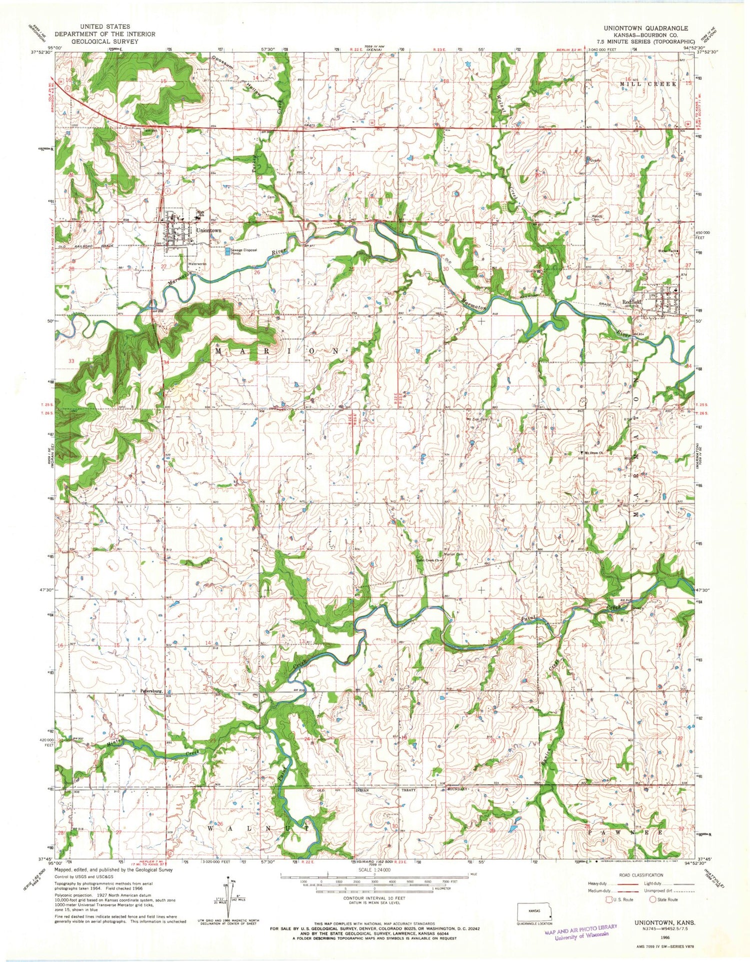
Classic USGS Uniontown Kansas 7.5'x7.5' Topo Map
Couldn't load pickup availability
Historical USGS topographic quad map of Uniontown in the state of Kansas. Map scale may vary for some years, but is generally around 1:24,000. Print size is approximately 24" x 27"
This quadrangle is in the following counties: Bourbon.
The map contains contour lines, roads, rivers, towns, and lakes. Printed on high-quality waterproof paper with UV fade-resistant inks, and shipped rolled.
Contains the following named places: Beachner Grain Elevator Number 16, Bourbon County Fire District 3 Station 1, Bourbon County Fire District 4 Redfield Station, Bunion Creek, City of Redfield, City of Uniontown, East Fairview School, First Missionary Baptist Church, Goff School, Harrison School, Hinton Creek, Lake Side, Marion Cemetery, Marion School, Mount Orum Cemetery, Mount Orum Church, Mount Zion Cemetery, Opossum Hollow, Orion School, Paint Creek Church of the Brethren, Petersburg, Redfield, Redfield Post Office, Redfield Wastewater Plant, Rolling Prairie School, Square Top School, Township of Marion, Turkey Creek, Union School, Uniontown, Uniontown Cemetery, Uniontown High School, Uniontown Post Office, Uniontown Sewer Treatment Plant, United Methodist Church of Redfield, United Methodist Church of Uniontown, Walnut Creek, West Bourbon Elementary School, Woods Cemetery, ZIP Codes: 66769, 66779


