MyTopo
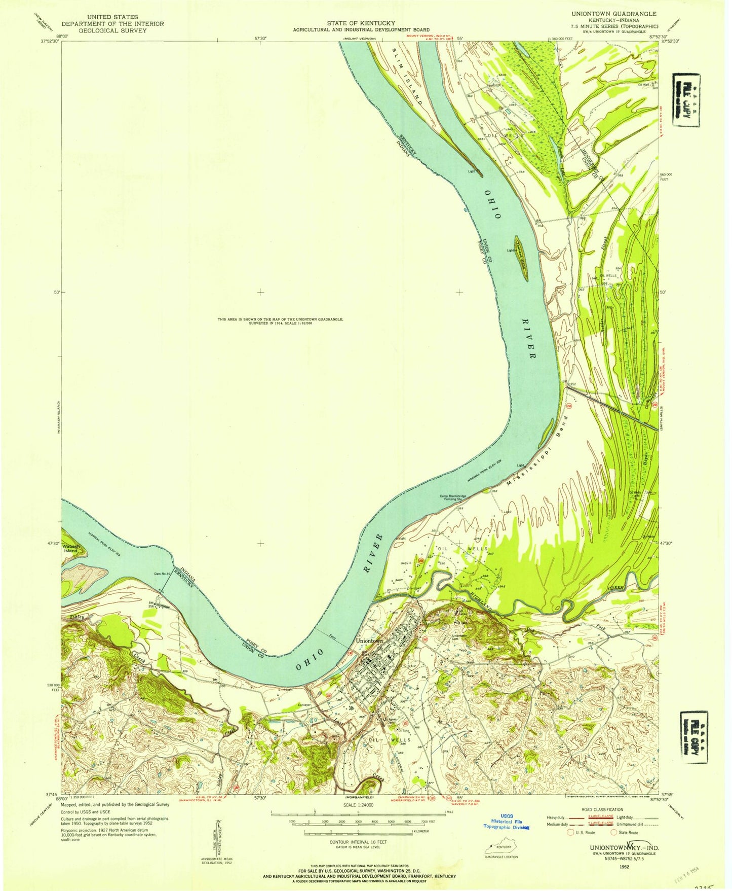
Classic USGS Uniontown Kentucky 7.5'x7.5' Topo Map
Couldn't load pickup availability
Historical USGS topographic quad map of Uniontown in the states of Kentucky, Indiana. Map scale may vary for some years, but is generally around 1:24,000. Print size is approximately 24" x 27"
This quadrangle is in the following counties: Henderson, Posey, Union.
The map contains contour lines, roads, rivers, towns, and lakes. Printed on high-quality waterproof paper with UV fade-resistant inks, and shipped rolled.
Contains the following named places: Bayou Drain, Boxtown, Camp Breckinridge Pumping Station, City of Uniontown, Clements Branch, Congress Green, Dam Number 49, Dry Fork, Dry Lake, Farmers Chapel, Fish Slough, Grassy Slough, Highland Creek, Hovey Lake, Hovey Lake Fish and Wildlife Area, John T. Myers Lock and Dam, Little Pitcher Lake, Lost Creek, Mississippi Bend, Piroque Slough, Point Township Volunteer Fire Department, Powells Lake, Rattle Slough, Saint Agnes Cemetery, Slim Island, Towhead Island, Township of Point, Union County Volunteer Fire Department, Uniontown, Uniontown City Cemetery, Uniontown City Fire Department, Uniontown Division, Uniontown Police Department, Uniontown Post Office, ZIP Code: 42461