MyTopo
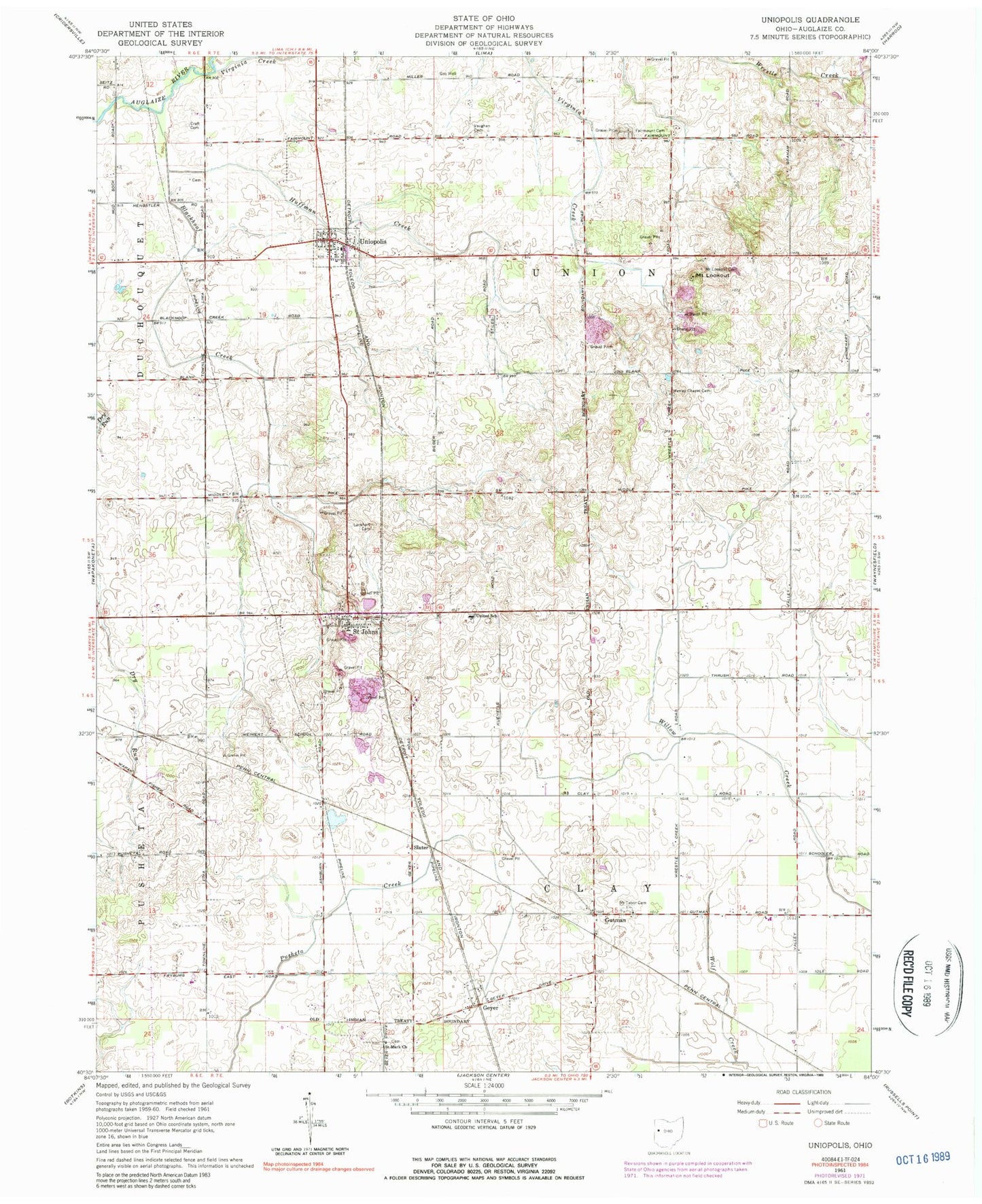
Classic USGS Uniopolis Ohio 7.5'x7.5' Topo Map
Couldn't load pickup availability
Historical USGS topographic quad map of Uniopolis in the state of Ohio. Map scale may vary for some years, but is generally around 1:24,000. Print size is approximately 24" x 27"
This quadrangle is in the following counties: Auglaize.
The map contains contour lines, roads, rivers, towns, and lakes. Printed on high-quality waterproof paper with UV fade-resistant inks, and shipped rolled.
Contains the following named places: Blackhoof Creek, Coleman Run, Conner-Kaiser Cemetery, Craft Cemetery, Dry Run, Fairmount Cemetery, Geyer, Geyer Cemetery, Geyer Post Office, Gutman, Gutman Post Office, Helminger Cemetery, Huffman Creek, Lockhart Cemetery, Maple Lane Farms, Mount Lookout, Mount Lookout Cemetery, Mount Tabor Cemetery, Mount Tabor Methodist Church, Reinhart Cemetery, Rinehart Post Office, Rineharts, Saint Johns, Saint Johns Cemetery, Saint Johns Census Designated Place, Saint Johns Post Office, Saint Johns United Methodist Church, Saint Johns Volunteer Fire and Rescue Department, Saint Mark Church, School Number 1, School Number 2, School Number 3, School Number 4, School Number 8, Slater, Tam Cemetery, Township of Clay, Township of Union, Uniopolis, Uniopolis Census Designated Place, Uniopolis Post Office, Uniopolis Volunteer Fire Department, United School, Vaughan Cemetery, Village of Uniopolis, Virginia Creek, Wesley Chapel Cemetery, Wesley Chapel Methodist Episcopal Church, ZIP Codes: 45884, 45888