MyTopo
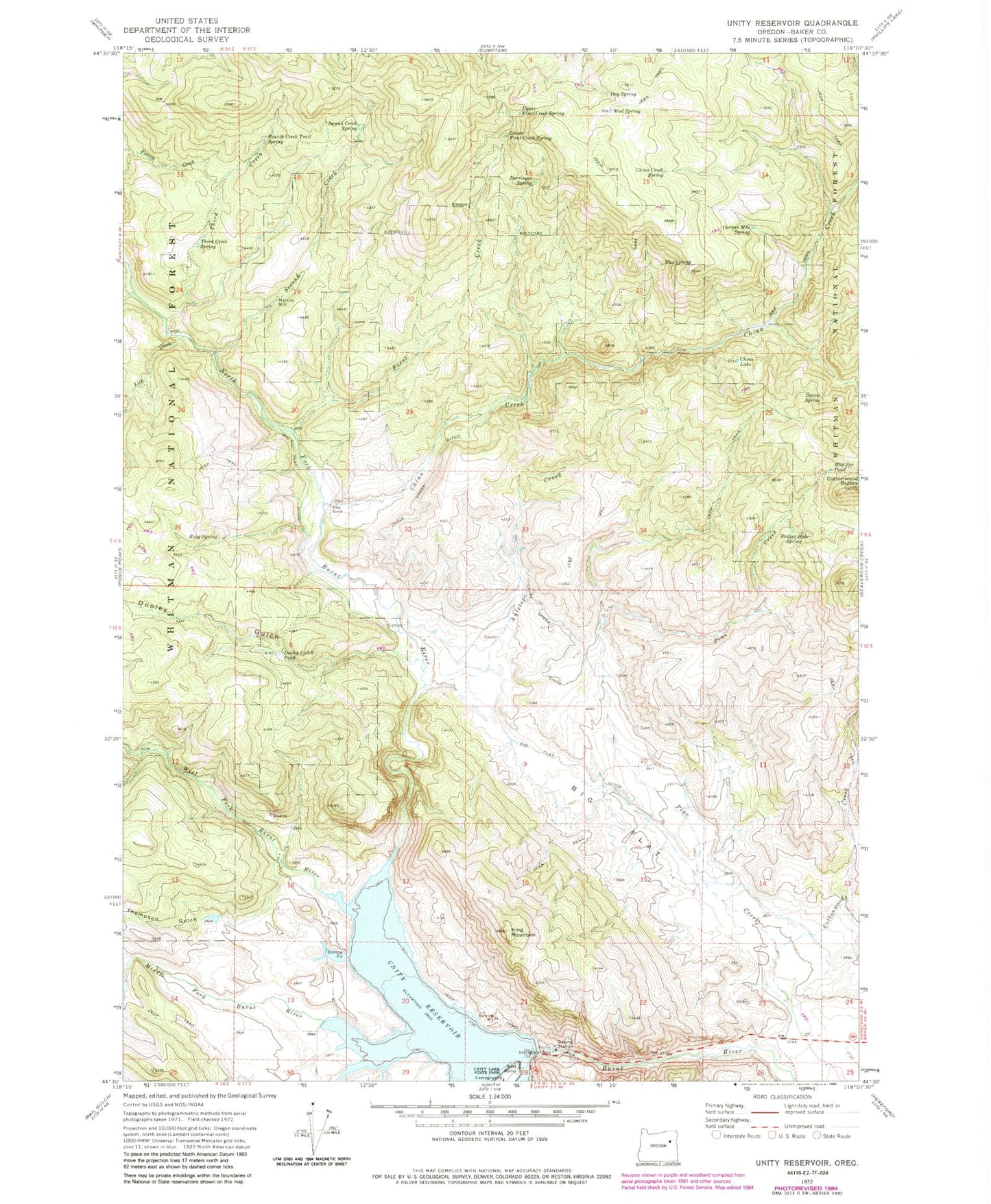
Classic USGS Unity Reservoir Oregon 7.5'x7.5' Topo Map
Couldn't load pickup availability
Historical USGS topographic quad map of Unity Reservoir in the state of Oregon. Map scale may vary for some years, but is generally around 1:24,000. Print size is approximately 24" x 27"
This quadrangle is in the following counties: Baker.
The map contains contour lines, roads, rivers, towns, and lakes. Printed on high-quality waterproof paper with UV fade-resistant inks, and shipped rolled.
Contains the following named places: Antelope Creek, Audrey, Audrey Post Office, Badger Hole Spring, Barrel Spring, Big Flat, Big Flat Cemetery, Big Flat Ditch, China Creek, China Creek Ditch, China Creek Spring, China Lake, Cottonwood Buttes, Cottonwood Creek, Curran Mountain Spring, Day Spring, Derringer Spring, Dooley Gulch, Dooley Gulch Pond, First Creek, Fourth Creek Trail Spring, Hanby Reservoir, Head Meadow, Hereford Division, King Mountain, King Ranch, King Spring, Lick Creek, Lower First Creek Spring, Martins Mill, Max Spring, Middle Fork Burnt River, Mud Spring, Mud Spring Pond, North Fork Burnt River, Pine Creek, Second Creek, Second Creek Spring, Sheep Creek, Third Creek, Third Creek Spring, Thompson Ditch, Thompson Gulch, Unity Dam, Unity Lake State Recreation Site Boat Ramp, Unity Reservoir, Upper First Creek Spring, West Fork Burnt River