MyTopo
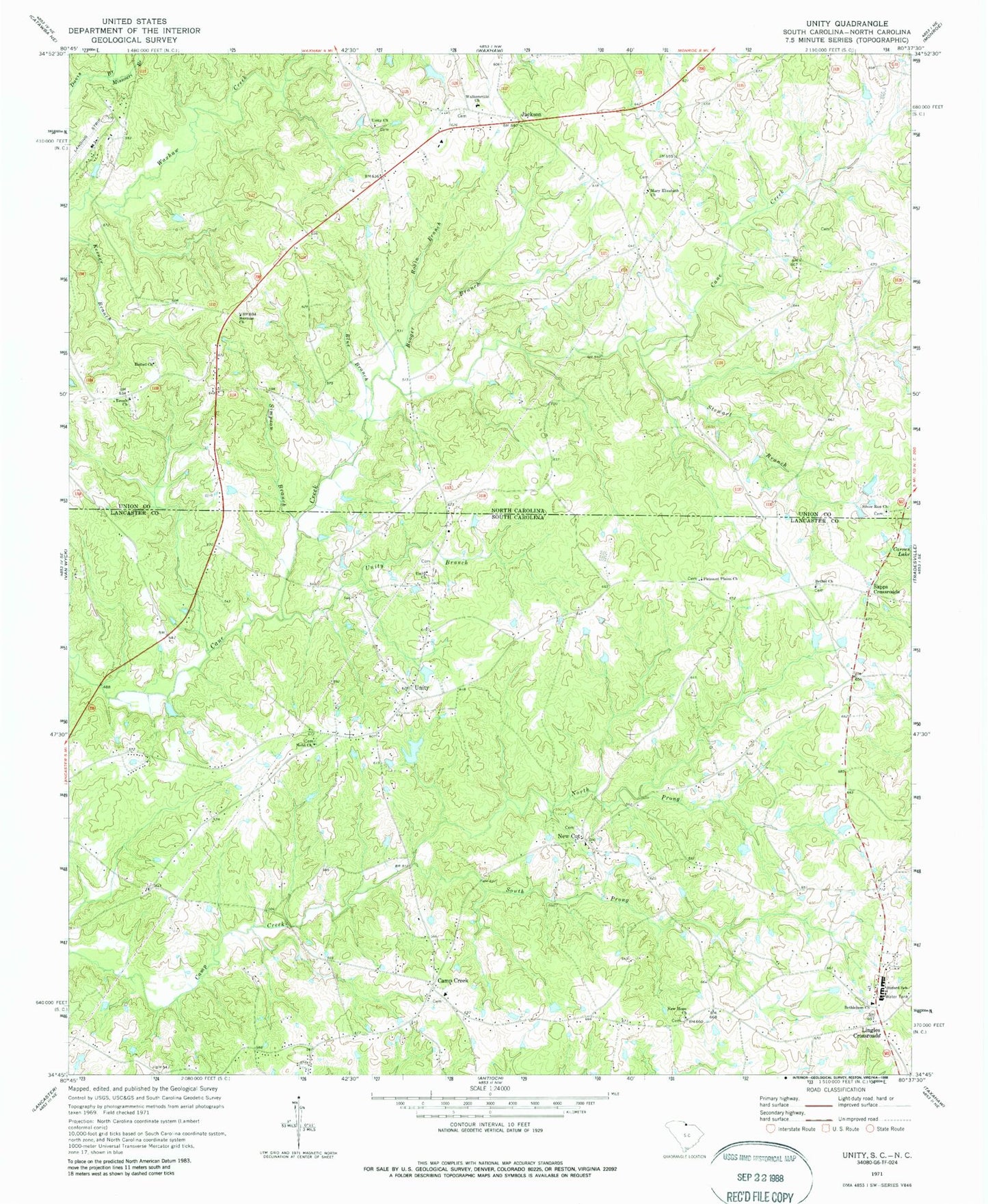
Classic USGS Unity South Carolina 7.5'x7.5' Topo Map
Couldn't load pickup availability
Historical USGS topographic quad map of Unity in the states of South Carolina, North Carolina. Map scale may vary for some years, but is generally around 1:24,000. Print size is approximately 24" x 27"
This quadrangle is in the following counties: Lancaster, Union.
The map contains contour lines, roads, rivers, towns, and lakes. Printed on high-quality waterproof paper with UV fade-resistant inks, and shipped rolled.
Contains the following named places: Belks Pond, Belks Pond D-1766 Dam, Bethel Church, Bethel Church Cemetery, Bethel School, Bethlehem Church, Bethlehem Evangelical Lutheran Church, Bethlehem School, Blue Branch, Booger Branch, Buford Elementary School, Buford Fire Department Station 3, Buford High School, Buford School, Buford Vocational School, Camp Creek, Camp Creek Baptist Church, Camp Creek School, Cane Creek Lake, Cane Creek Lake Dam, Cane Creek Park, Cane Creek Watershed Site 16, Cane Creek Watershed Site Seven, Cardenas Mexico Museum, Carnes Lake, Carnes Lake D-1768 Dam, Cheek Lake, Cheek Lake Dam, Doctor Sapps Crossroads, Herman Church, J and L Farm, Jaars, JAARS Census Designated Place, JAARS-Townsend Airport, Jackson, Jackson Volunteer Fire Department Station 25, Jacksonham School, Lasley Pond Dam D-1765, Lingles Crossroads, Mary Elizabeth Baptist Church Cemetery, Mary Elizabeth Church, Missouri Branch, Museum of the Alphabet, Nebo Church, Nebo Church Cemetery, Nebo School, New Bethel Cemetery, New Bethel School, New Cut, New Cut Memorial Cemetery, New Cut Presbyterian Church, New Hope Church, North Prong Camp Creek, Pleasant Plains Church, Robin Branch, Rowell Pond Dam D-1767, Rowells Pond, Sapps Crossroads, Silver Run Church, Silver Run Church Cemetery, Simpson Branch, South Prong Camp Creek, Stewart Branch, Tirzah Church, Tirzah Presbyterian Church Cemetery, Union School, Unity, Unity Aerodrome, Unity Branch, Unity Census Designated Place, Unity Church, Unity Church Cemetery, Unity Fire Department - Lancaster County Station 19, Unity School, Walkersville, Walkersville Church, Walkersville Presbyterian Church Cemetery, Zion United Methodist Church