MyTopo
Classic USGS University Lake Nebraska 7.5'x7.5' Topo Map
Regular price
$16.95
Regular price
Sale price
$16.95
Unit price
per
Couldn't load pickup availability
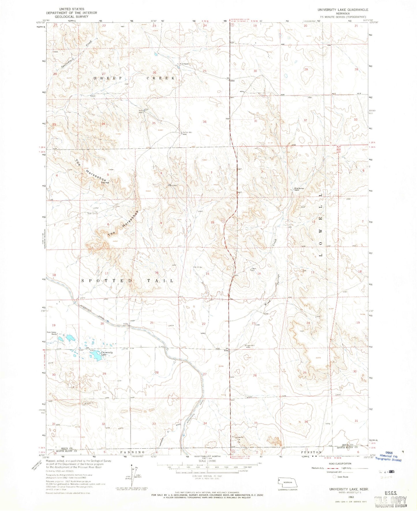
Historical USGS topographic quad map of University Lake in the state of Nebraska. Map scale may vary for some years, but is generally around 1:24,000. Print size is approximately 24" x 27"
This quadrangle is in the following counties: Scotts Bluff, Sioux.
The map contains contour lines, roads, rivers, towns, and lakes. Printed on high-quality waterproof paper with UV fade-resistant inks, and shipped rolled.
Contains the following named places: Claypit Well, F-X Ranch, High Plains Feed Yard, Logan Well, Number 15 Well, Number 4 Well, Point Option Ranch, Samson Well, South Camp, The Hat, The Horseshoe, University Lake, Wind Springs Creek, Wind Springs Ranch