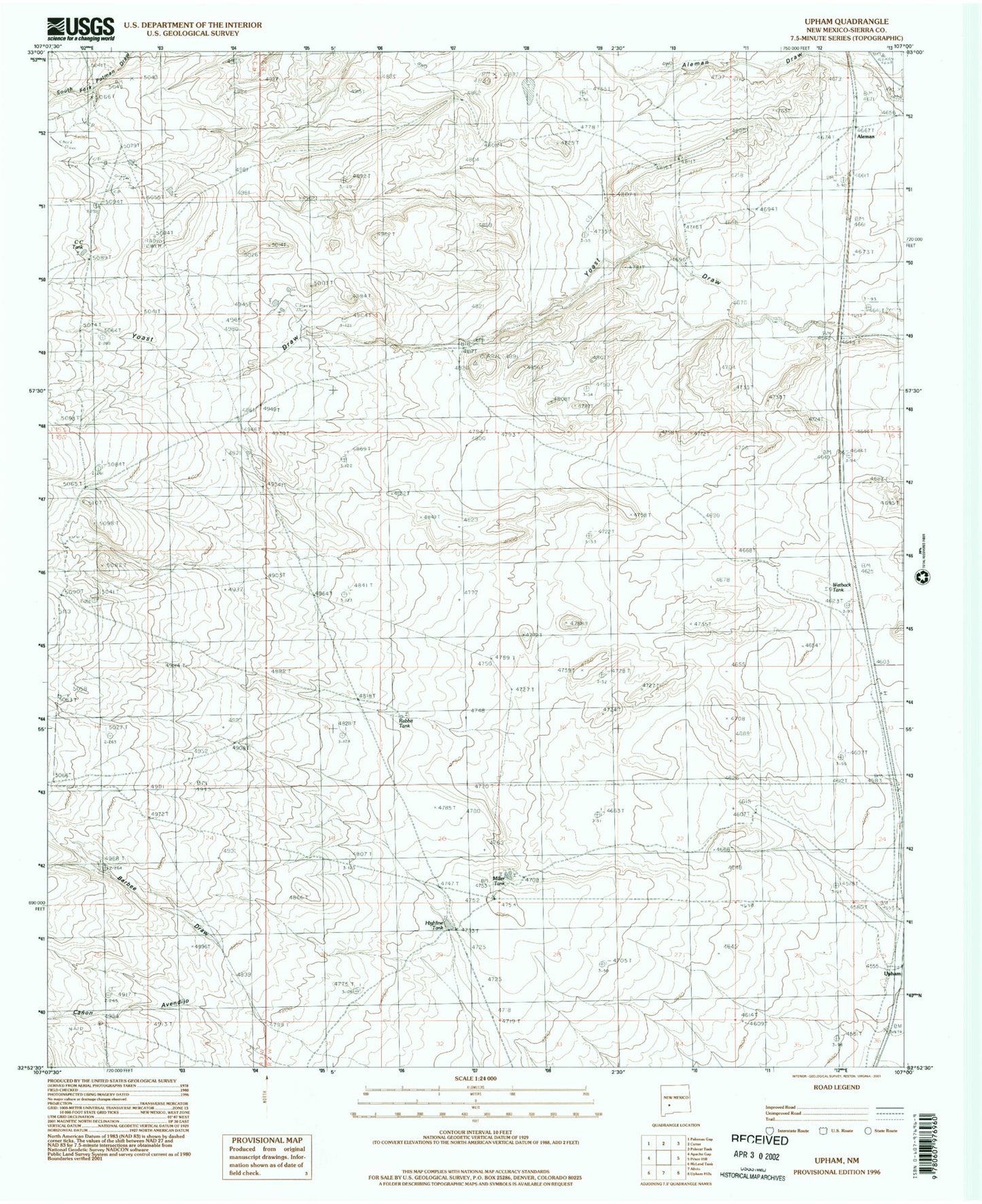
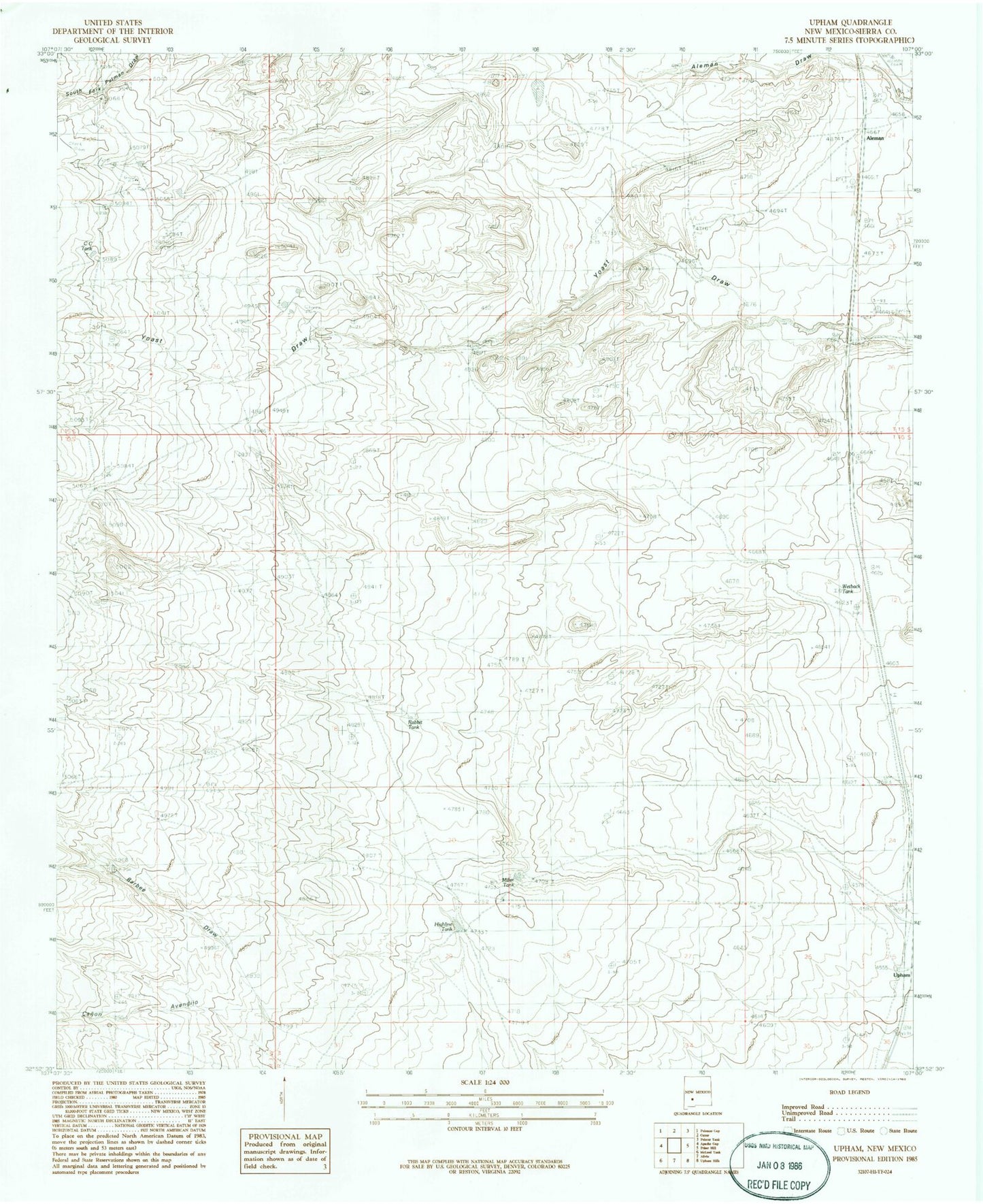
MyTopo
Classic USGS Upham New Mexico 7.5'x7.5' Topo Map
Couldn't load pickup availability
Historical USGS topographic quad map of Upham in the state of New Mexico. Map scale may vary for some years, but is generally around 1:24,000. Print size is approximately 24" x 27"
This quadrangle is in the following counties: Sierra.
The map contains contour lines, roads, rivers, towns, and lakes. Printed on high-quality waterproof paper with UV fade-resistant inks, and shipped rolled.
Contains the following named places: Aleman, Aleman Post Office, Aleman Weather Station, Birner Windmill, C C Tank, Federal M Number One, Foraker Well, Highline Tank, Jornada Dikes, Jornada Number Three Dam, Lyons-Slater Ranch, Miller Tank, Rabbit Tank, Sun Ray Midcontinent New Mexico Federal M Number 1 Spring, Upham, Wetback Tank, Yoast Windmill