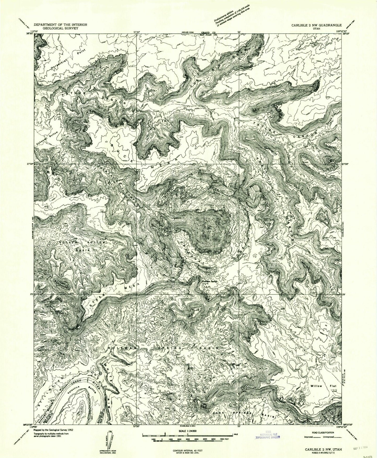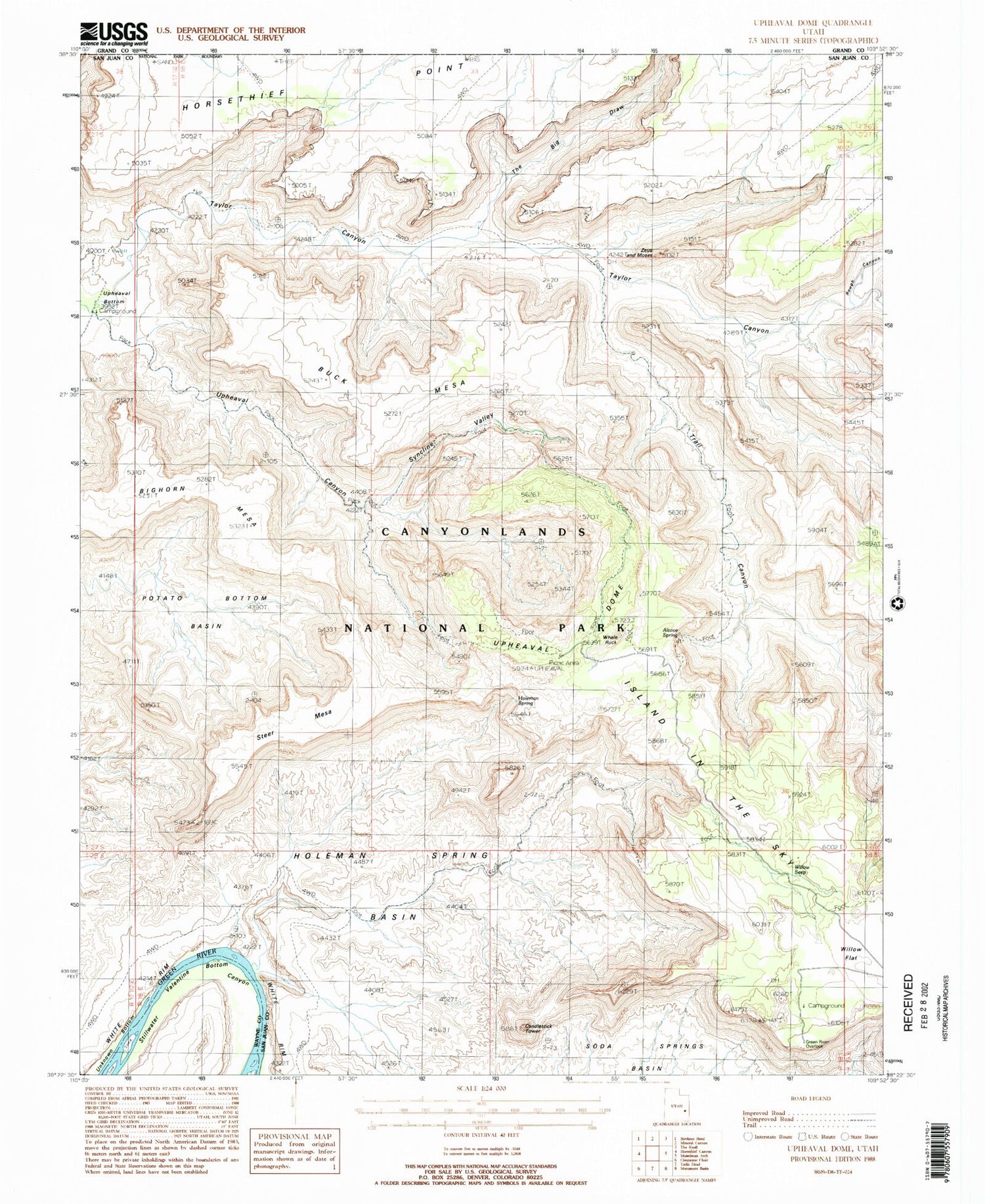
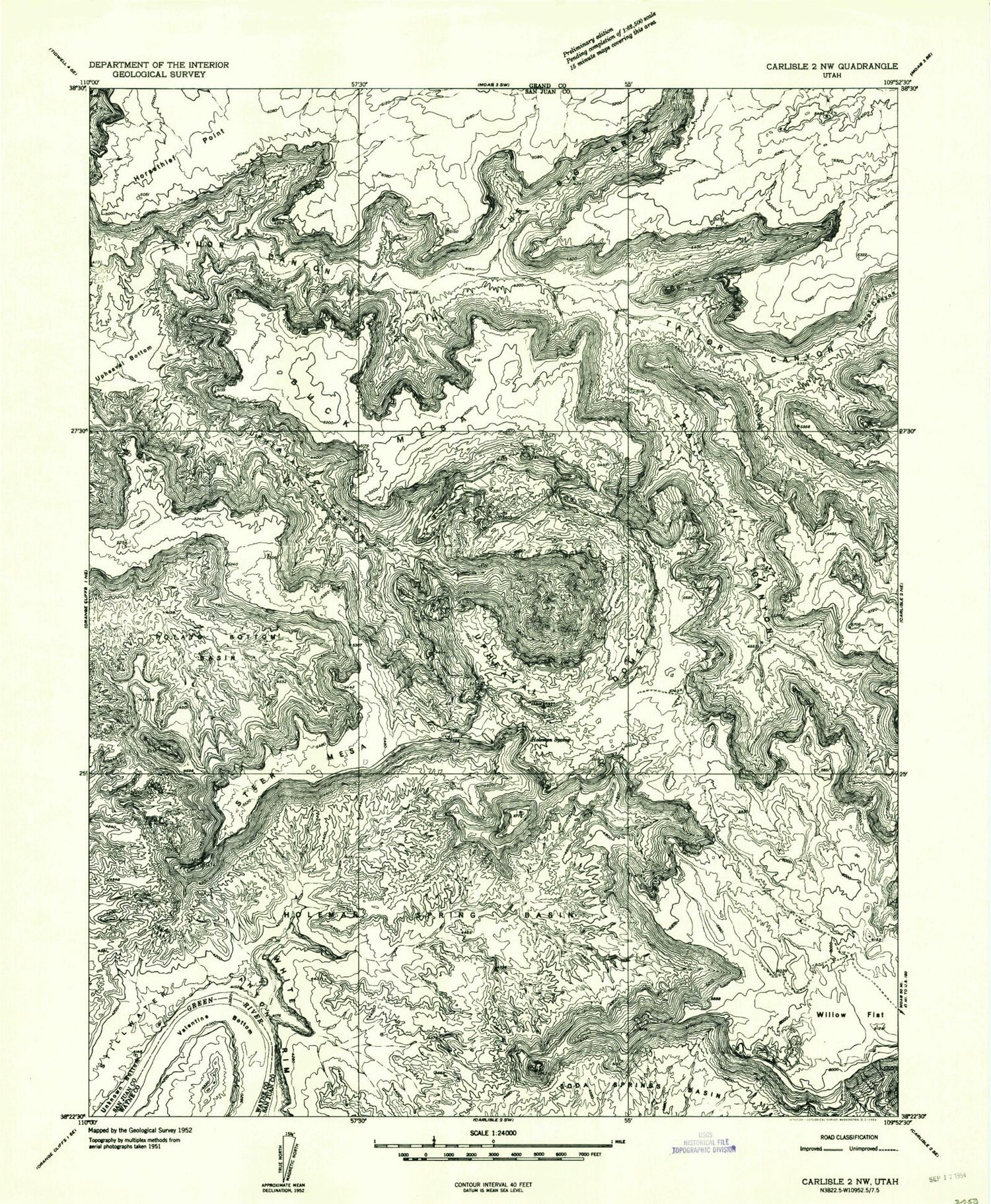
MyTopo
Classic USGS Upheaval Dome Utah 7.5'x7.5' Topo Map
Couldn't load pickup availability
Historical USGS topographic quad map of Upheaval Dome in the state of Utah. Typical map scale is 1:24,000, but may vary for certain years, if available. Print size: 24" x 27"
This quadrangle is in the following counties: Grand, San Juan, Wayne.
The map contains contour lines, roads, rivers, towns, and lakes. Printed on high-quality waterproof paper with UV fade-resistant inks, and shipped rolled.
Contains the following named places: Buck Mesa, Holeman Spring, Holeman Spring Basin, Potato Bottom Basin, Rough Canyon, Steer Mesa, Taylor Canyon, The Big Draw, Trail Canyon, Upheaval Bottom, Upheaval Canyon, Upheaval Dome, Valentine Bottom, Willow Flat, Willow Seep, Bighorn Mesa, Candlestick Tower, Green River Overlook, Alcove Spring, Whale Rock, Zeus and Moses, Syncline Valley, The Breach, Holeman Canyon, Upheaval Dome Trail, Willow Flat Campground, Candlestick Tower, Island in the Sky