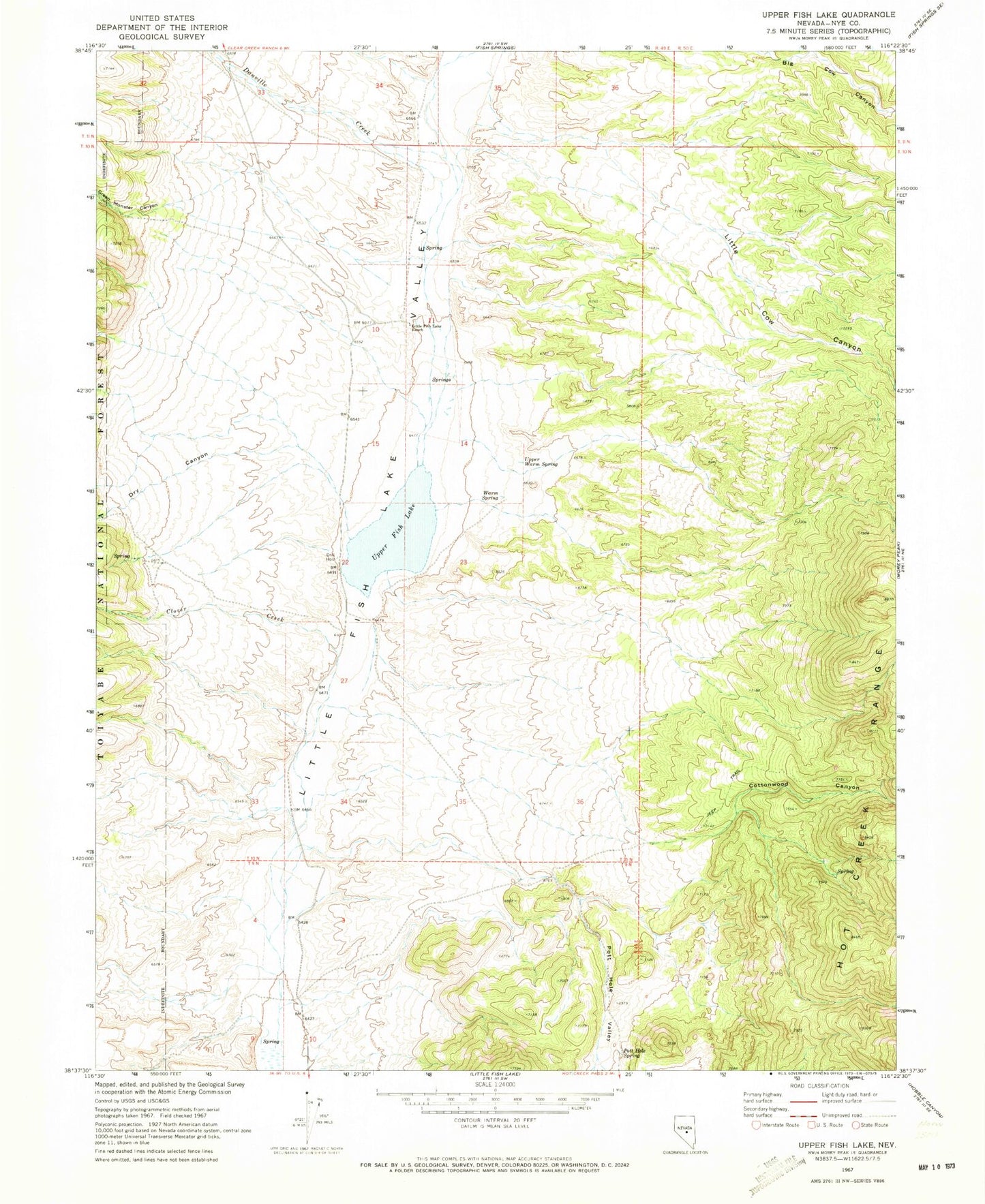
MyTopo
Classic USGS Upper Fish Lake Nevada 7.5'x7.5' Topo Map
Regular price
$16.95
Regular price
Sale price
$16.95
Unit price
per
Couldn't load pickup availability
Historical USGS topographic quad map of Upper Fish Lake in the state of Nevada. Map scale may vary for some years, but is generally around 1:24,000. Print size is approximately 24" x 27"
This quadrangle is in the following counties: Nye.
The map contains contour lines, roads, rivers, towns, and lakes. Printed on high-quality waterproof paper with UV fade-resistant inks, and shipped rolled.
Contains the following named places: Brush Spring, Clover Creek, Cottonwood Canyon, Crescent Hogback, Danville Creek, Dry Canyon, Green Monster Canyon, Green Monster Creek, Little Cow Canyon, Little Fish Lake Ranch, Pott Hole Spring, Pott Hole Valley, Upper Fish Lake, Upper Warm Spring, Warm Spring