MyTopo
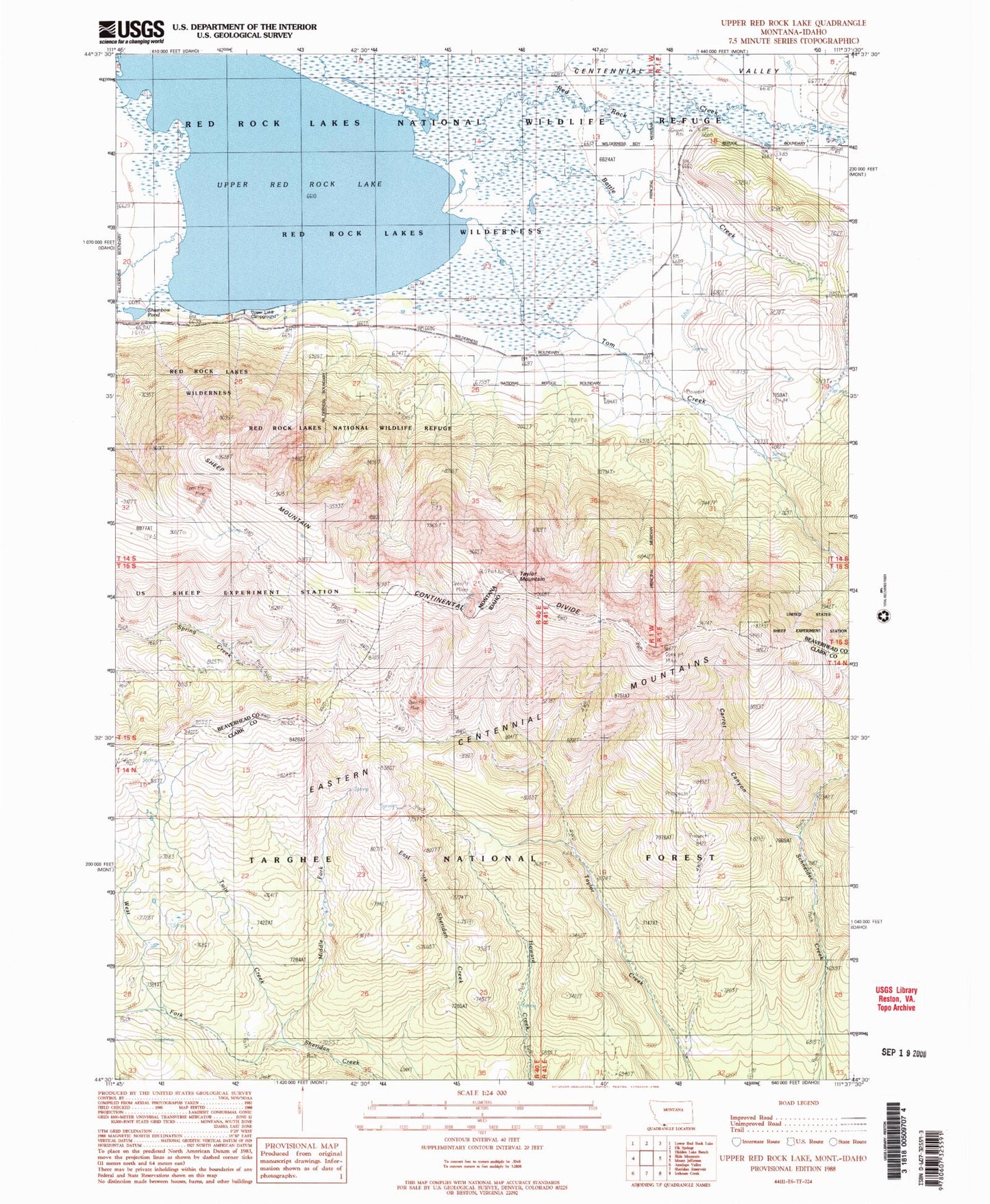
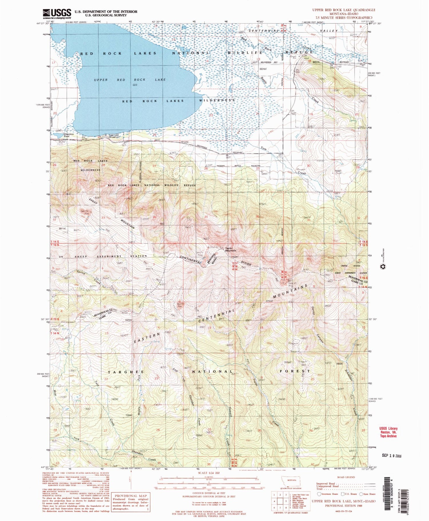
Classic USGS Upper Red Rock Lake Montana 7.5'x7.5' Topo Map
Couldn't load pickup availability
Historical USGS topographic quad map of Upper Red Rock Lake in the states of Montana, Idaho. Typical map scale is 1:24,000, but may vary for certain years, if available. Print size: 24" x 27"
This quadrangle is in the following counties: Beaverhead, Clark.
The map contains contour lines, roads, rivers, towns, and lakes. Printed on high-quality waterproof paper with UV fade-resistant inks, and shipped rolled.
Contains the following named places: Elk Creek, Hanson Ranch, Sheep Mountain, Tom Creek, Upper Red Rock Lake, Brays Butte, Shambow Pond, Arrowhead Mountain, Battle Creek, Upper Lake Campground, Taylor Mountain Mine, 14S01E29DBAB01 Spring, 14S01W21CDD_01 Spring, 14S01W22DDD_01 Spring, 14S01E20CAB_01 Spring, 14S01E17BDB_01 Well, Carrot Canyon, Frog Spring (historical), Howard Creek Trail, Middle Fork Sheridan Creek, Middle Fork Trail, Sheridan Creek Trail, Taylor Creek Trail, Taylor Mountain, Twin Creek, West Fork Sheridan Creek