MyTopo
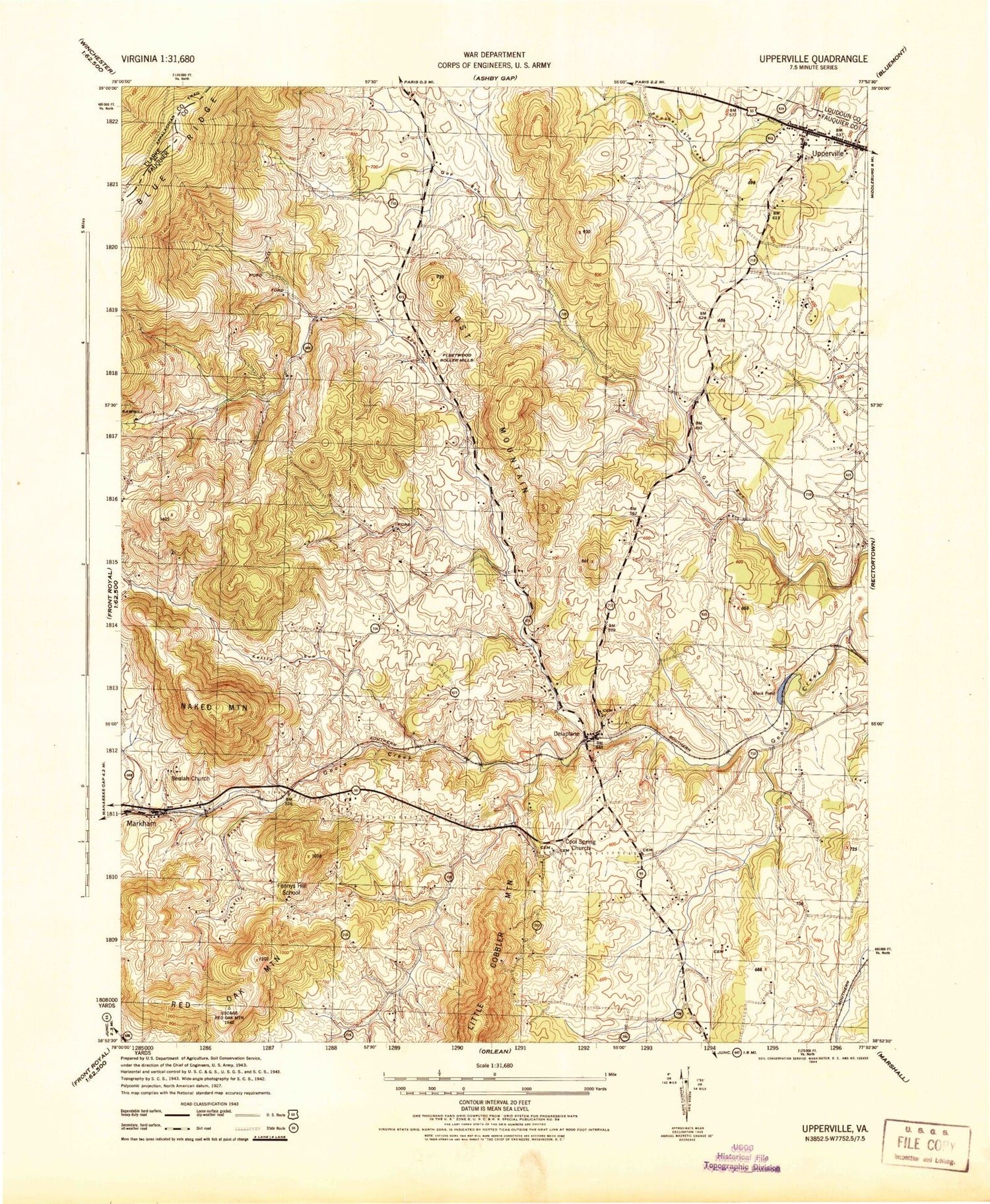
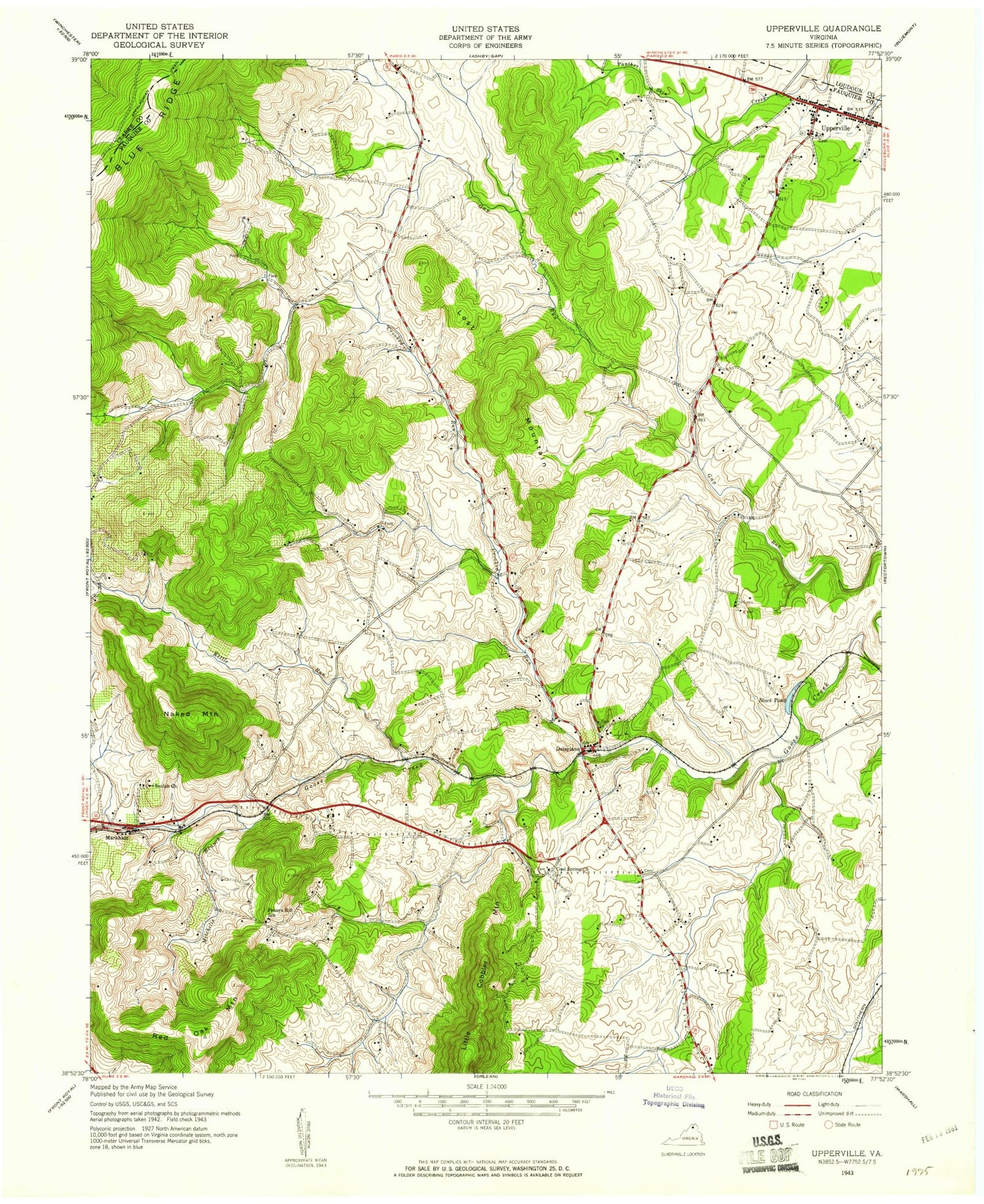
Classic USGS Upperville Virginia 7.5'x7.5' Topo Map
Couldn't load pickup availability
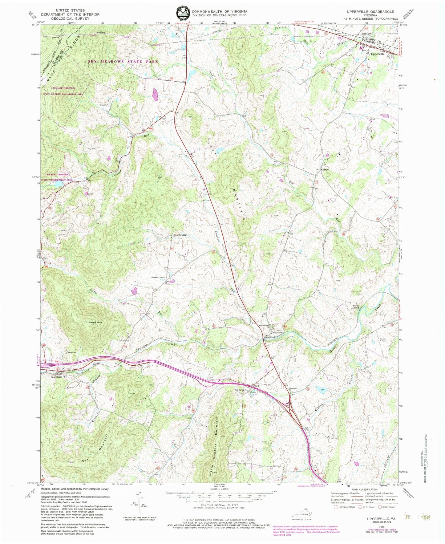
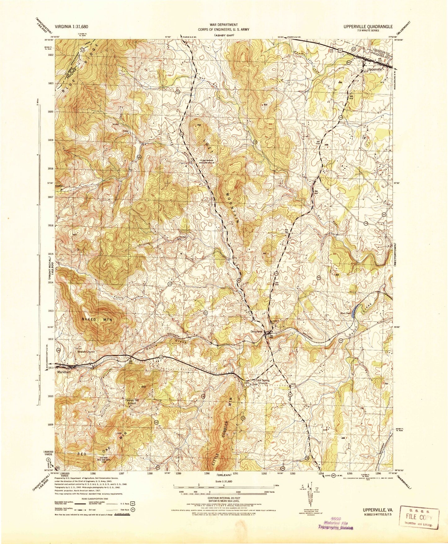
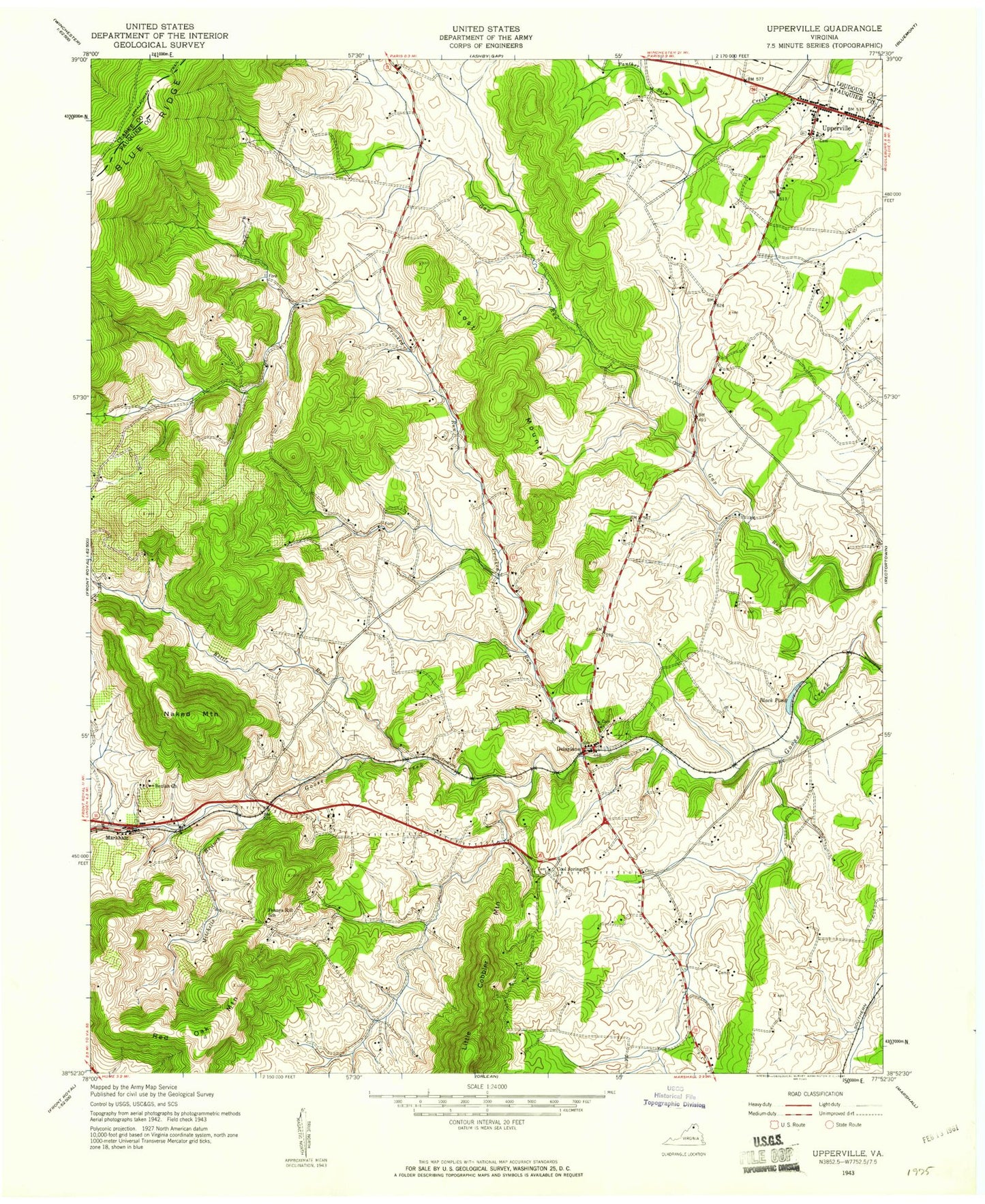
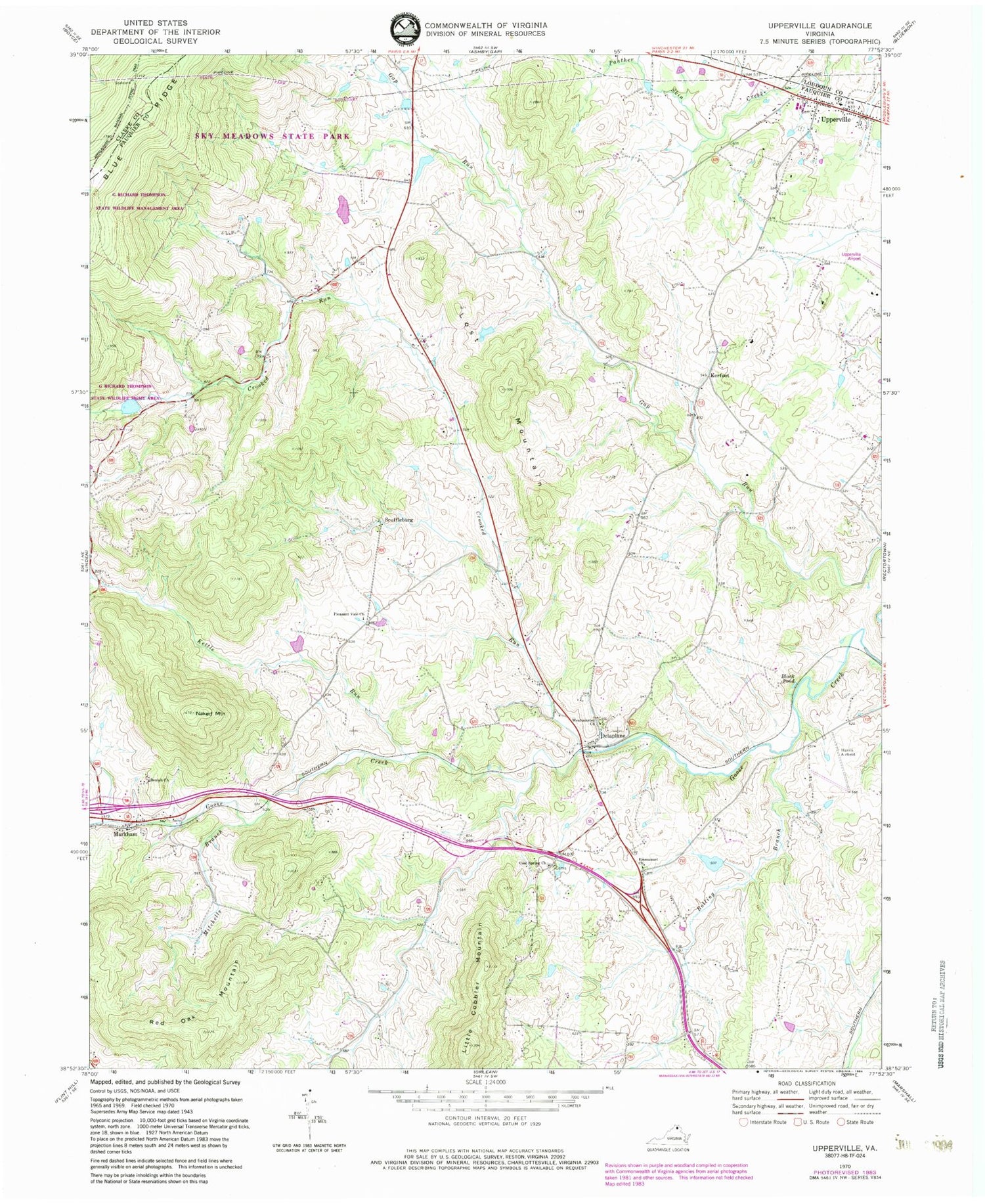
Historical USGS topographic quad map of Upperville in the state of Virginia. Typical map scale is 1:24,000, but may vary for certain years, if available. Print size: 24" x 27"
This quadrangle is in the following counties: Clarke, Fauquier, Loudoun.
The map contains contour lines, roads, rivers, towns, and lakes. Printed on high-quality waterproof paper with UV fade-resistant inks, and shipped rolled.
Contains the following named places: Beulah Church, Black Pond, Bolling Branch, Cool Spring Church, Crooked Run, Emmanuel Church, G R Thompson State Wildlife Management Area, Kettle Run, Lost Mountain, Mitchells Branch, Naked Mountain, Pleasant Vale Church, Red Oak Mountain, Westminster Church, Mathews Dam, Mathews Pond, Thompson Dam, Thompson Lake, Herbert Dam, Herbert Pond, Brockett Dam, Woodside Lake, Fleetwood Farm Dam Number One, Fleetwood Farm Pond Number One, Fleetwood Farm Dam Number Two, Fleetwood Farm Pond Number Two, Harris Airport (historical), Delaplane, Kerfoot, Scuffleburg, Upperville, Ashleigh, Ashville, Belle Grove, Brookside, Brushy Mountain, Calvary Gospel Cemetery, Cool Spring Cemetery, Delaplane Post Office, Emmanuel Cemetery, Fenny Hill School (historical), Fleetwood Roller Mills (historical), Highfield, Jacksontown, Markham Post Office, Mount Pisgah Baptist Church, Rawlingsdale, Sky Meadows State Park, Springfield, The Sage, Upperville Historic District, Upperville Post Office, Yew Hill, Rosenvix (historical), Upperville Volunteer Fire Company 5, Stribling Orchard, Orchard Hill Mountain, Upperville Census Designated Place, Beulah Church, Black Pond, Bolling Branch, Cool Spring Church, Crooked Run, Emmanuel Church, G R Thompson State Wildlife Management Area, Kettle Run, Lost Mountain, Mitchells Branch, Naked Mountain, Pleasant Vale Church, Red Oak Mountain, Westminster Church, Mathews Dam, Mathews Pond, Thompson Dam, Thompson Lake, Herbert Dam, Herbert Pond, Brockett Dam, Woodside Lake, Fleetwood Farm Dam Number One, Fleetwood Farm Pond Number One, Fleetwood Farm Dam Number Two, Fleetwood Farm Pond Number Two, Harris Airport (historical), Delaplane, Kerfoot, Scuffleburg, Upperville, Ashleigh, Ashville, Belle Grove, Brookside, Brushy Mountain, Calvary Gospel Cemetery, Cool Spring Cemetery, Delaplane Post Office, Emmanuel Cemetery, Fenny Hill School (historical), Fleetwood Roller Mills (historical), Highfield, Jacksontown, Markham Post Office, Mount Pisgah Baptist Church, Rawlingsdale, Sky Meadows State Park, Springfield, The Sage, Upperville Historic District, Upperville Post Office, Yew Hill, Rosenvix (historical), Upperville Volunteer Fire Company 5, Stribling Orchard, Orchard Hill Mountain, Upperville Census Designated Place
