MyTopo
Classic USGS Ute Mountain New Mexico 7.5'x7.5' Topo Map
Regular price
$16.95
Regular price
Sale price
$16.95
Unit price
per
Couldn't load pickup availability
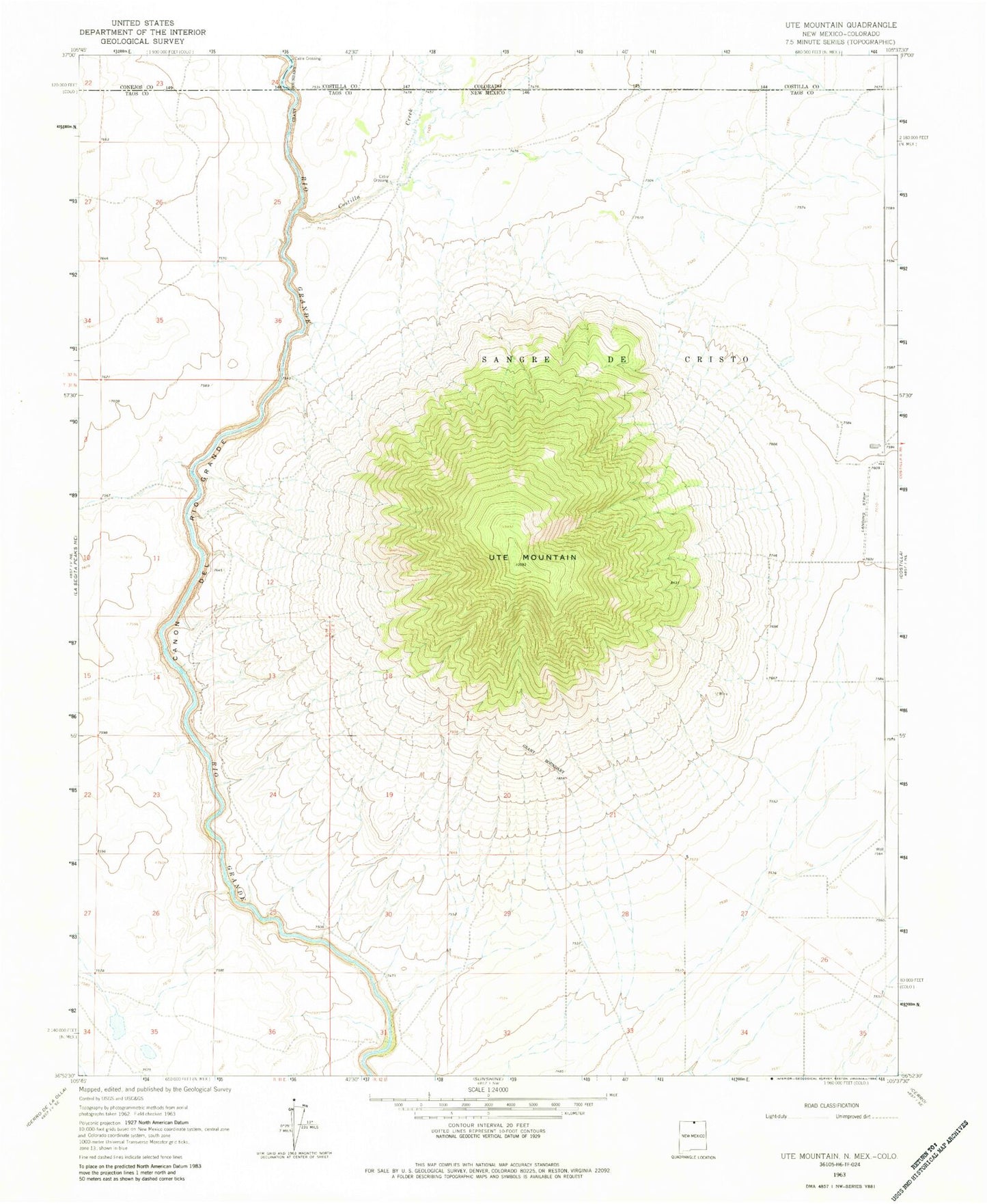
Historical USGS topographic quad map of Ute Mountain in the state of New Mexico. Map scale may vary for some years, but is generally around 1:24,000. Print size is approximately 24" x 27"
This quadrangle is in the following counties: Conejos, Costilla, Taos.
The map contains contour lines, roads, rivers, towns, and lakes. Printed on high-quality waterproof paper with UV fade-resistant inks, and shipped rolled.
Contains the following named places: 10010 Water Well, 10013 Water Well, 10018 Water Well, 10019 Water Well, 10034 Water Well, 10058 Water Well, 10060 Water Well, 10113 Water Well, 87524, Costilla Creek, Top O the World Farms, Top of the World Farms, Ute Mountain