MyTopo
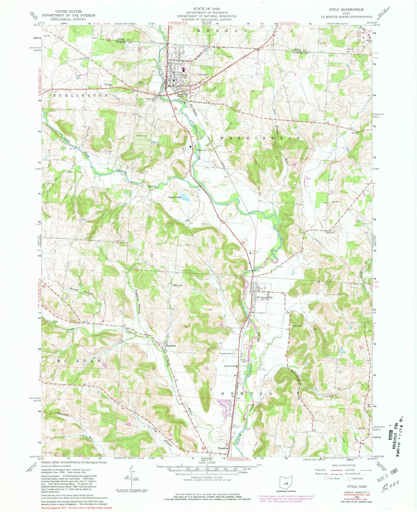
Classic USGS Utica Ohio 7.5'x7.5' Topo Map
Couldn't load pickup availability
Historical USGS topographic quad map of Utica in the state of Ohio. Map scale may vary for some years, but is generally around 1:24,000. Print size is approximately 24" x 27"
This quadrangle is in the following counties: Knox, Licking.
The map contains contour lines, roads, rivers, towns, and lakes. Printed on high-quality waterproof paper with UV fade-resistant inks, and shipped rolled.
Contains the following named places: Appleton Post Office, Bell Cemetery, Bell Church of Christ, Blackhawk School, Branstool Orchard, Burse Hollow, Chatham, Chatham United Methodist Church, Church of the Nativity, Clear Fork Licking River, Coad Cemetery, Coffmans Mills, Conard Cemetery, Cranberry Prairie, Dearing and Yoakum Mill, Dog Hollow Run, Echo School, Evans Cemetery, Fowlers Mills, Hillcrest Church, Hoar Pond, Hoar Pond Dam, Lake Fork Licking River, Legend Hills Orchard, Lock School, Marple Cemetery, McNaughton and Snare Mill, Newton Township Volunteer Fire Department Station 1 Headquarters, Newton Township Volunteer Fire Department Station 2, North Lawn Cemetery, Prairie Lake, Preston Hollow, Redbrush School, Saint Joseph Cemetery, Saint Louisville, Saint Louisville Post Office, Shipley Farms, Smoot Lake, South Lawn Cemetery, Sunnyside School, Township of Newton, Township of Washington, Utica, Utica Elementary School, Utica Emergency Squad, Utica High School, Utica Middle School, Utica Police Department, Utica Post Office, Utica Presbyterian Church, Utica Volunteer Fire Department, Vanatta, Vanatta Post Office, Village of Saint Louisville, Village of Utica, Washington High School, Whites School, Wyoming Valley, ZIP Code: 43080