MyTopo
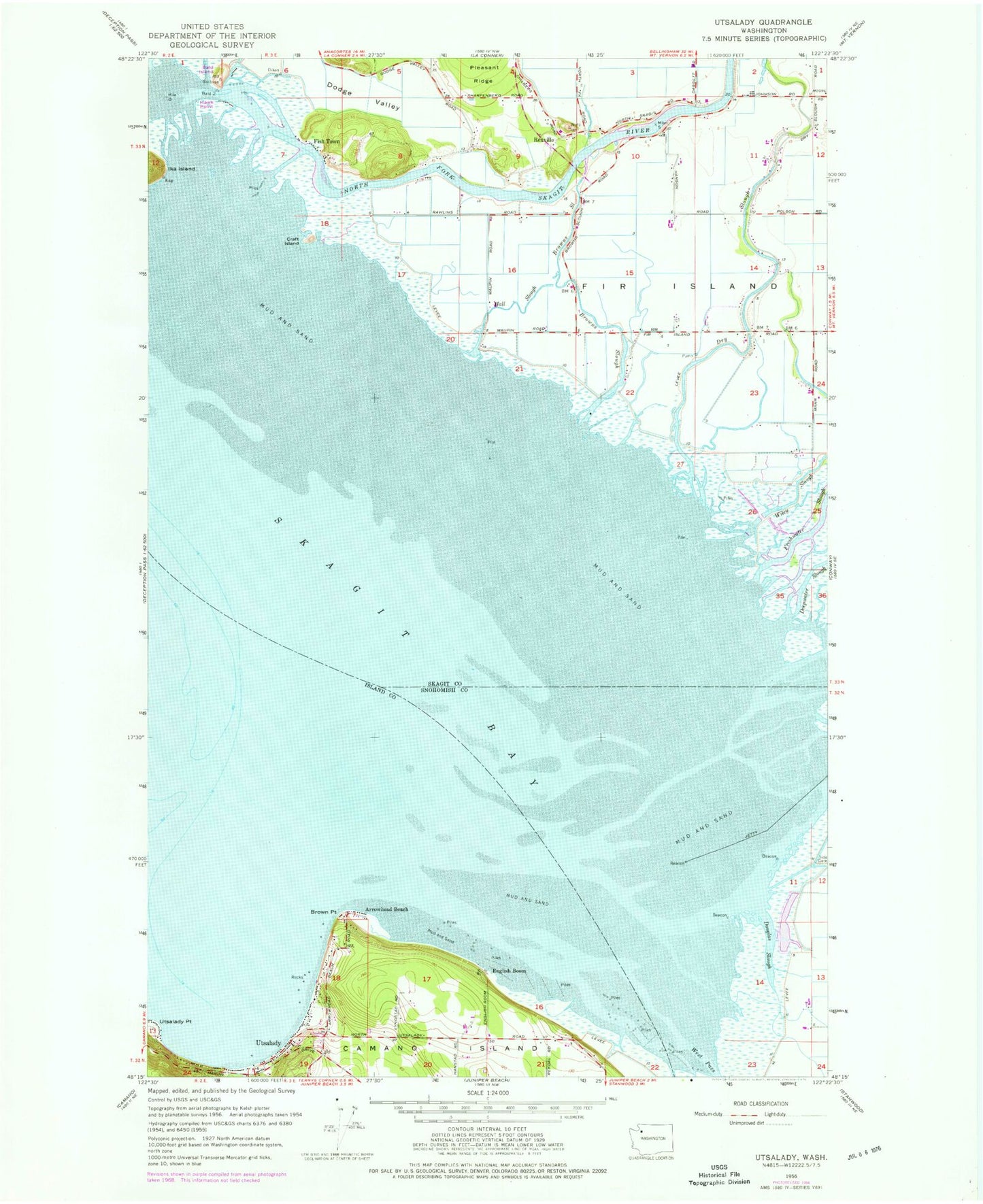
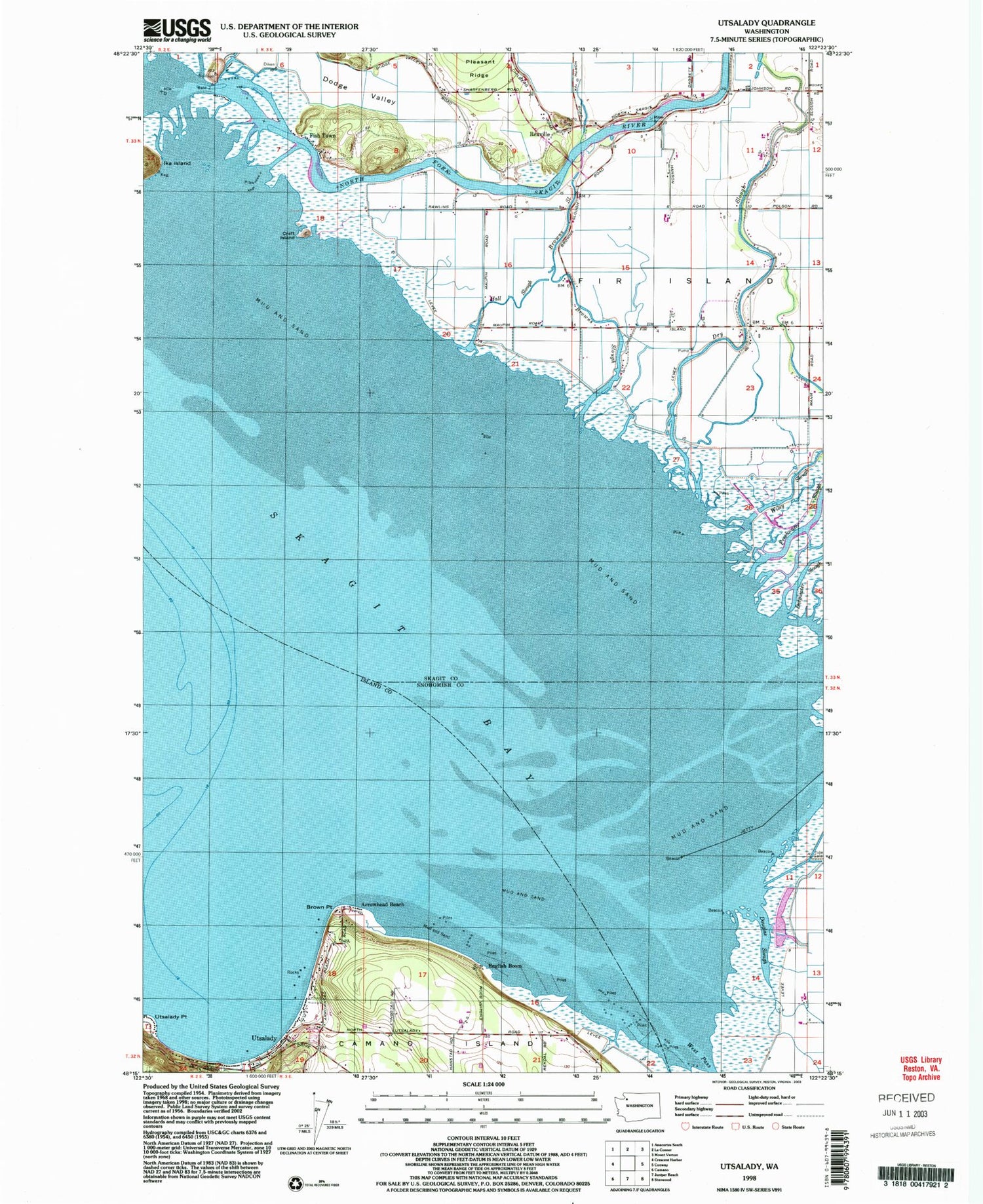
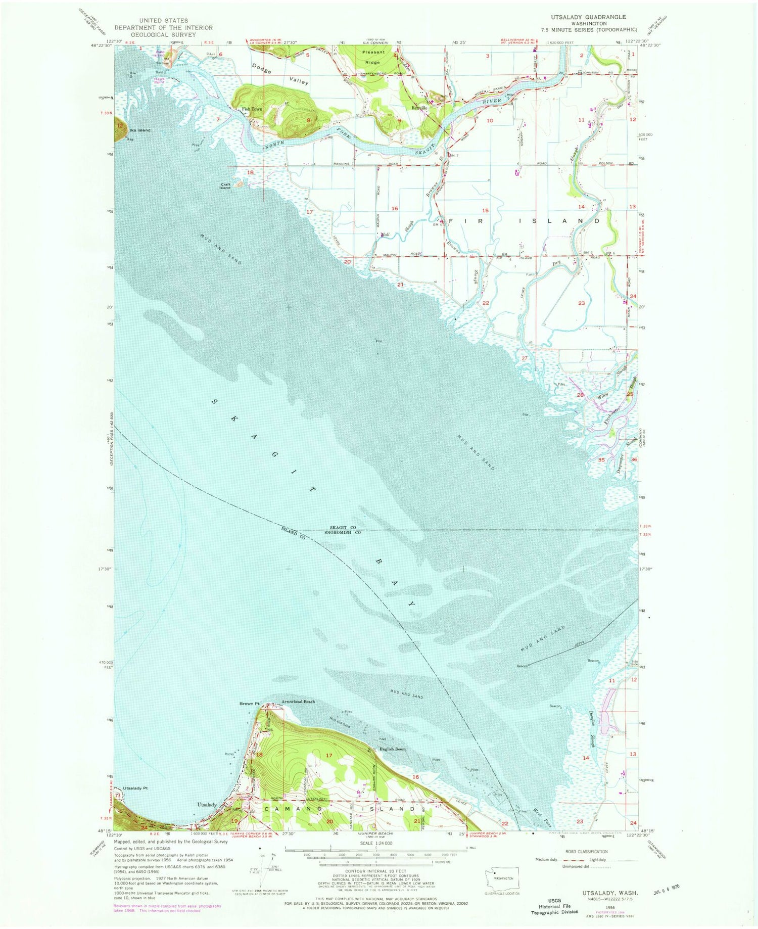
Classic USGS Utsalady Washington 7.5'x7.5' Topo Map
Couldn't load pickup availability
Historical USGS topographic quad map of Utsalady in the state of Washington. Map scale may vary for some years, but is generally around 1:24,000. Print size is approximately 24" x 27"
This quadrangle is in the following counties: Island, Skagit, Snohomish.
The map contains contour lines, roads, rivers, towns, and lakes. Printed on high-quality waterproof paper with UV fade-resistant inks, and shipped rolled.
Contains the following named places: Arrowhead Beach, Bald Island, Bayside Dairy, Brown Point, Browns Slough, Camano Island Airfield, Clam Bar Dairy, Craft Island, Crooked Slough, Deepwater Slough, Dodge Valley, Douglas Slough, Dry Slough, English Boom, Fir Island, Fish Town, Freshwater Slough, Hall Slough, Harmony Dairy, Hawk Point, North Fork Skagit River, Rexville, Skagit Bay, Skagit Delta, Skagit State Wildlife Recreation Area, Utsalady, Utsalady Bay, Utsalady Beach Boat Ramp, Wiley Slough