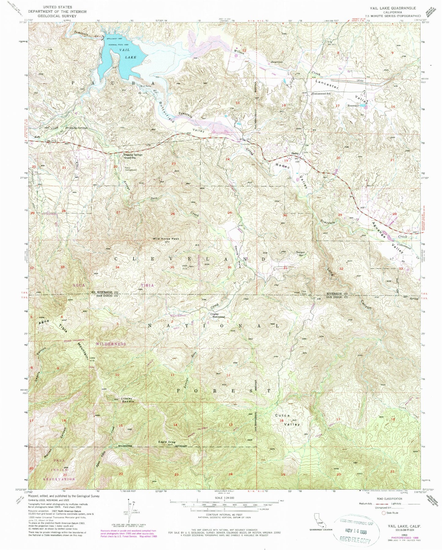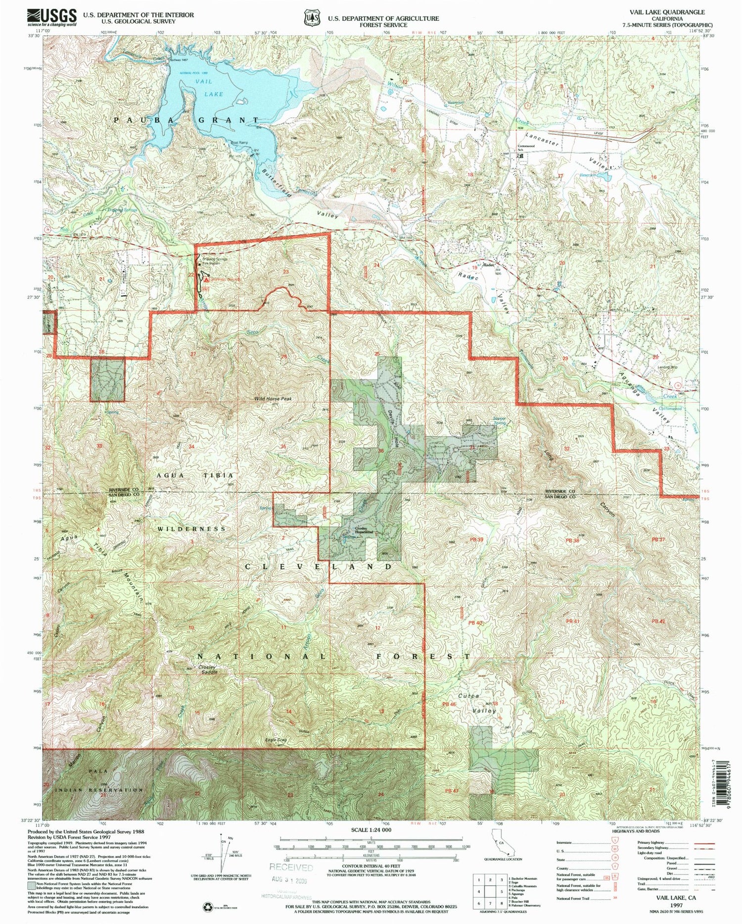

MyTopo
Classic USGS Vail Lake California 7.5'x7.5' Topo Map
Couldn't load pickup availability
Historical USGS topographic quad map of Vail Lake in the state of California. Typical map scale is 1:24,000, but may vary for certain years, if available. Print size: 24" x 27"
This quadrangle is in the following counties: Riverside, San Diego.
The map contains contour lines, roads, rivers, towns, and lakes. Printed on high-quality waterproof paper with UV fade-resistant inks, and shipped rolled.
Contains the following named places: Agua Tibia Mountain, Arroyo Seco Creek, Cottonwood Creek, Cottonwood K - 8 School, Crosley Homestead, Crosley Saddle, Crosley Truck Trail, Cutca Valley, Cutca Valley Truck Trail, Devils Hole, Dripping Springs, Dripping Springs Guard Station, Eagle Crage, Kolb Creek, Lancaster Valley, Long Canyon, Radec Valley, Sawyer Spring, Vail Lake, Wild Horse Peak, Wilson Creek, Radec, Butterfield Valley, Aguanga Valley, Wilson Valley, Dripping Springs Trail, Vail 2028 Dam, Spring Creek, Butterfield County Recreational Vehicle Park, Butterfield Lake Estates, Crossbar Oaks Campground, Ormsby Campground, Palomar Mesa Campground, Rancho California Lake Club, Rincon Mesa Campground, Agua Tibia Wilderness, Dripping Springs Campground, United States Forest Service Cleveland National Forest Station - Dripping Springs, Dripping Springs Trailhead, Vail Lake Boat Launch, Riverside County Fire Department Station 52 Cottonwood, Bergman Family Cemetery, Radec Cemetery