MyTopo
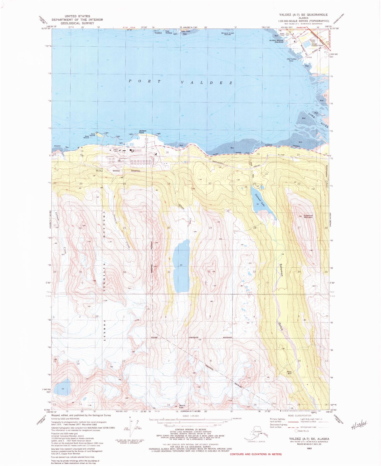
Classic USGS Valdez A-7 SE Alaska 7.5'x7.5' Topo Map
Couldn't load pickup availability
Historical USGS topographic quad map of Valdez A-7 SE in the state of Alaska. Typical map scale is 1:24,000, but may vary for certain years, if available. Print size: 24" x 27"
This quadrangle is in the following counties: Valdez-Cordova (CA).
The map contains contour lines, roads, rivers, towns, and lakes. Printed on high-quality waterproof paper with UV fade-resistant inks, and shipped rolled.
Contains the following named places: Allison Creek, Jackson Point, Mount Kate, Lowe River, Midas Mine, Salmon Creek, Sawmill Creek, Sawmill Spit, Solomon Gulch, Solomon Lake, Sugarloaf Mountain, Old Valdez, Fort Liscum (historical), Valdez Glacier Stream, Solomon Lake Dam, Solomon Gulch Dam A, Solomon Gulch Dam B, Solomon Gulch Lake, KVAK-AM (Valdez), KCHU-AM (Valdez), Valdez Marine Terminal, Midas Camp, Dayville, Dayville Creek, Swanport, City of Valdez, Alyeska Pipeline Service Company Fire and Rescue