MyTopo
Classic USGS Valentine Arizona 7.5'x7.5' Topo Map
Couldn't load pickup availability
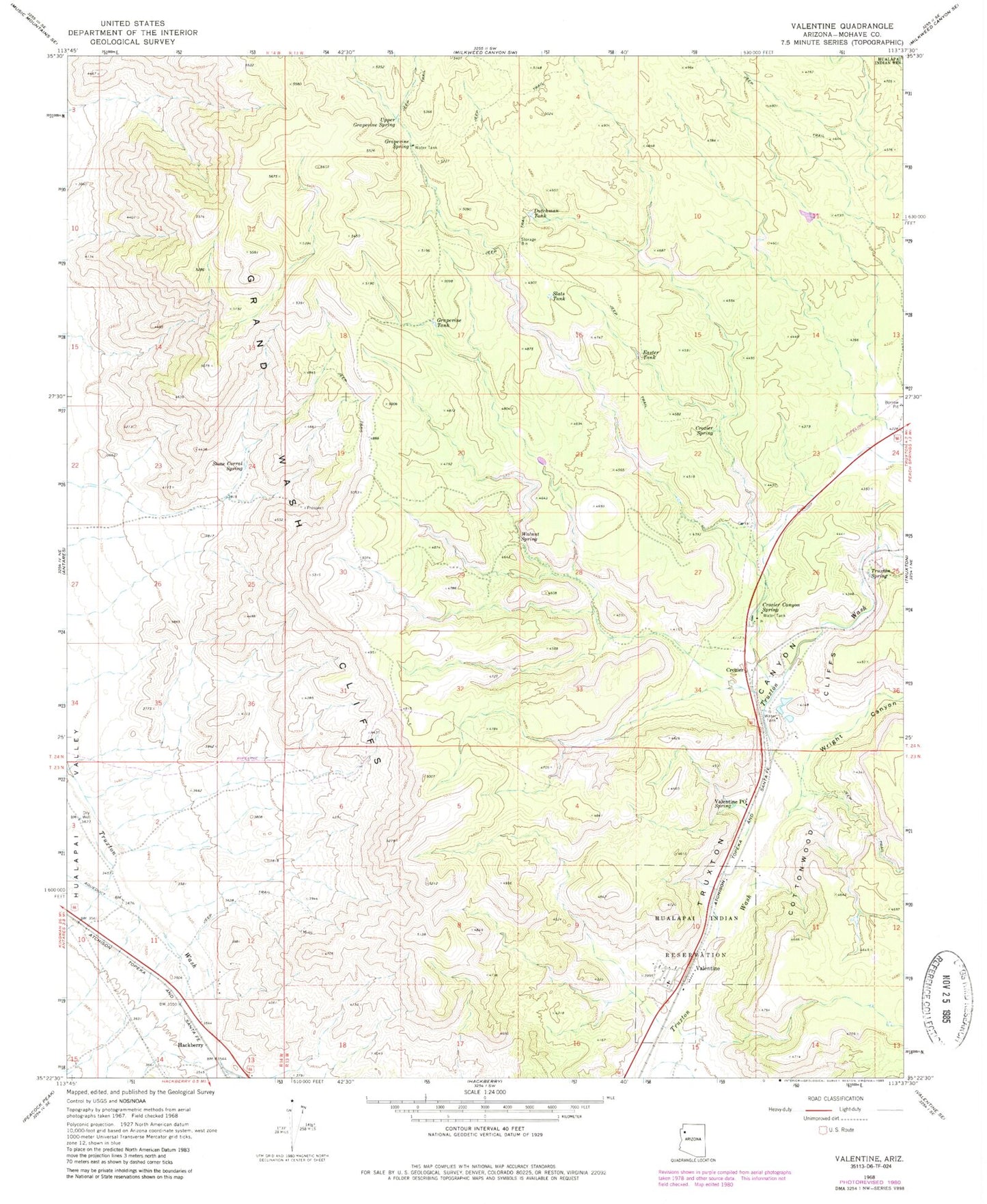
Historical USGS topographic quad map of Valentine in the state of Arizona. Map scale may vary for some years, but is generally around 1:24,000. Print size is approximately 24" x 27"
This quadrangle is in the following counties: Mohave.
The map contains contour lines, roads, rivers, towns, and lakes. Printed on high-quality waterproof paper with UV fade-resistant inks, and shipped rolled.
Contains the following named places: Crozier, Crozier Canyon Spring, Crozier Census Designated Place, Crozier Railroad Station, Crozier Spring, Dutchman Tank, Easter Tank, Grapevine Spring, Grapevine Tank, Hackberry, Hualapai Indian School Reserve, Northern Arizona Consolidated Fire District Station 37, Serendipity Mountain, Slats Tank, Stone Corral Spring, Truxton Spring, Upper Grapevine Spring, Valentine, Valentine Census Designated Place, Valentine Post Office, Valentine Railroad Station, Walnut Spring, Wright Canyon